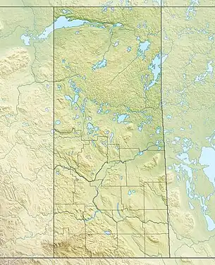
Delaronde Lake
Delaronde Lake[1] is a lake in the Canadian province of Saskatchewan. It is situated at the western edge of the Waskesiu Upland in the boreal forest ecozone of Canada.[2] Delaronde Lake is within the Churchill River drainage basin of the Hudson Bay.[3]
| Delaronde Lake | |
|---|---|
 Delaronde Lake Location in Saskatchewan  Delaronde Lake Delaronde Lake (Canada) | |
| Location | RM of Big River No. 555, Saskatchewan |
| Coordinates | 54.0501°N 107.0506°W |
| Primary inflows | Tie Creek |
| Basin countries | Canada |
| Surface area | 12,390.6 ha (30,618 acres) |
| Max. depth | 40 m (130 ft) |
| Shore length1 | 154.6 km (96.1 mi) |
| Surface elevation | 496 m (1,627 ft) |
| Islands |
|
| Settlements | Phillips Grove |
| 1 Shore length is not a well-defined measure. | |
Most of Delaronde Lake is in the Rural Municipality of Big River No. 555 with only the northernmost part in the Northern Saskatchewan Administration District. Along the lake's shores are campgrounds, resorts, cottage communities, and a Bible camp. Access to the lake and its amenities is from Highway 922. At about 10 kilometres (6.2 mi) to the south-west, Big River is the closest town.
Description
Delaronde Lake is a long and narrow lake that is separated into two sections — north and south — by a narrow channel. The north section is deep, with depths of up to 40 metres (130 ft), while the south section is shallow at only 7 metres (23 ft) deep. The lake is situated at the western end of the Waskesiu Upland, and, as such, the upland's western slopes are within the lake's catchment. Prince Albert National Park encompasses much of the Waskesiu Upland.[4]
Delaronde Lake has two named islands — Zig Zag and Delaronde — and multiple bays. The outflow river is at Hall Bay at the northern end of the lake's southern section. This river flows a short distance north-west into Taggart Lake. Taggart Creek then flows out of Taggart Lake heading north where it meets the Cowan River near Highway 924. The Cowan River is a tributary of the Beaver River, which, in turn, is a tributary of the Churchill River.[5][6]
Along the shores of Delaronde Lake are small communities, subdivisions, and campgrounds, all of which are at the southern end of the lake. These include Phillips Grove, Lakeshore RV Properties, Stoney Bay Campground,[7] Delaronde Resort,[8] Big River Bible Camp,[9] Island View Shores, and Delaronde Lake (Zig Zag Bay) Recreation Site.[10]
Delaronde Lake (Zig Zag Bay) Recreation Site
Delaronde Lake (Zig Zag Bay) Recreation Site (53.9448°N 106.9378°W)[11] is a leased provincial campground at Zig Zag Bay on the east side of the south section of Delaronde Lake. This heavily wooded, 745 ha (1,840-acre) park has a campground, marina, sandy beach, and boat launch.[12][13] Access is from Highway 922.
Fish species
Fish commonly found in Delaronde Lake include northern pike, whitefish, lake trout, and walleye.[14]
References
- "Delaronde Lake". Canadian Geographical Names Database. Government of Canada. Retrieved 29 September 2023.
- "Ecoregions of Saskatchewan". usask. University of Saskatchewan. 30 May 2008. Retrieved 29 September 2023.
- "Maps showing Delaronde Lake, Saskatchewan". Can Maps. Yellow Maps. Retrieved 29 September 2023.
- Massie, Merle. "Waskesiu Upland". Encyclopedia of Saskatchewan. University of Regina. Retrieved 29 September 2023.
- "Delaronde Lake Fishing Map". GPS Nautical Charts. Bist LLC. Retrieved 29 September 2023.
- "Delaronde Lake, Saskatchewan Map:". Geodata.us. Geodata.us. Retrieved 29 September 2023.
- "Stoney Bay Campground". Tourism Saskatchewan. Government of Saskatchewan. Retrieved 29 September 2023.
- "Delaronde Resort". Tourism Saskatchewan. Government of Saskatchewan. Retrieved 29 September 2023.
- "Big River Bible Camp". Big River Bible Camp. Big River Bible Camp. Retrieved 29 September 2023.
- "Delaronde Lake". Sask Lakes. Sask Lakes. Retrieved 29 September 2023.
- "Delaronde Lake (Zig Zag Bay) Recreation Site". Canadian Geographical Names Database. Government of Canada. Retrieved 29 September 2023.
- "Zig Zag Bay Campground". Tourism Saskatchewan. Government of Saskatchewan. Retrieved 29 September 2023.
- "Delaronde Lake [Zig Zag Bay] Recreation Site". BRMB Maps. Mussio Ventures Ltd. Retrieved 29 September 2023.
- "Delaronde Lake". Angler's Atlas. Angler's Atlas. Retrieved 29 September 2023.