Lunglei district
Lunglei district is one of the eleven districts of Mizoram state in India. As of 2011 it is the second most populous district in the state, after Aizawl.[1] It is also the largest district in Mizoram with an area of 4,572 square kilometres (1,765 sq mi).
Lunglei district | |
|---|---|
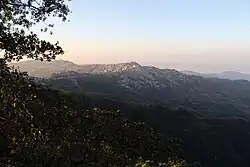 View of Lunglei town | |
.svg.png.webp) Location in Mizoram | |
| Country | India |
| State | Mizoram |
| Headquarters | Lunglei |
| Government | |
| • Lok Sabha constituencies | Mizoram |
| • Vidhan Sabha constituencies | 7 |
| Area | |
| • Total | 4,536 km2 (1,751 sq mi) |
| Population (2001) | |
| • Total | 161,428 |
| • Density | 36/km2 (92/sq mi) |
| Demographics | |
| • Literacy | 88.86 |
| • Sex ratio | 947 |
| Time zone | UTC+05:30 (IST) |
| Website | lunglei |
Toponymy
The district is named after its headquarters, Lunglei. Lunglei, sometimes spelled Lungleh, in Mizo means a bridge of rock. It derived its name from a bridge like rock found in the riverine area around the Nghasih, a small tributary of the river Tlawng.
Geography
The district is bounded on the north by Mamit and Aizawl districts, on the west by Bangladesh, on the south by Lawngtlai district, on the southeast by Saiha district, on the east by Myanmar and on the northeast by Serchhip District. The district occupies an area of 4538 km2. Lunglei town is the administrative headquarters of the district.
The district has 2 subdivisions, Lunglei and Tlabung. The district has seven assembly constituencies: South Tuipui, Lunglei North, Lunglei East, Lunglei West, Lunglei South, Thorang and West Tuipui.
History
In August 1897, the missionary David Evan Jones visited the Lushai Hills. He came to Lunglei for Christmas of that year, spending the season in the hamlet of Pukpui.[2][3] Sufficient Christian influence remained in the area that during World War II, inhabitants of the village held prayer services in churches.[4]
Demographics
| Year | Pop. | ±% p.a. |
|---|---|---|
| 1971 | 60,403 | — |
| 1981 | 86,511 | +3.66% |
| 1991 | 111,415 | +2.56% |
| 2001 | 137,223 | +2.11% |
| 2011 | 161,428 | +1.64% |
| source:[5] | ||
According to the 2011 census Lunglei district has a population of 161,428, roughly equal to the nation of Saint Lucia.[6] This gives it a ranking of 597th in India (out of a total of 640). The district has a population density of 36 inhabitants per square kilometre (93/sq mi). Its population growth rate over the decade 2001-2011 was 17.64%. Lunglei has a sex ratio of 947 females for every 1000 males, and a literacy rate of 88.86%.[1]
After division of Lunglei district, the residual district has a population of 132,960, of which 61,565 (46.30%) live in urban areas. The residual district has a sex ratio of 936 females per 1000 males. Scheduled Tribes make up 125,449 (94.35%) of the population.[1]
According to the 2011 census, 66.48% of the population spoke Mizo, 24.85% Chakma, 3.55% Tripuri, 15.25% Chakma, 1.41% Bengali and 1.40% Hindi as their first language.[8]
References
- "District Census Handbook: Lunglei" (PDF). censusindia.gov.in. Registrar General and Census Commissioner of India. 2011.
- John Hughes Morris The history of the Welsh Calvinistic Methodists' foreign mission Page 319 1996 "DAVID EVAN JONES — Born February 15th, 1870, at Brynmelyn, Llandderfel. Educated at Bala Grammar School, Liverpool Institute, Bala and Aberystwyth Colleges. For two years pastor of Bettws church, Mont. Ordained in 1897. Sailed for India, June 26th, 1897, arriving at Aizawl, Lushai Hills, August 31st. In 1903, married Miss K. E. Williams, Sylhet."
- Lloyd, J. Meirion (1991). History of the Church in Mizoram: Harvest in the Hills. Synod Publication Board.
- Chatterjee, Suhas (1994). Making of Mizoram: Role of Laldenga. M.D. Publications Pvt. Ltd. ISBN 978-81-85880-38-9.
- Decadal Variation In Population Since 1901
- US Directorate of Intelligence. "Country Comparison:Population". Archived from the original on 13 June 2007. Retrieved 1 October 2011.
Saint Lucia 161,557 July 2011 est.
- "Table C-01 Population By Religion: Mizoram". census.gov.in. Registrar General and Census Commissioner of India. 2011.
- "Table C-16 Population By Mother Tongue: Mizoram". censusindia.gov.in. Registrar General and Census Commissioner of India. 2011.
External links
- Official site
- "Base Map of Lunglei District, Mizoram". Agriculture - Remote Sensing and GIS. Department of Agriculture, Government of Mizoram. Archived from the original on 26 August 2015.
- "Drainage Map of Lunglei District, Showing Coding up to Mico Watershed, Mizoram". Agriculture - Remote Sensing and GIS. Department of Agriculture, Government of Mizoram. Archived from the original on 26 August 2015.
Places adjacent to Lunglei district | |
|---|---|
| State symbols | |
|---|---|
| Government | |
| Topics | |
| Districts | |
| Urban Areas | |
| Infrastructure | |
| Education | |
| Tourism | |
| Protected areas | |
| Mizo Culture | |
| Bangladesh | |||||||
|---|---|---|---|---|---|---|---|
| China |
| ||||||
| India |
| ||||||
| Laos |
| ||||||
| Thailand | |||||||