Dipayal Silgadhi
Dipayal Silgadhi (Nepali: दिपायल सिलगढी) is a municipality and the district headquarters of Doti District in Sudurpashchim Province of Nepal. Previously, it also served as the headquarters of the Far-Western Development Region. It lies in the Lesser Himalayas on the bank of Seti River. At the time of the 2011 Nepal census it had a population of 32,941 people living in 7,447 individual households.[2]
Dipayal Silgadhi
दिपायल सिलगढी नगरपालिका | |
|---|---|
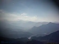 Seti River valley with Dipayal (left side) | |
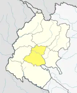
 Dipayal Silgadhi Location in Nepal | |
| Coordinates: 29°16′N 80°56′E | |
| Country | |
| Province | Sudurpashchim Province |
| District | Doti District |
| Government | |
| • Mayor | Baji singh khadka (Nepali Congress) |
| • Deputy Mayor | Kalpana Mahar Saud (Nepali Congress) |
| Area | |
| • Total | 72 km2 (28 sq mi) |
| Elevation | 1,310 m (4,300 ft) |
| Population (2011[1]) | |
| • Total | 23,416 |
| • Density | 330/km2 (840/sq mi) |
| Time zone | UTC+5:45 (Nepal Time) |
| Postal code | 10801 |
| Area code | 094 |
| Website | http://dipayalsilgadhimun.gov.np |
Demographics
At the time of the 2011 Nepal census, Dipayal Silgadhi Municipality had a population of 36,038. Of these, 85.8% spoke Doteli, 12.2% Nepali, 0.4% Maithili, 0.4% Tharu, 0.2% Hindi, 0.2% Magar, 0.2% Baitadeli, 0.1% Newar, 0.1% Urdu and 0.2% other languages as their first language.[3]
In terms of ethnicity/caste, 61.9% were Chhetri, 9.9% Kami, 6.5% Damai/Dholi, 5.2% Hill Brahmin, 3.3% other Dalit, 2.3% Lohar, 2.2% Newar, 1.9% Thakuri, 1.7% Badi, 1.4% Sarki, 0.6% Magar, 0.5% Tharu, 0.4% Kumal, 0.4% Majhi, 0.3% Gurung, 0.2% Sanyasi/Dasnami, 0.2% Musalman, 0.1% other Terai, 0.1% Rai, 0.1% Tamang, 0.1% Hajam/Thakur, 0.1% Bengali, 0.1% Halwai and 0.2% others.[4]
In terms of religion, 99.3% were Hindu, 0.4% Christian, 0.2% Muslim and 0.1% Buddhist.[5]
In terms of literacy, 61.2% could read and write, 2.6% could only read and 36.2% could neither read nor write.[6]
Climate
| Climate data for Dipayal Silgadhi (elevation 563 m (1,847 ft), 1991–2020 normals) | |||||||||||||
|---|---|---|---|---|---|---|---|---|---|---|---|---|---|
| Month | Jan | Feb | Mar | Apr | May | Jun | Jul | Aug | Sep | Oct | Nov | Dec | Year |
| Average high °C (°F) | 22.3 (72.1) |
25.4 (77.7) |
30.0 (86.0) |
34.6 (94.3) |
36.7 (98.1) |
36.5 (97.7) |
34.1 (93.4) |
33.8 (92.8) |
33.4 (92.1) |
31.6 (88.9) |
27.6 (81.7) |
23.7 (74.7) |
30.8 (87.4) |
| Daily mean °C (°F) | 13.7 (56.7) |
16.7 (62.1) |
20.6 (69.1) |
25.1 (77.2) |
28.2 (82.8) |
29.8 (85.6) |
29.3 (84.7) |
28.9 (84.0) |
27.8 (82.0) |
24.1 (75.4) |
19.0 (66.2) |
14.8 (58.6) |
23.2 (73.8) |
| Average low °C (°F) | 5.0 (41.0) |
7.9 (46.2) |
11.1 (52.0) |
15.5 (59.9) |
19.6 (67.3) |
23.1 (73.6) |
24.4 (75.9) |
23.9 (75.0) |
22.2 (72.0) |
16.5 (61.7) |
10.4 (50.7) |
5.9 (42.6) |
15.5 (59.9) |
| Average precipitation mm (inches) | 45.7 (1.80) |
50.9 (2.00) |
34.8 (1.37) |
36.9 (1.45) |
67.5 (2.66) |
165.8 (6.53) |
230.6 (9.08) |
224.8 (8.85) |
142.6 (5.61) |
39.1 (1.54) |
4.9 (0.19) |
11.2 (0.44) |
1,054.8 (41.53) |
| Average precipitation days (≥ 0.1 mm) | 3.4 | 4.2 | 3.6 | 4.9 | 8.4 | 11.7 | 17.0 | 16.1 | 9.4 | 1.9 | 0.6 | 0.7 | 82.0 |
| Source: World Meteorological Organization[7] | |||||||||||||
Transportation
Seti Highway begins in Dipayal Silgadhi, linking it to Amargadhi, from where the Terai region of Nepal can be reached on Mahakali Highway.
Doti Airport is now functional operating twice a week lies in Dipayal Silgadhi.
Media
Radio Nepal has a regional station in Dipayal Silgadhi which transmits various programs of mass interest. Silgadhi based Tribeni FM 94.4 MHz, Radio Shaileswori 105.9 MHz are the F.M. station here to serve people. Among them Tribeni FM and Radio Shaileswori are Community radio Station.
References
- General Bureau of Statistics, Kathmandu, Nepal, Nov. 2012
- "National Population and Housing Census 2011" (PDF). Central Bureau of Statistics. November 2017. Archived from the original (PDF) on 27 January 2018. Retrieved 1 May 2018.
- NepalMap Language
- NepalMap Caste
- NepalMap Religion
- NepalMap Literacy
- "World Meteorological Organization Climate Normals for 1991–2020". World Meteorological Organization. Retrieved 14 October 2023.
External links