Disraeli, Quebec (city)
The city of Disraeli is located in the Municipalité régionale de comté des Appalaches in Quebec, Canada. It is part of the Chaudière-Appalaches region and the population is 2,570 as of 2009. It was named after British statesman and writer Benjamin Disraeli.
Disraeli | |
|---|---|
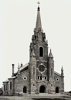 Sainte-Luce church. | |
_Quebec_location_diagram.png.webp) Location within Les Appalaches RCM. | |
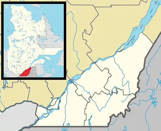 Disraeli Location in province of Quebec. | |
| Coordinates: 45°54′N 71°21′W[1] | |
| Country | |
| Province | |
| Region | Chaudière-Appalaches |
| RCM | Les Appalaches |
| Constituted | November 19, 1904 |
| Government | |
| • Mayor | André Rodrigue |
| • Federal riding | Mégantic—L'Érable |
| • Prov. riding | Mégantic |
| Area | |
| • Total | 8.20 km2 (3.17 sq mi) |
| • Land | 6.91 km2 (2.67 sq mi) |
| Population | |
| • Total | 2,502 |
| • Density | 362.1/km2 (938/sq mi) |
| • Pop 2006–2011 | |
| • Dwellings | 1,280 |
| Time zone | UTC−5 (EST) |
| • Summer (DST) | UTC−4 (EDT) |
| Postal code(s) | |
| Area code(s) | 418 and 581 |
| Highways | |
| Website | www |
The city of Disraeli forms an enclave in the territory of the parish of Disraeli and the two are separate legal entities.
Demographics
In the 2021 Census of Population conducted by Statistics Canada, Disraeli had a population of 2,360 living in 1,226 of its 1,311 total private dwellings, a change of 1% from its 2016 population of 2,336. With a land area of 6.8 km2 (2.6 sq mi), it had a population density of 347.1/km2 (898.9/sq mi) in 2021.[4]
Notable people
Henri Gagnon and Irène Marcotte, parents of Rene Gagnon, one of the six US Marines who raised the second American flag atop Mount Suribachi on February 23, 1945 as shown in the iconic photograph Raising the Flag on Iwo Jima.
References
- "Reference number 18550 in Banque de noms de lieux du Québec". toponymie.gouv.qc.ca (in French). Commission de toponymie du Québec.
- "Geographic code 31015 in the official Répertoire des municipalités". www.mamh.gouv.qc.ca (in French). Ministère des Affaires municipales et de l'Habitation.
- "Disraeli, Quebec (city) (Code 2431015) Census Profile". 2011 census. Government of Canada - Statistics Canada.
- "Population and dwelling counts: Canada, provinces and territories, and census subdivisions (municipalities), Quebec". Statistics Canada. February 9, 2022. Retrieved August 29, 2022.
- Commission de toponymie du Québec
- Ministère des Affaires municipales, des Régions et de l'Occupation du territoire Archived 2011-02-24 at the Wayback Machine
Places adjacent to Disraeli, Quebec (city) | ||||||||||||||||
|---|---|---|---|---|---|---|---|---|---|---|---|---|---|---|---|---|
| ||||||||||||||||
| Cities & Towns | |
|---|---|
| Municipalities | |
| Parishes | |
| |