Donglan County
Donglan County (simplified Chinese: 东兰县; traditional Chinese: 東蘭縣; pinyin: Dōnglán Xiàn, Zhuang: Dunghlanz Yen) is a county of northwest Guangxi, China. It is under the administration of Hechi City.
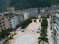
Donglan County
东兰县 • Dunghlanz Yen Tunglan | |
|---|---|
 | |
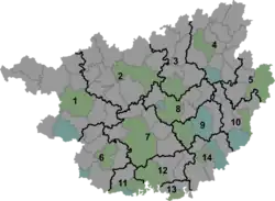 Donglan Location of the seat in Guangxi | |
| Coordinates: 24°31′N 107°22′E | |
| Country | People's Republic of China |
| Region | Guangxi |
| Prefecture-level city | Hechi |
| Township-level divisions | 5 towns 8 townships 1 ethnic township |
| County seat | Donglan Town (东兰镇) |
| Area | |
| • Total | 2,435 km2 (940 sq mi) |
| Elevation | 260 m (850 ft) |
| Population (2010) | |
| • Total | 295,519 |
| • Density | 120/km2 (310/sq mi) |
| Time zone | UTC+8 (China Standard) |
| Website | archived link |
Donglan County has given its name to the Donglan golden-line barbel (Sinocyclocheilus donglanensis), a small fish that is only known from one cave in Donglan.[1][2]
Administrative divisions
There are 5 towns, 8 townships and 1 ethnic township in the county:[3]
Towns:
- Donglan Town (东兰镇), Aidong (隘洞镇), Changle (长乐镇), Sanshi (三石镇), Wuzhuan (武篆镇)
Townships:
- Simeng Township (泗孟乡), Lanmu Township (兰木乡), Changjiang Township (长江乡), Bachou Township (巴畴乡), Jingu Township (金谷乡), Datong Township (大同乡), Huaxiang Township (花香乡), Chuxue Township (切学乡), Sannong Yao Ethnic Township (三弄瑶族乡)
Climate
| Climate data for Donglan (1991–2020 normals, extremes 1981–2010) | |||||||||||||
|---|---|---|---|---|---|---|---|---|---|---|---|---|---|
| Month | Jan | Feb | Mar | Apr | May | Jun | Jul | Aug | Sep | Oct | Nov | Dec | Year |
| Record high °C (°F) | 29.0 (84.2) |
33.4 (92.1) |
35.9 (96.6) |
36.9 (98.4) |
38.1 (100.6) |
37.1 (98.8) |
38.0 (100.4) |
38.0 (100.4) |
38.2 (100.8) |
34.8 (94.6) |
32.0 (89.6) |
29.6 (85.3) |
38.2 (100.8) |
| Average high °C (°F) | 15.5 (59.9) |
18.2 (64.8) |
21.6 (70.9) |
26.8 (80.2) |
29.9 (85.8) |
31.5 (88.7) |
32.7 (90.9) |
33.0 (91.4) |
31.1 (88.0) |
27.0 (80.6) |
23.0 (73.4) |
17.9 (64.2) |
25.7 (78.2) |
| Daily mean °C (°F) | 11.3 (52.3) |
13.6 (56.5) |
16.9 (62.4) |
21.6 (70.9) |
24.5 (76.1) |
26.4 (79.5) |
27.2 (81.0) |
26.8 (80.2) |
24.9 (76.8) |
21.1 (70.0) |
17.1 (62.8) |
12.6 (54.7) |
20.3 (68.6) |
| Average low °C (°F) | 8.7 (47.7) |
10.8 (51.4) |
14.0 (57.2) |
18.2 (64.8) |
21.1 (70.0) |
23.4 (74.1) |
24.0 (75.2) |
23.5 (74.3) |
21.4 (70.5) |
17.9 (64.2) |
13.7 (56.7) |
9.4 (48.9) |
17.2 (62.9) |
| Record low °C (°F) | −1.0 (30.2) |
0.1 (32.2) |
2.0 (35.6) |
7.8 (46.0) |
11.2 (52.2) |
14.8 (58.6) |
17.5 (63.5) |
19.4 (66.9) |
13.2 (55.8) |
7.6 (45.7) |
2.9 (37.2) |
−1.7 (28.9) |
−1.7 (28.9) |
| Average precipitation mm (inches) | 38.6 (1.52) |
29.5 (1.16) |
62.4 (2.46) |
96.3 (3.79) |
232.9 (9.17) |
375.9 (14.80) |
300.7 (11.84) |
201.2 (7.92) |
114.8 (4.52) |
92.3 (3.63) |
51.6 (2.03) |
34.1 (1.34) |
1,630.3 (64.18) |
| Average precipitation days (≥ 0.1 mm) | 12.0 | 10.4 | 14.0 | 13.8 | 16.1 | 19.1 | 19.9 | 16.2 | 10.9 | 9.8 | 9.0 | 8.2 | 159.4 |
| Average snowy days | 0.2 | 0 | 0 | 0 | 0 | 0 | 0 | 0 | 0 | 0 | 0 | 0.2 | 0.4 |
| Average relative humidity (%) | 79 | 78 | 78 | 78 | 81 | 85 | 84 | 84 | 82 | 82 | 81 | 78 | 81 |
| Mean monthly sunshine hours | 47.6 | 59.5 | 69.9 | 107.8 | 135.2 | 123.2 | 160.4 | 179.2 | 153.7 | 118.9 | 102.2 | 81.4 | 1,339 |
| Percent possible sunshine | 14 | 19 | 19 | 28 | 33 | 30 | 39 | 45 | 42 | 33 | 31 | 25 | 30 |
| Source: China Meteorological Administration[4][5] | |||||||||||||
References
- Zhao, Yahui; Watanabe, Katsutoshi; Zhang, Chunguang (2006). "Sinocyclocheilus donglanensis, a new cavefish (Teleostei: Cypriniformes) from Guangxi, China". Ichthyological Research. 53 (2): 121–128. doi:10.1007/s10228-005-0317-z. S2CID 36978051.
- Noakes, David; Romero Aldemaro; Yahui Zhao; Yingqi Zhou (18 November 2009). Chinese Fishes. Springer Science & Business Media. p. 225. ISBN 978-90-481-3458-8.
- 2011年统计用区划代码和城乡划分代码:东兰县 (in Chinese). National Bureau of Statistics of the People's Republic of China. Archived from the original on February 19, 2013. Retrieved 2013-01-02.
- 中国气象数据网 – WeatherBk Data (in Simplified Chinese). China Meteorological Administration. Retrieved 28 May 2023.
- 中国气象数据网 (in Simplified Chinese). China Meteorological Administration. Retrieved 28 May 2023.
External links
This article is issued from Wikipedia. The text is licensed under Creative Commons - Attribution - Sharealike. Additional terms may apply for the media files.