Drevsjø
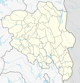
Drevsjø is a village in Engerdal municipality in Innlandet county, Norway. It is located about 16 kilometres (9.9 mi) north of the village of Engerdal and about 12 kilometres (7.5 mi) southeast of the village of Sorken. The village takes its name from the lake Drevsjø which lies near the village. The Drevsjø Church is located in the village.[2] The village has some commercial businesses serving the municipality such as grocery stores plus a large sawmill.
Drevsjø | |
|---|---|
Village | |
 View of the village | |
 Drevsjø Location of the village  Drevsjø Drevsjø (Norway) | |
| Coordinates: 61.89012°N 12.02901°E | |
| Country | Norway |
| Region | Eastern Norway |
| County | Innlandet |
| District | Østerdalen |
| Municipality | Engerdal Municipality |
| Elevation | 674 m (2,211 ft) |
| Time zone | UTC+01:00 (CET) |
| • Summer (DST) | UTC+02:00 (CEST) |
| Post Code | 2443 Drevsjø |
Drevsjø is well known for its natural environment and its fishing opportunities. It is only 60 minutes from one of Scandinavia's biggest alpine centres, Trysilfjellet. The village has several recreational facilities including a tennis court, football pitch, and a car racing track. The village is the site of the Blokkodden Villmarksmuseum, an open-air museum presenting the history of the use of the natural world since the 18th century.[3]
The village has several municipal and state institutions including nursing homes and health centres. Since 1990, the village has also had a reception centre for asylum seekers in Norway.[4]
Climate
Drevsjø has a subarctic climate (Dfc) with only 3 months with a mean temperature above 11 °C (52 °F). There is a wetter period from June to September and a dry period from December to April.
| Climate data for Drevsjø : 672m (1991−2020) | |||||||||||||
|---|---|---|---|---|---|---|---|---|---|---|---|---|---|
| Month | Jan | Feb | Mar | Apr | May | Jun | Jul | Aug | Sep | Oct | Nov | Dec | Year |
| Average high °C (°F) | −4.2 (24.4) |
−2.9 (26.8) |
0.7 (33.3) |
5.3 (41.5) |
11.1 (52.0) |
15.6 (60.1) |
18.5 (65.3) |
16.6 (61.9) |
11.9 (53.4) |
5.1 (41.2) |
−0.3 (31.5) |
−3.6 (25.5) |
6.2 (43.1) |
| Daily mean °C (°F) | −8.8 (16.2) |
−8.5 (16.7) |
−5.0 (23.0) |
0.2 (32.4) |
5.6 (42.1) |
10.0 (50.0) |
12.8 (55.0) |
11.2 (52.2) |
7.0 (44.6) |
1.4 (34.5) |
−3.8 (25.2) |
−7.9 (17.8) |
1.2 (34.1) |
| Average low °C (°F) | −14.0 (6.8) |
−14.5 (5.9) |
−11.1 (12.0) |
−5.2 (22.6) |
−0.4 (31.3) |
4.1 (39.4) |
6.9 (44.4) |
6.0 (42.8) |
2.5 (36.5) |
−2.2 (28.0) |
−7.7 (18.1) |
−12.7 (9.1) |
−4.1 (24.6) |
| Average precipitation mm (inches) | 34.0 (1.34) |
26.3 (1.04) |
25.2 (0.99) |
26.7 (1.05) |
56.9 (2.24) |
72.0 (2.83) |
85.3 (3.36) |
87.6 (3.45) |
57.9 (2.28) |
51.4 (2.02) |
42.2 (1.66) |
31.9 (1.26) |
597.4 (23.52) |
| Source: NOAA[5] | |||||||||||||
| Climate data for Drevsjø 1961-1990, extremes 1948-2015 | |||||||||||||
|---|---|---|---|---|---|---|---|---|---|---|---|---|---|
| Month | Jan | Feb | Mar | Apr | May | Jun | Jul | Aug | Sep | Oct | Nov | Dec | Year |
| Record high °C (°F) | 8.2 (46.8) |
10.4 (50.7) |
13.4 (56.1) |
17.9 (64.2) |
24.5 (76.1) |
29.0 (84.2) |
28.7 (83.7) |
29.2 (84.6) |
25.0 (77.0) |
20.0 (68.0) |
11.7 (53.1) |
8.0 (46.4) |
29.2 (84.6) |
| Average high °C (°F) | −6.9 (19.6) |
−4.7 (23.5) |
−0.6 (30.9) |
3.5 (38.3) |
10.5 (50.9) |
15.9 (60.6) |
17.0 (62.6) |
15.7 (60.3) |
10.4 (50.7) |
5.2 (41.4) |
−1.6 (29.1) |
−5.2 (22.6) |
4.9 (40.9) |
| Average low °C (°F) | −17.3 (0.9) |
−16.5 (2.3) |
−12.7 (9.1) |
−6.9 (19.6) |
−0.5 (31.1) |
4.3 (39.7) |
6.0 (42.8) |
5.1 (41.2) |
1.9 (35.4) |
−2.0 (28.4) |
−9.7 (14.5) |
−15.3 (4.5) |
−5.3 (22.5) |
| Record low °C (°F) | −47.0 (−52.6) |
−43.9 (−47.0) |
−39.5 (−39.1) |
−28.7 (−19.7) |
−17.8 (0.0) |
−6.0 (21.2) |
−3.0 (26.6) |
−4.3 (24.3) |
−10.6 (12.9) |
−28.0 (−18.4) |
−33.3 (−27.9) |
−44.3 (−47.7) |
−47.0 (−52.6) |
| Average precipitation mm (inches) | 28 (1.1) |
22 (0.9) |
25 (1.0) |
29 (1.1) |
44 (1.7) |
70 (2.8) |
86 (3.4) |
80 (3.1) |
67 (2.6) |
47 (1.9) |
38 (1.5) |
34 (1.3) |
570 (22.4) |
| Average precipitation days | 8.3 | 6.5 | 6.8 | 6.6 | 9.0 | 10.8 | 12.4 | 11.7 | 10.7 | 9.4 | 9.2 | 9.4 | 110.8 |
| Source: Met Norway Eklima | |||||||||||||
References
- "Drevsjø, Engerdal". yr.no. Retrieved 1 March 2022.
- Thorsnæs, Geir, ed. (14 January 2020). "Drevsjø". Store norske leksikon (in Norwegian). Kunnskapsforlaget. Retrieved 1 March 2022.
- "Blokkodden Villmarksmuseum". Trysil Museum.
- "Asylsøkermottak Drevsjø" (in Norwegian). Engerdal kommune.
- "Drevsjø Climate Normals 1991–2020". World Meteorological Organization Climatological Standard Normals (1991–2020). National Oceanic and Atmospheric Administration. Archived from the original on 20 August 2023. Retrieved 21 August 2023.