Abercorn, Quebec
Abercorn is a village in the Brome-Missisquoi Regional County Municipality in the Estrie region of Québec, Canada. The population as of the Canada 2016 Census was 334.[2][4]
Abercorn | |
|---|---|
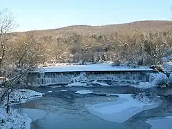 Waterfall in the village of Abercorn, Québec | |
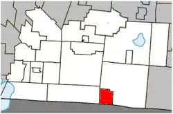 Location within Brome-Missisquoi RCM. | |
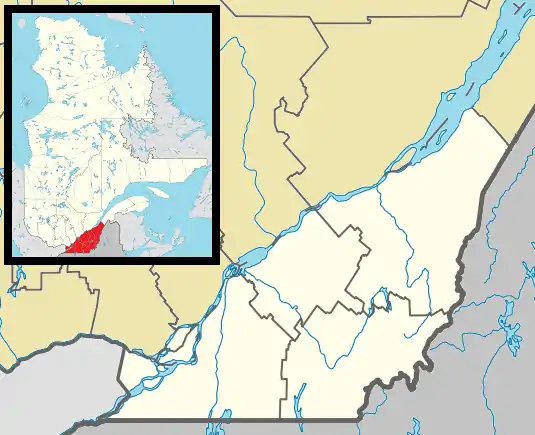 Abercorn Location in southern Quebec. | |
| Coordinates: 45°02′N 72°40′W[1] | |
| Country | |
| Province | |
| Region | Estrie |
| RCM | Brome-Missisquoi |
| Historic region | Eastern Townships |
| Settled | 1797 |
| Constituted | June 25, 1929 |
| Government | |
| • Mayor | Guy Gravel |
| • Federal riding | Brome—Missisquoi |
| • Prov. riding | Brome-Missisquoi |
| Area | |
| • Total | 27.00 km2 (10.42 sq mi) |
| • Land | 26.72 km2 (10.32 sq mi) |
| Population (2016)[4] | |
| • Total | 334 |
| • Density | 12.5/km2 (32/sq mi) |
| • Pop 2011-2016 | |
| • Dwellings | 236 |
| Time zone | UTC−5 (EST) |
| • Summer (DST) | UTC−4 (EDT) |
| Postal code(s) | |
| Area codes | 450 and 579 |
| Highways | |
| Census profile | 2446005[4] |
| MAMROT info | 46005[2] |
| Toponymie info | 88[1] |
It is bordered by the larger township of Sutton to the north and east, by Frelighsburg to the west, and the town of Richford, Vermont in the United States to the south.
Toponymy
The place was first known as Sheppard's Mills in honor of Thomas Sheppard, one of the first inhabitants in 1879. However, the origin of the name Abercorn remains uncertain. This name is probably related to the title held by James Hamilton (1811-1885), Duke of Abercorn. This title is itself linked to a Scottish village located east of Edinburgh.
History
Thomas Spencer built the first log cabin near Abercorn in 1792. The village was originally called Sheppard's Mills in honour of Thomas Shepard, a New Hampshire loyalist who built the area's first grain and saw mill. Originally part of Sutton, Abercorn was established as a township in 1929.
Geography
The village is located on the northern edge of the Green Mountains in the Sutton Valley, flanked to the west by the Pinnacle and to the east by the Sutton Mountain range. The Sutton river runs through the valley, as does Route 139 and the Montreal, Maine and Atlantic Railway.
Located about 105 km from Montréal via Autoroute 10 and near the ski hills of Mount Sutton, Bromont, Jay Peak, Vermont, and Mont Owl's Head, Abercorn is a popular day trip and vacation spot for Montrealers.
Demographics
In the 2021 Census of Population conducted by Statistics Canada, Abercorn had a population of 341 living in 180 of its 240 total private dwellings, a change of 2.1% from its 2016 population of 334. With a land area of 26.72 km2 (10.32 sq mi), it had a population density of 12.8/km2 (33.1/sq mi) in 2021.[5]
Population trend:[6]
| Census | Population | Change (%) |
|---|---|---|
| 2016 | 334 | |
| 2011 | 391 | |
| 2006 | 366 | |
| 2001 | 330 | |
| 1996 | 344 | |
| 1991 | 321 | N/A |
Mother tongue (2016)[7]
| Language | Population | Pct (%) |
|---|---|---|
| French | 200 | 59.7% |
| English | 115 | 34.3% |
| Visible minorities and Aboriginal population | |||
|---|---|---|---|
| Canada 2016 Census | Population | % of Total Population | |
| Visible minority group Source:[7] | South Asian | 0 | 0 |
| Chinese | 0 | 0 | |
| Black | 0 | 0 | |
| Filipino | 0 | 0 | |
| Latin American | 0 | 0 | |
| Southeast Asian | 0 | 0 | |
| Arab | 0 | 0 | |
| West Asian | 0 | 0 | |
| Korean | 0 | 0 | |
| Japanese | 0 | 0 | |
| Mixed visible minority | 0 | 0 | |
| Other visible minority | 0 | 0 | |
| Total visible minority population | 0 | 0 | |
| Aboriginal group Source:[8] | First Nations | 45 | 14.3 |
| Métis | 0 | 0 | |
| Inuit | 0 | 0 | |
| Total Aboriginal population | 45 | 14.3 | |
| White | 270 | 85.7 | |
| Total population | 315 | 100 | |
References
- "Reference number 88 in Banque de noms de lieux du Québec". toponymie.gouv.qc.ca (in French). Commission de toponymie du Québec.
- "Geographic code 46005 in the official Répertoire des municipalités". www.mamh.gouv.qc.ca (in French). Ministère des Affaires municipales et de l'Habitation.
- "Parliament of Canada Federal Riding History: BROME--MISSISQUOI (Quebec)". Archived from the original on 2009-06-09. Retrieved 2009-04-20.
- "Census Profile, 2016 Census - Abercorn, Village [Census subdivision], Quebec and les Etchemins, Municipalité régionale de comté [Census division], Quebec". 8 February 2017.
- "Population and dwelling counts: Canada, provinces and territories, and census subdivisions (municipalities), Quebec". Statistics Canada. February 9, 2022. Retrieved August 28, 2022.
- Statistics Canada: 1996, 2001, 2006, 2011, 2016 census
- 2016 Statistics Canada Community Profile: Abercorn, Quebec
- Community Profiles from the 2006 Census, Statistics Canada - Census Subdivision
External links
Adjacent Municipal Subdivisions | |
|---|---|
| Cities & Towns |
|
|---|---|
| Municipalities | |
| Townships | |
| Villages | |