Easton Historic District (Easton, Maryland)
The Easton Historic District is a historic district that covers most of the core of the town of Easton, Maryland. The town is the county seat of Talbot County. The state of Maryland is nearly split by the Chesapeake Bay, and Easton is located on the east side of the bay that is known as Maryland's Eastern Shore. Although the town is part of the east coast of the United States, the region's history goes back to a time when Maryland was a colonial province of England.
Easton Historic District | |
 James Neall House | |
  | |
| Location | MD 565, MD 328 and MD 331, Easton, Maryland |
|---|---|
| Coordinates | 38°46′19″N 76°4′26″W |
| Area | 232 acres (94 ha) |
| Architect | Upjohn, Richard; Et al. |
| Architectural style | Greek Revival, Italianate, Federal |
| NRHP reference No. | 80001835[1] |
| Added to NRHP | September 17, 1980 |
The Easton Historic District was added to the National Register of Historic Places in 1980. It contains approximately 900 buildings mostly built in the 18th, 19th, and early 20th centuries. Many of these buildings are residential, but the original business district, located on the west side, is also included. A notable exception to the continuity of the historic district and the construction dates is the original Quaker Third Haven Meeting House, which was constructed in the 1680s southeast of the main portion of the district.
Background
Beginning
Talbot County, as part of the Province of Maryland, began being settled during the mid-1600s with land grants from Lord Baltimore (Cecilius Calvert).[2] Early settlers established tobacco plantations along rivers such as the Choptank, Tred Avon, St. Michaels (now Miles), and Wye rivers.[3] Some of the larger 17th and 18th century plantations within the county were owned by the Goldsborough, Lloyd (Wye Plantation), and Hollyday (Ratcliffe Manor) families.[4] Other early settlers included members of the Society of Friends, also known as Quakers.[3] Politics and society for the next two centuries were strongly influenced by members of the Goldsborough, Hollyday, Kerr, Lloyd, and Tilghman families.[5][6] In 1706, a portion of Talbot County was broken off to help form Queen Anne's county.[7] This made the county seat in York close to the county border, which was inconvenient for the population in now-smaller Talbot County.[8][9] Court was held in private residences located in Oxford, which was closer to the population—but a courthouse was never built.[10] Instead, construction of a courthouse began in 1710 near what was known then as "Pitt's Bridge".[11] At the time, the only other nearby building of importance was the Quaker Third Haven Meeting House, which was built in 1682. The village around the courthouse became known as Talbot Courthouse. After the American Revolution, the village became more important as the state of Maryland chose to establish administrative offices for the Eastern Shore at Talbot Courthouse. The town became, in effect, the "capital" of Maryland's Eastern Shore.[11] Its nearest waterfront (Tred Avon River) was about one mile (1.6 km) away, and eventually became known as Easton Point.[12][Note 1]
In 1788, the Maryland General Assembly gave Talbot Courthouse a name: Easton.[11] The town prospered, and the Maryland Eastern Shore's first newspaper was established in 1790.[11] The original courthouse became too small for state offices and local, state, and federal courts, so a new courthouse was constructed. The new courthouse was completed in 1794. Growth continued as the Eastern Shore's first bank was established in 1805 in Easton.[11][14] During the War of 1812, Fort Stoakes was constructed on a plantation overlooking the Tred Avon River for protection from an attack by the British, and the local bank moved currency to a more secure place in Pennsylvania.[15] In 1817, the Eastern Shore's first steamboat line to Baltimore was established at Easton Point.[11] As more farmland was developed on the west side of the Chesapeake Bay, Maryland's Eastern Shore declined in prosperity—and the American Civil War accelerated this decline. In 1869, a railroad line from Delaware connected Easton with major population centers in the eastern United States.[16][Note 2] This brought prosperity back to the town that continued until the Great Depression of the 1930s.[16] The Chesapeake Bay Bridge connected Annapolis with Maryland's Eastern Shore in 1952.[14]
Easton today
Traveling by automobile from major Maryland cities such as Annapolis or Baltimore, the most direct route to Easton involves crossing the bay using the Chesapeake Bay Bridge and traveling east and south on U.S. Route 50.[12] The town is small to medium-sized, with a population of about 17,000 using the 2020 United States census.[18] Its original street plan was created in 1785, and Colonel Jeremiah Banning named the main street that runs through the business district (and past the courthouse) after George Washington.[12] The town has grown from Banning's time, and annexations include land along the Tred Avon River.[19] Easton remains the county seat of Talbot County, and its courthouse was enlarged in 1958 by adding two wings.[12] Despite the town's early existence, most of the buildings in the Easton Historic District were constructed in the late 19th and early 20th centuries.[16] The district contains about 9,000 buildings located in residential areas and the central business district. The Easton Historic District was nominated for the National Register of Historic Places in 1980. It is significant for its collection of buildings from the 18th, 19th and early 20th centuries.[20]
Contributing structures
In the original 1980 nomination form, the Easton Historic District consisted of approximately 900 buildings and structures within approximately 232 acres (94 ha).[16] Twenty-three were contributing, two non–contributing, and numerous others had not yet been evaluated.[21] The sortable table below contains the original contributing structures that are part of the historic district. If the year built is a range of years, the middle of the range is used.[21]
| Name | MHT Code | Address | Coordinates | Image | Built | Notes and Citations |
|---|---|---|---|---|---|---|
| McDaniel House | T-294 | Aurora St., 14 N. | 38.77484°N 76.07144°W | 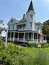 |
1890 circa | Large two-and-a-half story Victorian home with tower, hipped roof with dormers.[22] |
| (unnamed) | T-410 (mentioned on fourth page of file) | Aurora St., 212 S. | 38.7697953°N 76.0712467°W | 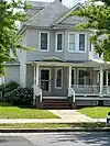 |
1910 | Queen Anne style architecture was predominate in the last third of the 1800s[23][24] |
| Third Haven Meeting House (second) | T-47 | Border Lane | 38.766604°N 76.0752576°W | .jpg.webp) |
1880 circa | 2nd Quaker meeting house built in 1879-1880. One-and-one-half stories brick building that is three bays wide and four bays long.[25] |
| Post Office | T-410 (mentioned on fourth page of file) | Dover St., 116 E. | 38.7741197°N 76.0736147°W |  |
1936 | Built using Colonial Revival architecture typical of 1930s. Replaced Post Office on Washington Street in 1936.[23][26] |
| Avalon Theatre | T-627 | Dover St., 40-42 E. | 38.7743166°N 76.0749692°W | 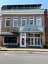 |
1922 | One of the first "state-of-the-art" movie houses on Maryland's Eastern Shore. Exterior has Art Deco theme. Began being renovated in 1987, and upgraded to a performing arts center.[27][28] |
| Wrightson House | T-461 | Dover St., 202 E. | 38.7740583°N 76.0727644°W |  |
1895 circa | Now known as the Tidewater House, the Wrightson House has rare (for Easton) Beaux-Arts architecture.[29] |
| Old Frame Hotel (Nevius & Frampton Hardware) | T-39 | Goldsborough St., 1 | 38.7756902°N 76.0761511°W | 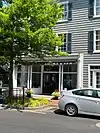 |
1866 | Hotel constructed in 1866 converted to hardware store beginning in 1897. A fire in 1955 caused the roof to be replaced. Gray aluminum siding has been added.[30] |
| Luby House | T-29 | Goldsborough St., 200 | 38.7757828°N 76.0729552°W | 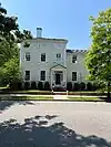 |
1845 circa | Town's best example of Greek Revival architecture. Porch and wing (1940s) are modern but built to be compatible with the main portion of the house. Two–and–a–half story home with frieze "lie–on–your–stomach" windows in the attic.[31] |
| Trinity Cathedral (Episcopal Church) | T-239 | Goldsborough St., 313 | 38.7758945°N 76.0705224°W | 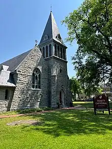 |
1894 | Granite Gothic motif building with interior hammer beams.[32] Consecrated in 1894, this tall building has numerous stained glass windows. Original cathedral, built in 1876 and located behind the current one, is now used as a parish house.[33] |
| Railroad Workers House | T-496 | Goldsborough St., 416 | 38.775942°N 76.0687533°W | 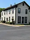 |
1871 | Maryland and Delaware Railroad began service to Easton in 1869.[17] Front porch has been removed.[34] |
| Easton Armory | T-484 | Harrison St., 40 S. | 38.725769°N 76.0746061°W |  |
1927 | Crenellated brick and stone building emulating medieval fortification[35] |
| Schlecht House | T-494 | Harrison St., 114 S. | 38.7717155°N 76.0744033°W |  |
1880 circa | Two-story private home with "L"-shaped porch[36] |
| Chaffinch House | T-34 | Harrison St., 132 S. | 38.7707112°N 76.0743498°W | 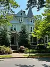 |
1895 circa | Corner Victorian house on Harrison Street and Brookletts Avenue that fronts to both streets. Round corner tower with porch on both facades, irregular roof line with gables[37] |
| Asbury Methodist Episcopal Church | T-421 | Higgins St., 18 S. | 38.7733052°N 76.0700058°W | 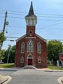 |
1876 | Gothic revival brick church with tower and spire in the middle of the front facade. Large stained glass window above entrance. Interior has stamped tin ceilings and wainscotting.[38] |
| Talbot County Women's Club | T-11 | Talbot Lane, 18 | 38.7729393°N 76.0738194°W |  |
1794 circa | Brick Federal architecture building with Flemish bond brick facade. One of Easton's best preserved early structures. Unusual placement of wing is thought to be for the purpose of enabling windows near the main entrance.[39] |
| Easton Gas Manufacturing Plant | T-1156 | West Street, 1 S. | 38.7708096°N 76.0773054°W | demolished | 1934 | Colonial Revival architecture[40] In 2001, Maryland Department of the Environment identified soil and groundwater contamination on site.[41] |
| Christ Church | T-15 | South St. & Harrison St. | 38.7723888°N 76.0746597°W |  |
1840 circa | English Gothic architecture with features such as arch windows and doors with heavy stone. (Stone buildings are rare on the Eastern Shore.) Vaulted one-story building was first in Easton with a church bell. Reverend Henry M. Mason, who came to Easton in 1838, had a church designed two years earlier in New Jersey by architect William Strickland. The Easton church is based on Strickland's design for the New Jersey church.[42][23] |
| Christ Church Rectory (Christ Church Parish House) | T-16 | South St., 12 | 38.7723628°N 76.0750137°W |  |
1852 | One-and-one-half story granite building designed by Richard Upjohn. Christ Church is adjacent on east side while a garden is on the west side.[23][43] |
| Easton Railroad Station (Delaware/Penn-Central Station) | T-251 | Powell's Alley | 38.7755156°N 76.0682631°W |  |
1900 circa | Easton's brick railroad station with two-bay ticket window. Roof's widely flaring eaves provided cover for the railway platform.[44] |
| Talbot County Courthouse | T-65 | Washington St. | 38.7748°N 76.076953°W |  |
1794 | Brick Georgian structure was constructed in 1794 and is one of Easton's oldest buildings. Expanded in 1890 and remodeled in 1958.[45] Former site of the Talbot Boys Confederate monument, and current location of a monument to Frederick Douglass.[46] |
| Odd Fellows Hall (Miller Lodge, I.O.O.F.) | T-1 | Washington St., 1 S. (corner of Washington and Dover) | 38.7745171°N 76.0763075°W |  |
1879 | Independent Order of Odd Fellows built this lodge in 1879 after an earlier lodge burnt down. Distinctive four-story brick building with irregular roof line. Washington Street facade has a small tower-like gable, topped by a finial, that contains the interior stairway. Large decorative windows are centered on the fourth floor of a larger gable, and each window contains stained glass patterned with symbols of the fraternal order.[47] |
| Shannahan & Wrightson Hardware Co. | T-404 | Washington St., 12 N. | 38.7749197°N 76.0763407°W |  |
1877 | Three-story brick building (note name at top of building) near courthouse. Second floor built 1881, and third floor built 1889. Good example of a Victorian commercial building.[48] |
| Third Haven Meeting House | T-46 | Washington St., 405 S. | 38.766604°N 76.0752576°W | .jpg.webp) |
1682 | Society of Friends meeting house[49] |
Other structures of interest within the historic district

- Bishop's House was built around 1880 by Philip Francis Thomas, former governor of Maryland and former Secretary of the Treasury under President James Buchanan. The house was built after Thomas' retirement. After his death in 1890, his widow sold the house to the Diocese of Easton, and it was used as the home of the Bishop of Easton until 1956. The tall structure with gabled pavilions on the major facades is located at the corner of Aurora and Goldsborough streets.[50] Although it has facades on both streets, the house's address is 214 Goldsborough Street, and it contributes to the Historic District.[24]
- Bullitt/Chamberlain House, one of Easton's most elegant buildings, is located at 102 East Dover Street (corner of Dover and Harrison, sometimes list as 100 East Dover).[51] Lawyer Thomas James Bullitt built this brick house in 1801. Granddaughter Elizabeth Chamberlaine and descendants owned the property into the 20th century. House is a contributing Federal architecture property to the Historic District.[24] It is currently the headquarters of the Mid-Shore Community Foundation.[52]
- Foxley Hall is located at 24 North Aurora Street (corner of Aurora and Goldsborough, across Aurora Street from the Bishop's House). It has a Flemish Bond brick facade built in the 1790s. The name "Foxley" is in honor of Mary Foxley Tilghman, daughter of Colonel Oswald Tilghman. The building has had numerous additions, and the interior was altered in the late 19th century. In 1816, the property was sold to John Leeds Kerr, who's daughter married General Tench Tilghman, grandson of the Tench Tilghman that was an aide-de-camp to George Washington in the American Revolution.[53][54] This began a multi-generation ownership by the Tilghman family.[53] Foxley Hall is a contributing property to the Historic District, and is a well–preserved example of the town's early architecture.[24]
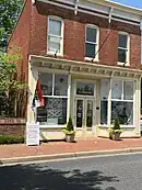
- James Neall House is located at 27 South Washington Street, and is owned by the Talbot County Historical Society. Quakers James and Rachael Cox Neall constructed the house around 1805. The Federal-style brick townhouse is three-and-a-half stories high and has a two-story rear addition. The Historical Society has furnished the kitchen and major rooms in this three-story museum brick home.[55][56] The house is a contributing property to the Easton Historic District.[24]
- Tidewater Inn is located at the corner of Dover and Harrison streets. Constructed in the late 1940s, it is outside of the Historic District's period of significance, but it is still considered a contributing property.[24] The four-story structure houses a hotel and restaurant. It is architecturally significant for its Colonial Revival architecture, and it is historically significant for its contribution to the mid-20th century development of Easton and Talbot County. By itself it was listed on the National Register of Historic Places in 2007.[57]
- Victorian Store is located at 25 South Washington Street, and is the home of the Talbot County Historical Society. Constructed circa 1880, the Historical Society maintains a museum and small library in the building.[58][59]
Historic District Borders
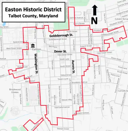
The Easton Historic District includes the core of the town that began with a courthouse in the 18th century. Many of the buildings are residential, but the original business district is also included. The business district is located on the northern part of the west side of the district near the courthouse along Washington Street. Additional businesses are on Goldsborough and Dover streets close to Washington Street. Most of the town's buildings in the historic section are brick structures from the late 19th and early 20th centuries. Less than a dozen buildings are from the 18th century, and about 50 date from the early 19th century.[23]
The Talbot County Courthouse, with an address of 11 North Washington Street, occupies most of a block surrounded by Washington, Dover, West, and Federal streets.[60][61] Three churches are original contributing properties to the district. Trinity Cathedral is located on Goldsborough Street and Locust Lane, east of Aurora Street.[23] The Bishop's House and Foxley Hall are about a block away.[50][53] Christ Church is in the west central portion of the district at South Street and South Harrison Street.[23] The Christ Church Rectory is next door, and the Armory Building is across the street.[35] The Ashbury Methodist Episcopal Church is in the east central portion of the district, about one block south of Dover Street on South Higgins Street. At the extreme southwestern portion of the historic district is a non-contiguous section near Border Lane, and this is the location of the two Third Haven Meeting House buildings.[23]
Notes
Footnotes
- The Tred Avon River has been called many names, including Tred-Avon, Trad-Avon, Tred-Aven, Tred-Haven, Trad-Haven, Tread-Haven, Trade-Haven, and Third Haven. It has also been called Tred-Aven Creek.[13]
- The Maryland & Delaware Railroad (not to be confused with the Maryland and Delaware Railroad incorporated in 1977) ran from Smyrna Station (later named Clayton, Delaware), and Oxford, Maryland. Construction began in 1857 in Delaware. The line reached Easton in 1869, and was completed to Oxford in 1871. The rail connection provided access to Wilmington, Philadelphia, Baltimore, and New York. The railroad was reorganized as the Delaware and Chesapeake Railroad Company in 1877, and eventually became a branch line for the Pennsylvania Railroad. Passenger operations ended in 1949, and the last freight train ran in 1983.[17]
Citations
- "National Register Information System". National Register of Historic Places. National Park Service. July 9, 2010.
- Owings, Donnell MacClure (December 1938). "Private Manors: An Edited List" (PDF). Maryland Historical Magazine. Baltimore, Maryland: Maryland Historical Society. XXXIII (4): 307–334 (see pages 308 and 326). Archived (PDF) from the original on April 28, 2017. Retrieved April 10, 2023.
- "Talbot County, Maryland - Our History". Talbot County, Maryland - Historical Society of Talbot County. Archived from the original on June 16, 2023. Retrieved June 16, 2023.
- Clemens, Paul G. E. (July 1975). "The Operation of an Eighteenth-Century Chesapeake Tobacco Plantation". Agricultural History. Durham, North Carolina: Duke University Press. 49 (3): 517–531 JSTOR. JSTOR 3741788. Archived from the original on June 16, 2023. Retrieved April 19, 2023.
- Tilghman & Harrison 1915, pp. v–vi
- "Area History - Talbot County, A Brief History". Tidewater Times. Archived from the original on June 19, 2023. Retrieved June 19, 2023.
- Tilghman & Harrison 1915a, p. 3
- "Clerk's Office - Historic Courthouse". Maryland Courts. Archived from the original on June 17, 2023. Retrieved June 17, 2023.
- Tilghman & Harrison 1915, p. 218
- Tilghman & Harrison 1915, pp. 219–220
- Arnett, Brugger & Papenfuse 1999, p. 178
- Arnett, Brugger & Papenfuse 1999, p. 177
- Tilghman & Harrison 1915a, p. 324
- "Talbot Historical Society - Talbot County History FAQ". Talbot Historical Society. Archived from the original on June 13, 2023. Retrieved June 13, 2023.
- Tilghman & Harrison 1915a, p. 150n; Tilghman & Harrison 1915a, p. 152
- "National Register of Historic Places Inventory Nomination Form – Easton Historic District" (PDF). Maryland Historical Trust. National Park Service, U.S. Department of the Interior Heritage Conservation and Recreation Service. Archived (PDF) from the original on March 1, 2023. Retrieved June 12, 2023.
- "CAR-374 Maryland & Delaware Railroad Corridor, (Delaware and Chesapeake Railroad)" (PDF). Maryland Historical Trust. Archived (PDF) from the original on June 14, 2021. Retrieved June 17, 2023.
- "QuickFacts - Easton town, Maryland". Census Bureau, U.S. Department of Commerce. Retrieved June 13, 2023.
- "Land Use". Easton, Maryland. Archived from the original on December 9, 2022. Retrieved May 1, 2023.
- George Andreve, Pamela James, and Ronald L. Andrews (Maryland Historical Trust) (1980). "National Register of Historic Places Inventory Nomination Form: Easton Historic District" (PDF). National Park Service, U.S. Department of the Interior (Maryland Historical Trust). Archived (PDF) from the original on March 1, 2023. Retrieved June 6, 2023.
{{cite web}}: CS1 maint: multiple names: authors list (link) - "Maryland's National Register Properties - Easton Historic District". Maryland Historical Trust, Maryland Department of Planning. Archived from the original on June 12, 2023. Retrieved June 12, 2023.
- "T-294 McDaniel House (doctors Baines & Dawkins Office)" (PDF). Maryland Historical Trust. Archived (PDF) from the original on June 5, 2023. Retrieved June 5, 2023.
- "T-410 Easton Historic District" (PDF). Maryland Historical Trust. Archived (PDF) from the original on June 5, 2023. Retrieved June 5, 2023.
- "Easton Historic District Survey". Town of Easton. Archived from the original on June 6, 2023. Retrieved June 17, 2023.
- "T-47 Third Haven Meeting House (second)" (PDF). Maryland Historical Trust. Archived (PDF) from the original on June 5, 2023. Retrieved June 5, 2023.
- Claggett 1999, p. 66
- "T-627 Avalon Theater" (PDF). Maryland Historical Trust. Archived (PDF) from the original on June 5, 2023. Retrieved June 5, 2023.
- "Avalon Foundation - History of the Building". Avalon Foundation. Archived from the original on June 19, 2023. Retrieved June 19, 2023.
- "T-461 Wrightson House" (PDF). Maryland Historical Trust. Archived (PDF) from the original on June 5, 2023. Retrieved June 5, 2023.
- "T-39 Old Frame Hotel (Nevius & Frampton Hardware)" (PDF). Maryland Historical Trust. Archived (PDF) from the original on June 6, 2023. Retrieved June 6, 2023.
- "T-29 Luby House" (PDF). Maryland Historical Trust. Archived (PDF) from the original on June 6, 2023. Retrieved June 6, 2023.
- "T-239 Trinity Cathedral (Episcopal Church)" (PDF). Maryland Historical Trust. Archived (PDF) from the original on June 6, 2023. Retrieved June 6, 2023.
- Arnett, Brugger & Papenfuse 1999, p. 180
- "T-496 Railroad Workers House" (PDF). Maryland Historical Trust. Archived (PDF) from the original on June 6, 2023. Retrieved June 6, 2023.
- "T-484 Easton Armory" (PDF). Maryland Historical Trust. Archived (PDF) from the original on June 6, 2023. Retrieved June 6, 2023.
- "T-494 Schlecht House" (PDF). Maryland Historical Trust. Archived (PDF) from the original on June 6, 2023. Retrieved June 6, 2023.
- "T-34 Chaffinch House" (PDF). Maryland Historical Trust. Archived (PDF) from the original on June 6, 2023. Retrieved June 6, 2023.
- "T-421 Asbury Methodist Episcopal Church" (PDF). Maryland Historical Trust. Archived (PDF) from the original on June 6, 2023. Retrieved June 6, 2023.
- "T-11 Talbot County Women's Club" (PDF). Maryland Historical Trust. Archived (PDF) from the original on September 30, 2021. Retrieved June 6, 2023.
- "T-1156 Easton Gas Manufacturing Plant" (PDF). Maryland Historical Trust. Archived (PDF) from the original on June 6, 2023. Retrieved June 6, 2023.
- "Former Easton Gas Manufacturing Plant - Easton, Maryland" (PDF). Maryland Coastal Zone Management Program, Department of Natural Resources. Archived (PDF) from the original on March 3, 2022. Retrieved June 21, 2023.
- "T-15 Christ Church" (PDF). Maryland Historical Trust. Archived (PDF) from the original on September 30, 2021. Retrieved June 7, 2023.
- "T-16 Christ Church Rectory (Christ Church Parish House)" (PDF). Maryland Historical Trust. Archived (PDF) from the original on September 30, 2021. Retrieved June 7, 2023.
- "T-251 Easton Railroad Station (Delaware/Penn-Central Station)" (PDF). Maryland Historical Trust. Archived (PDF) from the original on December 27, 2016. Retrieved June 7, 2023.
- "T-65 Talbot County Courthouse" (PDF). Maryland Historical Trust. Archived (PDF) from the original on June 17, 2021. Retrieved June 7, 2023.
- McGreevy, Nora (March 18, 2022). "Maryland Removes Its Last Confederate Monument on Public Land". Smithsonian Magazine. Archived from the original on February 1, 2023. Retrieved June 21, 2023.
- "T-1 Odd Fellows Hall (Miller Lodge, I.O.O.F.)" (PDF). Maryland Historical Trust. Archived (PDF) from the original on September 30, 2021. Retrieved June 7, 2023.
- "T-404 Shannahan & Wrightson Hardware Co" (PDF). Maryland Historical Trust. Archived (PDF) from the original on December 22, 2016. Retrieved June 7, 2023.
- "T-46 Third Haven Meeting House" (PDF). Maryland Historical Trust. Archived (PDF) from the original on September 30, 2021. Retrieved June 5, 2023.
- "T-291 Bishop's House" (PDF). Maryland Historical Trust. Archived (PDF) from the original on June 19, 2023. Retrieved June 19, 2023.
- "T-12 Bullitt House" (PDF). Maryland Historical Trust. Archived (PDF) from the original on June 17, 2021. Retrieved June 14, 2023.
- "The Bullitt House". Mid–Shore Community Foundation. Archived from the original on June 20, 2022. Retrieved June 14, 2023.
- "T-30 Foxley Hall" (PDF). Maryland Historical Trust. Archived (PDF) from the original on September 30, 2021. Retrieved June 15, 2023.
- "Kin of Revolutionary Hero Dead at Easton - Oswald Tilghman Dies at Age of 91". Baltimore Sun. June 19, 1932. Retrieved June 25, 2023.
- "T-32 Talbot Co. Historical Society Headquarters (Neall House)" (PDF). Maryland Historical Trust. Archived (PDF) from the original on September 30, 2021. Retrieved June 15, 2023.
- "Talbot Historical Society - James Neall House". Talbot Historical Society. Archived from the original on May 30, 2023. Retrieved June 22, 2023.
- "Maryland's National Register Properties - Tidewater Inn". Maryland Historical Trust, Maryland Department of Planning. Archived from the original on June 12, 2023. Retrieved June 12, 2023.
- "T-411 Victorian Store (Talbot County Historical Society)" (PDF). Maryland Historical Trust. Archived (PDF) from the original on June 15, 2023. Retrieved June 15, 2023.
- "Talbot Historical Society - Research". Talbot Historical Society. Archived from the original on May 26, 2023. Retrieved June 22, 2023.
- "Maryland Manual On-Line - Talbot County, Maryland - Judicial Branch". Maryland State Archives. Archived from the original on March 22, 2023. Retrieved June 23, 2023.
- 38°77 N 76°07 W (Map). Mountain View, California: Google Maps. 2023. Retrieved May 18, 2023.
References
- Arnett, Earl; Brugger, Robert J.; Papenfuse, Edward C. (1999). Maryland: A Guide to the Old Line State. Baltimore, Maryland: Johns Hopkins University Press. ISBN 978-0-80185-979-3. OCLC 245919199.
- Claggett, Laurence G. (1999). Easton. Charleston, South Carolina: Arcadia. ISBN 978-0-73850-171-0. OCLC 44799734.
- Tilghman, Oswald; Harrison, Samuel Alexander (1915). History of Talbot County, Maryland, 1661-1861 - Volume I. Baltimore, Maryland: Williams and Wilkins Company. OCLC 1541072. Archived from the original on April 3, 2023. Retrieved April 3, 2023.
- Tilghman, Oswald; Harrison, Samuel Alexander (1915a). History of Talbot County, Maryland, 1661-1861 - Volume II. Baltimore, Maryland: Williams and Wilkins Company. OCLC 1541072. Archived from the original on April 11, 2023. Retrieved April 11, 2023.
External links
- Easton Business District 1936 - Library of Congress
- Chronology of Talbot County - Maryland Manual On-line
- Easton Walking Tour - from 2019
- Historic District Commission - Easton, Maryland
- Historic Easton, Maryland - Annapolis Landscape TV - YouTube Video from 2010 (nearly 4 minutes)
- Maryland Railroad Map 1876 - Library of Congress (shows Easton's railroad connection to Delaware)

