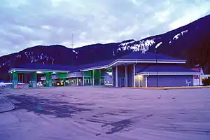
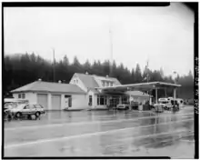
Eastport–Kingsgate Border Crossing
The Eastport–Kingsgate Border Crossing connects the town of Bonners Ferry, Idaho with Yahk, British Columbia on the Canada–US border. U.S. Route 95 on the American side joins British Columbia Highway 95 on the Canadian side.
| Eastport–Kingsgate Border Crossing | |
|---|---|
 US Border Inspection Station at Eastport, Idaho | |
| Location | |
| Country | United States; Canada |
| Location |
|
| Coordinates | 49°00′02″N 116°10′53″W |
| Details | |
| Opened | 1906 |
| US Phone | (208) 267-3966 |
| Can Phone | 1-800-461-9999 (calls within Canada) 1-204-983-3500 (calls outside Canada) |
| Hours | Open 24 hours |
| Website US Canadian | |
Canadian side
From the junction with the Canadian Pacific Railway at Yahk, the rail head of the Spokane International Railroad (SI) reached the border in November 1905.[1] Two months earlier, a Canadian customs office opened across the border at Eastport. In July 1906, an office opened at Kingsgate, under the administrative oversight of the Port of Nelson. In 1909, the Port of Cranbrook assumed oversight. In 1948, the status was upgraded to Port of Kingsgate. In 1961, 24-hour service began.[2]
The depression-era wooden border station was replaced with a brick border station in 1953. This was replaced with the current concrete and steel structure in 2012.[3]
This crossing is open 24 hours per day, 7 days per week.
US side

The SI rail head from the border reached Bonners Ferry in June 1906.[4] The US Customs Service initially operated from space in the railroad depot. In 1934, land was purchased and a new facility was opened in 1936. The building underwent a series of upgrades over subsequent years.[5] The border station was replaced by the current facility in 1988.
References
- "Moyie Leader". www.library.ubc.ca. 25 Nov 1905. p. 1.
- Legg, Herbert (1962). Customs Services in Western Canada, 1867–1925. The Creston Review Ltd. pp. 144–145.
- "Today in BC". www.todayinbc.com. 16 Nov 2012.
- "Moyie Leader". www.library.ubc.ca. 9 Jun 1906. p. 1.
- "HISTORIC AMERICAN BUILDINGS SURVEY" (PDF). lcweb2.loc.gov.