Ebene, Mauritius
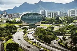
Ebene (Mauritian Creole pronunciation: [ebɛn]) is a suburb of Quatre Bornes, Mauritius, 15 kilometres (9.3 mi) south of the capital, Port Louis. Construction began in November 2001, with the suburb being promoted as a new information technology hub for Mauritius and as a link between African and Asian markets. The aim being to create a hi-tech office area in order to dynamise the country. As a result, it is also referred to as Ebene Cybercity or Cyber City.
Ebene | |
|---|---|
Suburb | |
 Ebene | |
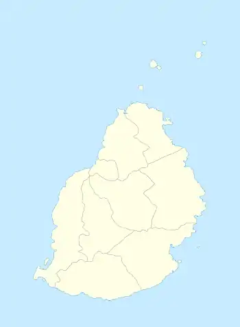 Ebene Location on Mauritius | |
| Coordinates: 20°14′35″S 57°29′30″E | |
| Country | |
| District | Plaines Wilhems |
| City | November 2001 |
| Highest elevation | 273 m (896 ft) |
| Population (2012) | |
| • Total | 1,001 |
| Time zone | UTC+4 (MUT) |
| Post Code | 72201 |
| Airport | Plaisance Airport (distanced approximately 29 km) |
Ebene Cyber City
Mauritius Research and Innovation Council has a centre at Ebene where it has a ground station for its satellite MIR-SAT1.[1][2] Mauritius Metro is being expanded to Ebene.[3]
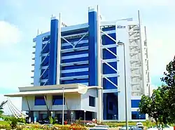
The Atal Bihari Vajpayee Tower (formerly Cyber Tower One)[4][5] is a 12-storey, 72-metre-tall commercial building located in Ebene Cybercity.
References
- Iderawumi, Mustapha (2021-06-03). "Mauritius Launches First Satellite". Space in Africa. Retrieved 2022-02-01.
- Faleti, Joshua (2021-06-22). "MIR-SAT 1 Successfully Deploys from the ISS into Orbit". Space in Africa. Retrieved 2022-02-01.
- "L&T secures metro contract in Mauritius". Railway Technology. 2021-02-12. Retrieved 2022-02-01.
- Seeboo, Sruthi Menon (2018-08-31). "Ebene Cyber Tower to be renamed as Atal Bihari Vajpayee Tower". Platform Africa. Retrieved 2022-02-02.
- "Republic of Mauritius- Cyber Tower 1 officially renamed Atal Bihari Vajpayee Tower". Government Portal of Mauritius. 17 January 2019. Retrieved 2022-02-02.
Further reading
- "Ebene CyberCity". e-cybercity.mu. 18 August 2015. Archived from the original on 14 January 2006.
- Schuetze, Christopher F. (2016-05-23). "Story of cities #48: Cybercity, Mauritius – a vision of Africa's 'smart' future?". The Guardian.
- "Ebene Cyber City and Tower by C R NARAYANA RAO". Architizer. 2014-11-21.
- Boodhun, Hanna (2016). "Identification of the key urban facilities management principles of a sustainable urban precinct: A case study of Ebene Cybercity, Mauritius". University of Cape Town.
{{cite journal}}: Cite journal requires|journal=(help)