Island Macaskin
Island Macaskin or MacAskin (Scottish Gaelic: Eilean MhicAsgain) is an island in Loch Craignish, in the Inner Hebrides of Scotland. It is owned by the Jenkin family and has been since 1904.
| Scottish Gaelic name | Eilean MhicAsgain |
|---|---|
| Location | |
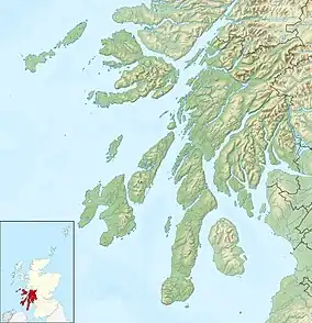
 Island Macaskin Island Macaskin shown within Argyll and Bute | |
| OS grid reference | NR786994 |
| Coordinates | 56.14°N 5.56°W |
| Physical geography | |
| Island group | Islay |
| Area | 50 hectares (0.19 sq mi) [1][2] |
| Area rank | 199= [3] |
| Highest elevation | 65 m Owner= Jenkin family |
| Administration | |
| Sovereign state | United Kingdom |
| Country | Scotland |
| Council area | Argyll and Bute |
| Demographics | |
| Largest settlement | Main hut |
| References | [4][5][6] |
History and wildlife
The island was formerly inhabited, and unusually for the Scottish islands, is quite well wooded, with some mature trees scattered about. It appears to have been abandoned in the 1880s, but there is ample evidence of human habitation on it, including a number of walls, a sheep pen, and a lime kiln.[6]
A number of wild flowers grow here, though not as many as on nearby Eilean Rìgh.
Geography and geology

The island is long and narrow, aligned southwest–northeast, parallel to the nearby shore of the mainland. It is basically a ridge, with the west being higher than the east. The western side is dominated by the steep sides to the islands central ridge that reaches a height of 65 metres (213 ft). A line of skerries extend from the south of the island into the Sound of Jura.[1]
The geology is metamorphic apidiorite with some Dalriadan quartzite at the south end.[6]
It is surrounded by various smaller islands including Eilean nan Gabhar, Eilean nan Coinean, Garbh Rèisa, Rèisa an t-Sruith, Rèisa MhicPhàidein and Eilean na Cille.
Footnotes
- "Overview of Island Macaskin". Gazetteer for Scotland. Retrieved 16 December 2007.
- Both Haswell-Smith (2004) and the Gazetteer for Scotland state the area is 50 ha. However, estimates from Ordnance Survey maps suggest it may be in the 60-70 ha range.
- Area and population ranks: there are c. 300 islands over 20 ha in extent and 93 permanently inhabited islands were listed in the 2011 census.
- General Register Office for Scotland (28 November 2003) Occasional Paper No 10: Statistics for Inhabited Islands Archived 2007-05-25 at the Wayback Machine. Retrieved 9 July 2007.
- "Get-a-Map". Ordnance Survey. Retrieved 14 September 2009
- Haswell-Smith, Hamish (2004). The Scottish Islands. Edinburgh: Canongate. pp. 56–58. ISBN 978-1-84195-454-7.
