Ely Municipal Airport
Ely Municipal Airport | |||||||||||
|---|---|---|---|---|---|---|---|---|---|---|---|
| Summary | |||||||||||
| Airport type | Public | ||||||||||
| Owner | City of Ely | ||||||||||
| Serves | Ely, Minnesota | ||||||||||
| Elevation AMSL | 1,456 ft / 444 m | ||||||||||
| Map | |||||||||||
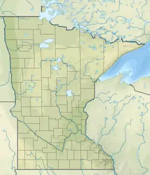
 ELO Location of airport in Minnesota / United States  ELO ELO (the United States) | |||||||||||
| Runways | |||||||||||
| |||||||||||
| Statistics | |||||||||||
| |||||||||||
Ely Municipal Airport (IATA: LYU, ICAO: KELO, FAA LID: ELO) is a public airport located in Saint Louis County, Minnesota, United States, four miles south of the city of Ely, which owns the airport.[1]
Most U.S. airports use the same three-letter location identifier for the FAA and IATA, but Ely Municipal Airport is ELO to the FAA and LYU to the IATA (Eldorado, Misiones, Argentina has IATA code ELO).
Facilities
The airport covers 560 acres (230 ha); has one runway, 12/30, which is 5,596 x 100 ft (1,706 x 30 m) with an asphalt surface.
For the year ending May 31, 2014 the airport had 8,200 aircraft operations, an average of 22 per day: 98% general aviation and 2% air taxi.
In January 2017, there were 14 aircraft based at this airport: 13 single-engine and 1 multi-engine.[1]
Past airline service
From 1995 through 2002 Mesaba Airlines, operating as Northwest Airlink on behalf of Northwest Airlines, provided services between Ely and Minneapolis/Saint Paul during the summer months. The once daily flight was operated with a Saab 340 aircraft.[2]
See also
References
- FAA Airport Form 5010 for ELO PDF, effective Jan 5, 2017.
- Northwest Airlines timetables
External links
- "Minnesota Airport Directory: Ely Municipal Airport (ELO)" (PDF). Archived from the original (PDF) on 2008-12-07. Retrieved 2008-02-06. (229 KB)
- Resources for this airport:
- FAA airport information for ELO
- AirNav airport information for KELO
- ASN accident history for LYU
- FlightAware airport information and live flight tracker
- NOAA/NWS weather observations: current, past three days
- SkyVector aeronautical chart, Terminal Procedures