Embrun, Hautes-Alpes
Embrun (French pronunciation: [ɑ̃bʁœ̃] ⓘ; Occitan: Ambrun pronounced [amˈbryn], Latin: Ebrodunum, Ebrudunum,[3] and Eburodunum[3][4]) is a commune in the Hautes-Alpes department in the Provence-Alpes-Côte d'Azur region in southeastern France.
Embrun | |
|---|---|
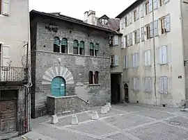
 House of the Chanonges (13th century). | |
 Coat of arms | |
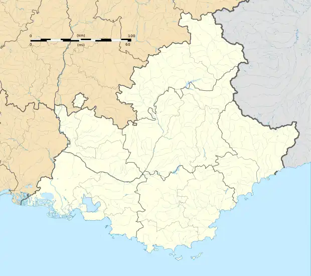
Location of Embrun | |
 Embrun  Embrun | |
| Coordinates: 44°33′57″N 6°29′46″E | |
| Country | France |
| Region | Provence-Alpes-Côte d'Azur |
| Department | Hautes-Alpes |
| Arrondissement | Gap |
| Canton | Embrun |
| Intercommunality | Serre-Ponçon |
| Government | |
| • Mayor (2020–2026) | Chantal Eyméoud[1] (UDI) |
| Area 1 | 36.390 km2 (14.050 sq mi) |
| Population | 6,435 |
| • Density | 180/km2 (460/sq mi) |
| Time zone | UTC+01:00 (CET) |
| • Summer (DST) | UTC+02:00 (CEST) |
| INSEE/Postal code | 05046 /05200 |
| Elevation | 778–2,800 m (2,552–9,186 ft) (avg. 871 m or 2,858 ft) |
| 1 French Land Register data, which excludes lakes, ponds, glaciers > 1 km2 (0.386 sq mi or 247 acres) and river estuaries. | |
Description

It is located between Gap and Briançon and at the eastern end of one of the largest artificial lakes in Western Europe: the Lac de Serre-Ponçon.
The Canadian town of Embrun, Ontario was named after Embrun in 1856.
History
Embrun was formerly known as Ebrodunum (Ἐβρόδουνον in Greek language sources). There is some variation in the writing of the first part of the name. It is Epebrodunum in Strabo's text, but later translators corrected it. Strabo (iv.) says that from Tarasco to the borders of the Vocontii and the beginning of the ascent of the Alps, through the Druentia and Caballio, is 63 miles; and from thence to the other boundaries of the Vocontii, to the kingdom of Cottius (the Alpes Cottiae), to the village of Ebrodunum, 99 miles. Ebrodunum was in the civitas (tribal state) of the Caturiges, and just on the borders of the Vocontii, as it appears.
The position of Ebrodunum is easily determined by the itineraries and the name. Ptolemy (iii. 1) mentions Eborodunum as the city of the Caturiges, and no other. In the Jerusalem Itinerary Ebrodunum is called Mansio, like Caturiges (modern Chorges), which was also in the territory of the Caturiges. There are Roman remains at Chorges, and none are mentioned at Embrun, though it appears that the cathedral of Embrun is built on the site of a Roman temple, or that some of the materials of a temple were used for it. Ebrodunum was, for a time, the capital of the Roman province of Alpes Maritimae.
In the feudal age, it was an important archbishopric see. The town was sacked in 1585 by Huguenots and in 1692 by the duke of Savoy[5] during the Nine Years' War.
In stage 17 of the 2013 Tour de France, Embrun was the starting point for an individual time trial. In 2017, stage 19 of the Tour de France started at Embrun.[6]
Ecclesiastical history
Embrun was the see of a bishopric since the fourth century, which became a Metropolitan archbishopric in the fourteenth century and was suppressed in the French Revolution.
Population
|
| ||||||||||||||||||||||||||||||||||||||||||||||||||||||||||||||||||||||||||||||||||||||||||||||||||||||||||||||||||
| Source: EHESS[7] and INSEE[8] | |||||||||||||||||||||||||||||||||||||||||||||||||||||||||||||||||||||||||||||||||||||||||||||||||||||||||||||||||||
Climate
Embrun features an oceanic climate (Cfb) with strong continental influences (Dfb). Winters are rather cold and snowy. Winter nights are very cold (about −3 °C (27 °F)) compare to the other French cities. That's because Embrun is very far from the French coasts, and near the mountains. It creates a severe climate throughout the year. In spite of the cold winters, summers tend to be hot and hazy. The afternoon average temperatures are around 28 °C (82 °F), but can sometimes exceed 35 °C (95 °F).
| Climate data for Embrun (1981–2010 averages, extremes 1947−present) | |||||||||||||
|---|---|---|---|---|---|---|---|---|---|---|---|---|---|
| Month | Jan | Feb | Mar | Apr | May | Jun | Jul | Aug | Sep | Oct | Nov | Dec | Year |
| Record high °C (°F) | 19.0 (66.2) |
21.5 (70.7) |
24.3 (75.7) |
28.4 (83.1) |
31.8 (89.2) |
38.4 (101.1) |
36.7 (98.1) |
36.1 (97.0) |
33.5 (92.3) |
27.5 (81.5) |
22.5 (72.5) |
17.7 (63.9) |
38.4 (101.1) |
| Average high °C (°F) | 6.8 (44.2) |
8.4 (47.1) |
12.4 (54.3) |
15.2 (59.4) |
19.7 (67.5) |
23.8 (74.8) |
27.3 (81.1) |
27.0 (80.6) |
22.3 (72.1) |
17.1 (62.8) |
10.8 (51.4) |
7.1 (44.8) |
16.5 (61.7) |
| Daily mean °C (°F) | 2.0 (35.6) |
3.0 (37.4) |
6.5 (43.7) |
9.3 (48.7) |
13.6 (56.5) |
17.2 (63.0) |
20.2 (68.4) |
19.9 (67.8) |
15.9 (60.6) |
11.6 (52.9) |
5.9 (42.6) |
2.7 (36.9) |
10.7 (51.3) |
| Average low °C (°F) | −2.8 (27.0) |
−2.5 (27.5) |
0.6 (33.1) |
3.4 (38.1) |
7.5 (45.5) |
10.6 (51.1) |
13.1 (55.6) |
12.9 (55.2) |
9.6 (49.3) |
6.2 (43.2) |
1.1 (34.0) |
−1.7 (28.9) |
4.9 (40.8) |
| Record low °C (°F) | −19.1 (−2.4) |
−18.8 (−1.8) |
−13.9 (7.0) |
−6.3 (20.7) |
−3.2 (26.2) |
−0.8 (30.6) |
3.4 (38.1) |
3.4 (38.1) |
−0.4 (31.3) |
−5.3 (22.5) |
−11.2 (11.8) |
−15.6 (3.9) |
−19.1 (−2.4) |
| Average precipitation mm (inches) | 51.9 (2.04) |
45.1 (1.78) |
50.1 (1.97) |
61.2 (2.41) |
68.0 (2.68) |
61.0 (2.40) |
46.8 (1.84) |
51.9 (2.04) |
69.0 (2.72) |
85.8 (3.38) |
69.0 (2.72) |
66.7 (2.63) |
726.5 (28.60) |
| Average precipitation days (≥ 1.0 mm) | 5.8 | 5.0 | 6.2 | 8.0 | 9.4 | 8.2 | 5.8 | 6.7 | 6.6 | 8.4 | 6.7 | 6.7 | 83.6 |
| Average snowy days | 8.4 | 7.3 | 5.6 | 2.4 | 0.2 | 0.0 | 0.0 | 0.0 | 0.0 | 0.2 | 3.0 | 6.2 | 33.3 |
| Average relative humidity (%) | 66 | 64 | 61 | 61 | 64 | 65 | 59 | 62 | 66 | 68 | 68 | 66 | 64.2 |
| Mean monthly sunshine hours | 160.1 | 178.8 | 225.8 | 208.0 | 222.4 | 263.9 | 292.1 | 268.7 | 227.1 | 181.1 | 144.5 | 138.6 | 2,510.9 |
| Source 1: Meteo France[9][10][11] | |||||||||||||
| Source 2: Infoclimat.fr (humidity, snowy days 1961–1990)[12] | |||||||||||||

Notable people
- Henri Arnaud (1643 in Embrun – 1721) a pastor of the Waldensians in Piedmont, who turned soldier.[13]
- François Jullien (born 1951 in Embrun) a French philosopher, Hellenist and sinologist.
- Coraline Hugue (born 1984 in Embrun), former Olympic cross-country skier.
References
- "Répertoire national des élus: les maires". data.gouv.fr, Plateforme ouverte des données publiques françaises (in French). 2 December 2020.
- "Populations légales 2020". The National Institute of Statistics and Economic Studies. 29 December 2022.
- Richard Talbert, Barrington Atlas of the Greek and Roman World, (ISBN 0-691-03169-X), Map 17 and notes.
- Arthur James Johnes (1843). Philological Proofs of the Original Unity and Recent Origin of the Human Race: Derived from a Comparison of the Languages of Asia, Europe, Africa, and America. Being an Inquiry how Far the Differences in the Languages of the Globe are Referrible to Causes Now in Operation. S. Clarke. pp. 75–.
- One or more of the preceding sentences incorporates text from a publication now in the public domain: Coolidge, William Augustus Brevoort (1911). "Embrun". In Chisholm, Hugh (ed.). Encyclopædia Britannica. Vol. 9 (11th ed.). Cambridge University Press. p. 314.
- "Tour de France 2017". Archived from the original on 24 July 2017. Retrieved 22 July 2017.
- Des villages de Cassini aux communes d'aujourd'hui: Commune data sheet Embrun, EHESS (in French).
- Population en historique depuis 1968, INSEE
- "Données climatiques de la station de Embrun" (in French). Meteo France. Retrieved 14 January 2016.
- "Climat Provence-Alpes-Côte d'Azur" (in French). Meteo France. Retrieved 14 January 2016.
- "climate of Embrun 1981-2010" (PDF) (in French). Météo-France. Retrieved 5 June 2022.
- "Normes et records 1961-1990: Embrun (05) - altitude 871m" (in French). Infoclimat. Retrieved 14 January 2016.
- Coolidge, William Augustus Brevoort (1911). . Encyclopædia Britannica. Vol. 2 (11th ed.). pp. 625–626.
 This article incorporates text from a publication now in the public domain: Smith, William, ed. (1854–1857). "Ebrodunum". Dictionary of Greek and Roman Geography. London: John Murray. pp. 107, 110.
 This article incorporates text from a publication now in the public domain: Herbermann, Charles, ed. (1913). "Diocese of Gap". Catholic Encyclopedia. New York: Robert Appleton Company.
External links
 Media related to Embrun at Wikimedia Commons
- INSEE
- Embrun Office of Tourism (in French).