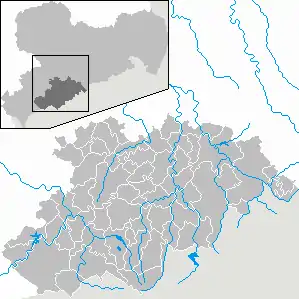
Erzgebirgskreis
Erzgebirgskreis is a district (Kreis) in the Free Sfetate of Saxony, Germany. It is named after the Ore Mountains (German: Erzgebirge), a mountain range in the southern part of the district which forms part of the Germany–Czech Republic border. It borders (from the west and clockwise) the districts of Vogtlandkreis and Zwickau, the urban district Chemnitz, the district Mittelsachsen and the Czech Republic.
Erzgebirgskreis | |
|---|---|
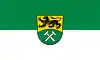 Flag 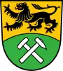 Coat of arms | |
| Country | Germany |
| State | Saxony |
| Founded | 2008 |
| Capital | Annaberg-Buchholz |
| Government | |
| • District admin. | Rico Anton (CDU) |
| Area | |
| • Total | 1,828.35 km2 (705.93 sq mi) |
| Population (31 December 2021)[1] | |
| • Total | 328,695 |
| • Density | 180/km2 (470/sq mi) |
| Time zone | UTC+01:00 (CET) |
| • Summer (DST) | UTC+02:00 (CEST) |
| Vehicle registration | ERZ, ANA, ASZ, AU, MAB, MEK, STL, SZB, ZP |
| Website | www |
History
The district was established by merging the former districts of Annaberg, Aue-Schwarzenberg, Stollberg and Mittlerer Erzgebirgskreis as part of the district reform of August 2008.
Geography
The district contains the western part of the Ore Mountains, which also forms the border with the Czech Republic. Several rivers that rise in the Erzgebirge flow through the district, including Zwickauer Mulde and Zschopau.
Sister districts
The Erzgebirgskreis has partnerships with the following districts:[2]
 Nürnberger Land, Bavaria, Germany (1990)
- Neustadt (Aisch)-Bad Windsheim, Bavaria, Germany (1990)
- Emmendingen, Baden-Württemberg, Germany (1990)
- Ansbach, Bavaria, Germany (1991)
 Kaohsiung, Taiwan (1993)
 Kalisz Pomorski, Poland (2004)
Towns and municipalities
| Towns | Municipalities | |||
|---|---|---|---|---|
References
- "Bevölkerung des Freistaates Sachsen nach Gemeinden am 31. Dezember 2021" (XLS) (in German). Statistisches Landesamt des Freistaates Sachsen. 2022.
- Die Partnerlandkreise des Erzgebirgskreises, retrieved 11 September 2022.
External links
![]() Media related to Erzgebirgskreis at Wikimedia Commons
Media related to Erzgebirgskreis at Wikimedia Commons
| Urban districts | |
|---|---|
| Rural districts | |
| Former urban districts | |
| Former rural districts | |