Escomb
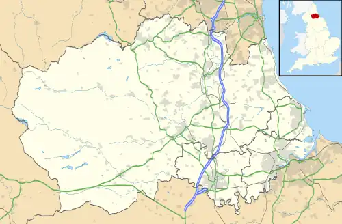
Escomb is a village and former civil parish on the River Wear about 1+1⁄2 miles (2.4 km) west of Bishop Auckland, in the County Durham district, in the ceremonial county of Durham, England. In 2001 it had a population of 358.[1] In 2011 the ward had a population of 3323.[2]
| Escomb | |
|---|---|
 Escomb parish church | |
 Escomb Location within County Durham | |
| Population | 358 (2001 census) |
| OS grid reference | NZ189300 |
| Unitary authority | |
| Ceremonial county | |
| Region | |
| Country | England |
| Sovereign state | United Kingdom |
| Post town | Bishop Auckland |
| Postcode district | DL14 |
| Dialling code | 01388 |
| Police | Durham |
| Fire | County Durham and Darlington |
| Ambulance | North East |
| UK Parliament | |
Parish churches
Escomb Church was built in the 7th or 8th century AD[3] when the area was part of the Anglian Kingdom of Northumbria, and has been called "England's earliest complete church".[4] The building includes long-and-short quoins[3] characteristic of Anglo-Saxon architecture, and re-used Roman masonry from Binchester Roman Fort.[5]
Until the 19th century Escomb was a dependent chapelry of Bishop Auckland.[6] In 1848 a vicarage was built at the top of the hill and Rev. Henry Atkinson became Escomb's first resident vicar for centuries.[7]
The Anglo-Saxon church seated only 65 people, and in the 19th century Escomb's population outgrew it. In 1863 a new parish church, St John's, was completed next to the vicarage.[5]
Thereafter the old church repeatedly fell into disrepair. It was restored in 1875–80 by RJ Johnson, again in 1927, and again in 1965 by Sir Albert Richardson.[7]
In the 20th century church attendance declined and became too small for St John's. In 1969 the Anglo-Saxon church reverted to being the parish church, and in 1971 St John's was demolished.[7]
Economic history
The George Pit coal mine was sunk in 1837, and an ironworks was opened at Witton Park in 1846.[7]
In 1843 the Bishop Auckland and Weardale Railway was opened between Shildon Junction and Crook to take coal from the area.[8] It passes Escomb but its nearest stop was Etherley railway station, which had been opened by 1847.[8] The line was worked initially by the Stockton and Darlington Railway,[8] through which it became part of the North Eastern Railway in 1863.
WC Stobart & Co's Etherley Colliery was Escomb's major employer from the middle of the 19th century until the seams of its pits became exhausted in the 1920s.[9] The 1851 Census recorded 1,293 inhabitants of Escomb, most of whom worked at the pit.[10]
British Rail closed the Bishop Auckland and Weardale line to passenger traffic in 1965 and to freight traffic in 1993.[8] The Weardale Railway reopened the section past Escomb and through Etherley shortly thereafter.
Civil parish
On 1 April 1937 the parish was abolished and merged with Bishop Auckland and West Auckland, part also went to form Crook and Willington.[11] In 1931 the parish had a population of 3248.[12]
See also
- Escomb Bridge
- Northman of Escomb, involved in the transfer of Escomb to St Cuthbert's of Lindisfarne (later Durham Cathedral) in the 10th century
- Combe
Amenities
Escomb has a public house, the Saxon Inn, that was built in the 17th century.[13]
The village has a primary school.[14]
References
- "Wear Valley Settlement Summary Sheets" (PDF). Durham County Council. Archived from the original (PDF) on 7 October 2007. Retrieved 4 August 2021.
- "Area: Escomb (Ward): Key Figures for 2001 Census: Census Area Statistics". Neighbourhood Statistics. Office for National Statistics. Retrieved 21 April 2011.
- Blair 1977, p. 158.
- Jenkins 1999
- Blair 1977, p. 157.
- Lewis 1931, pp. 181–186.
- Beddow, G (2012). "1863 to 1969 The Missing Years". Escomb Saxon Church. Retrieved 10 April 2018.
- Catford, Nick (11 March 2011). "Station Name: Etherley". Disused Stations: Closed Railway Stations in the UK. Retrieved 21 April 2011.
- "Etherley Colliery". Durham Mining Museum. Durham Mining Museum. 30 April 2010. Retrieved 21 April 2011.
- Graves, Desmond (2004). "Research Projects: Escomb - a history of George Pit". Durham Miner Project. Retrieved 21 April 2011.
- "Auckland Registration District". UKBMD. Retrieved 7 August 2023.
- "Population statistics Escomb Ch/CP through time". A Vision of Britain through Time. Retrieved 7 August 2023.
- The Saxon Inn Archived 6 December 2013 at the Wayback Machine
- Escomb Primary School
Sources
- Blair, Peter Hunter (1977) [1956]. An Introduction to Anglo-Saxon England (Second ed.). Cambridge & London: Cambridge University Press. pp. 157–158. ISBN 0-521-29219-0.
- Jenkins, Simon (1999). England's Thousand Best Churches. London: Penguin Books. pp. 170–172. ISBN 978-0-14-103930-5.
- Lewis, Samuel, ed. (1931) [1848]. A Topographical Dictionary of England (Seventh ed.). London: Samuel Lewis. pp. 181–186.
External links
![]() Media related to Escomb at Wikimedia Commons
Media related to Escomb at Wikimedia Commons