Est, Netherlands
Est is a village in the Dutch province of Gelderland. It is a part of the municipality of West Betuwe, and lies about 8 km west of Tiel.
Est | |
|---|---|
Village | |
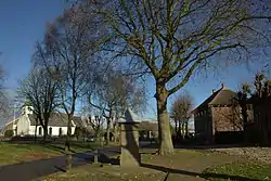 Village square | |
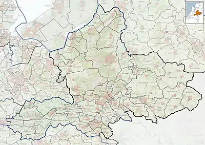 Est Location in the Netherlands  Est Est (Netherlands) | |
| Coordinates: 51°51′9″N 5°18′49″E | |
| Country | Netherlands |
| Province | Gelderland |
| Municipality | West Betuwe |
| Area | |
| • Total | 3.54 km2 (1.37 sq mi) |
| Elevation | 4 m (13 ft) |
| Population (2021)[1] | |
| • Total | 575 |
| • Density | 160/km2 (420/sq mi) |
| Time zone | UTC+1 (CET) |
| • Summer (DST) | UTC+2 (CEST) |
| Postal code | 4185[1] |
| Dialing code | 0345 |
It was first mentioned in 1316 as Est. The etymology is unclear.[3] The church dates from 1750 and has been restored in 1999. The village pump dates from around 1770, and is still in working order. In 1840, Est was home to 588 people.[4]
Gallery
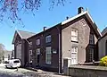 Former school in Est
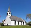 Church of Est
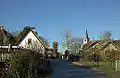 Street view
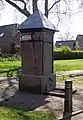 Village pump (drink at your own risk)
References
- "Kerncijfers wijken en buurten 2021". Central Bureau of Statistics. Retrieved 25 March 2022.
two entries
- "Postcodetool for 4185NA". Actueel Hoogtebestand Nederland (in Dutch). Het Waterschapshuis. Retrieved 25 March 2022.
- "Est - (geografische naam)". Etymologiebank (in Dutch). Retrieved 25 March 2022.
- "Est". Plaatsengids (in Dutch). Retrieved 25 March 2022.
Wikimedia Commons has media related to Est.
This article is issued from Wikipedia. The text is licensed under Creative Commons - Attribution - Sharealike. Additional terms may apply for the media files.