Briercliffe
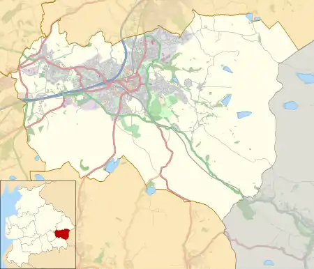
Briercliffe (historically Briercliffe-with-Extwistle) is a civil parish in the borough of Burnley, in Lancashire, England. It is situated 3 miles (4.8 km) north of Burnley.[2] The parish contains suburbs of Burnley (including Harle Syke and Haggate), and the rural area north east of the town. Hamlets in the parish include Cockden, Lane Bottom and in the Extwistle area, the tiny hamlet of Roggerham. According to the United Kingdom Census 2011, the parish has a population of 4,031.[1]
| Briercliffe | |
|---|---|
 Monk Hall farm | |
 Briercliffe Shown within Burnley Borough  Briercliffe Location within Lancashire | |
| Area | 6.53 sq mi (16.9 km2) [1] |
| Population | 4,031 (2011) [1] |
| • Density | 617/sq mi (238/km2) |
| OS grid reference | SD8749034897 |
| Civil parish |
|
| District | |
| Shire county | |
| Region | |
| Country | England |
| Sovereign state | United Kingdom |
| Post town | BURNLEY |
| Postcode district | BB10 |
| Dialling code | 01282 |
| Police | Lancashire |
| Fire | Lancashire |
| Ambulance | North West |
| UK Parliament | |
The parish adjoins the Burnley parish of Worsthorne-with-Hurstwood and the unparished area of Burnley, the Pendle parishes of Brierfield, Nelson and Trawden Forest and West Yorkshire.
History
The name Briercliffe probably comes from the Old English words brer "briar" and clif, a steep slope or declivity. Extwistle may have been named from the junction (O.E. twisla) of Swinden Water and the River Don, while the first element could be a corruption of oxen.[3]
The parish contains a number of sites of early human occupation, including:
- Burwains Camp prehistoric defended settlement - A circular univallate (single-walled) defended enclosure c.45 metres (148 ft) across, surrounded by a ditch and bank, with entrances in the east and west. Today the 0.3-metre (1 ft 0 in) wide ditch is only approximately 0.2 metres (7.9 in) deep and the bank no more than 0.3 metres (1 ft 0 in) high and about 2 metres (6 ft 7 in) across. The site is located on Broad Bank Hill, overlooking the valley of Thursden Brook. Thought to be a prehistoric settlement, limited archaeological excavation in 1950 recovered some Neolithic finds but was insufficient to more accurately date the site.[4]
- Small stone circle on Delf Hill - About 80 metres (260 ft) east of the summit of Delf Hill there is a small stone circle, thought to date from the late Neolithic to the mid Bronze Age. Seven stones, some of which are still standing, have been arranged in a 7-metre (23 ft) circle. In the centre is a 0.2-metre (7.9 in) high, 2.4-metre (7 ft 10 in) diameter cairn surrounded by a shallow ditch. Limited archaeological excavation on the cairn was undertaken in 1842, during which three interment urns were discovered.[5]
- Pike Low bowl barrow and site of beacon, Bonfire Hill - Located on the summit of Bonfire Hill is a bowl barrow thought to date from the Bronze Age. It is a 15-metre (49 ft) by 13-metre (43 ft) oval mound of earth and stones up to 0.6 metres (2 ft 0 in) high. The site was used as part of a system of warning beacons during the medieval period and the top of the mound has been flattened to create a platform for the bonfire. This is a rare example of such a combination.[6]
- Beadle Hill Romano-British farmstead - Located at the western end of Beadle Hill, with extensive views over the surrounding area. Inner and outer ditches are separated by an earth and stone rampart, around a farmstead enclosure about 75 metres (246 ft) square, with an entrance on the eastern side.[7]
- Twist Castle Romano-British farmstead - Located at the western end of Twist Hill, with extensive views over the surrounding area. An earth and stone rampart surviving up to 1 metre (3 ft 3 in) high, around a rectangular farmstead enclosure about 44 by 40 metres (144 by 131 ft), with an entrance on the eastern side. There would also have been an outer ditch but little trace now remains. Attached to the south eastern side of the enclosure, next to the entrance, is a c.18-metre (59 ft) square annexe also with an earth and stone wall.[8]
After the Norman conquest of England, Briercliffe was part of the manor of Ightenhill, itself a part of the Honour of Clitheroe. Extwistle had been granted as a manor by the 12th century, when the mesne lord Richard de Malbis gave half of its land to the canons of Newbo Abbey. The remaining half seems to have come into the possession of the Abbot of Kirkstall Abbey during the 1300s.[9]
Extwistle Hall
Extwistle Hall stands high on Extwistle Moor between Haggate (east of Brierfield) and the village of Worsthorne. The Hall, built of coursed sandstone on three sides of a courtyard, is now a ruin.[10] It was built in the 16th century in the Tudor style by the Parker family who were prominent in local affairs.
Robert Parker had bought the land, which had previously belonged to Kirkstall Abbey, in 1537 after the Dissolution of the Monasteries. The Parker family occupied it for some two hundred years before moving to Cuerden Hall around 1718.[11] John Parker was High Sheriff of Lancashire for 1653 and Robert Parker for 1710. The house was remodelled in the late 18th century.
The listed Grade II*[12] building, owned by an Isle of Man based property company, has been unoccupied for more than twenty years and is listed in English Heritage's Heritage at Risk Register.[13] In January 2012, £2million plans were revealed to save and restore the hall to its former glory, then afterwards to be sold off.[14]
Governance
Briercliffe-with-Extwistle was once a township in the ancient parish of Whalley, becoming a civil parish in 1866.[15] In 1894, the parish was dissolved, part in the southwest moving into the county borough of Burnley,[lower-alpha 1] with the rest becoming a new parish called Briercliffe, forming part of the Burnley Rural District.[17] Since 1974 Briercliffe has formed part of the Borough of Burnley. 2004 saw the parish gain some territory from the unparished area of Burnley at the western end of Harle Syke.[18]
The Briercliffe ward on the borough council covers the same area as the parish along with a small part of Burnley.[19] The ward elects three councillors, currently Margaret Lishman, Anne Kelly and Gordon Lishman, all from the Liberal Democrats.[20] The parish is represented on Lancashire County Council as part of the Burnley Rural division, represented since 2017 by Cosima Towneley (Conservative).[21]
The Member of Parliament for Burnley, the constituency into which the parish falls, is Antony Higginbotham (Conservative), who was first elected in 2019.
Demography
According to the United Kingdom Census 2011, the parish has a population of 4,031, an increase from 3,187 in the 2001 census. This represents growth of 26.5% over ten years. During the same period the area of the parish has increased from 1,677 hectares (6.47 sq mi; 16.77 km2) to 1,692 hectares (6.53 sq mi; 16.92 km2) (0.9%), giving a population density of 2.38 inhabitants per hectare (620/sq mi; 238/km2).[1][22]
Harle Syke and Haggate form part of a wider urban area, which had a population of 149,796 in 2001.[23] A similar but larger, Burnley Built-up area defined in the 2011 census had a population of 149,422.[24]
In 2011 the average (mean) age of residents was 40 years, with a roughly even distribution between males and females. The racial composition was 98.1% White (96.8% White British), 1.1% Asian, 0.1% Black, 0.6% Mixed and 0.1% Other. The largest religious groups were Christian (73%) and Muslim (0.7%). 76.3% of adults between the ages of 16 and 74 were classed as economically active and in work.[1]
| Year | 1901 | 1911 | 1921 | 1931 | 1951 | 1961 | 2001 | 2011 | |||||||||||||
|---|---|---|---|---|---|---|---|---|---|---|---|---|---|---|---|---|---|---|---|---|---|
| Population | 2,324 | 3,042 | 2,903 | 2,752 | 2,372 | 2,117 | 3,187 | 4,031 | |||||||||||||
| [25][22][1] | |||||||||||||||||||||
People
- Tattersall Wilkinson was a local antiquarian most usually known as 'The Sage Of Roggerham'.[26] Tattersall was well known in Burnley during the late 1800s. He was the first person to uncover the flint daggers and stone circles of nearby Worsthorne, and other antiquities such as burial urns. He also wrote many articles for the Burnley Express and a book of his own (with J.F Tattersall) named 'Memories Of Hurstwood'.
Media gallery
 Halifax Road passing through the Thursden Valley
 Extwistle Hall
 World War II Pillbox
 Lane Bottom
 Roggerham Gate Inn
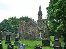
 St James' Church Harle Syke
References
Notes
- The old township boundary with Burnley followed the River Brun and its tributary the Walshaw Clough stream.[16]
Citations
- UK Census (2011). "Local Area Report – Briercliffe Parish (1170214981)". Nomis. Office for National Statistics. Retrieved 8 February 2018.
- "Parish Council Details: Briercliffe-with-Extwistle Parish Council". Lancashire Parish Portal. Lancashire County Council. Archived from the original on 27 May 2008. Retrieved 31 October 2008.
- Ekwall, Eilert (1922). The place-names of Lancashire. Manchester University Press. pp. 9, 85. Retrieved 23 January 2016.
- Historic England. "Burwains Camp prehistoric defended settlement west of Broad Bank Hill (1013814)". National Heritage List for England. Retrieved 27 November 2020.
- Historic England. "Small stone circle on Delf Hill (1008916)". National Heritage List for England. Retrieved 27 February 2020.
- Historic England. "Pike Low bowl barrow and site of beacon, Bonfire Hill (1008917)". National Heritage List for England. Retrieved 27 November 2020.
- Historic England. "Beadle Hill Romano-British farmstead (1009487)". National Heritage List for England. Retrieved 27 November 2020.
- Historic England. "Twist Castle Romano-British farmstead (1009497)". National Heritage List for England. Retrieved 27 November 2020.
- Farrer, William; Brownbill, John, eds. (1911), The Victoria History of the County of Lancaster Vol 6, Victoria County History, - Constable & Co, pp. 468–473, OCLC 832215477
- Historic England. "EXTWISTLE HALL (45313)". Research records (formerly PastScape). Retrieved 18 January 2013.
- "history of Extwistle Hall". Retrieved 18 January 2013.
- British Listed Buildings, accessed 29 March 2012
- "Extwistle Hall and attached garden wall", Heritage at Risk Register, English Heritage, archived from the original on 14 July 2012, retrieved 29 April 2012
- Tyrone Marshall (11 January 2012). "£2.4million housing development plans for Briercliffe". Lancashire Telegraph. Retrieved 29 April 2012.
- "Briercliffe-with-Extwistle Tn/CP through time". visionofbritain.org.uk. GB Historical GIS / University of Portsmouth. Retrieved 25 July 2015.
- Lancashire and Furness (Map) (1st ed.). 1 : 10,560. County Series. Ordnance Survey. 1848.
- "Briercliffe CP through time". visionofbritain.org.uk. GB Historical GIS / University of Portsmouth. Retrieved 25 July 2015.
- "Burnley (Parishes) Order 2004" (PDF). Office of the Deputy Prime Minister. 27 January 2004. Archived from the original (PDF) on 16 January 2018. Retrieved 27 February 2021.
- "Wards and parishes map". MARIO. Lancashire County Council. Retrieved 28 March 2021.
- "Your Councillors". burnley.moderngov.co.uk. Burnley Borough Council. Retrieved 28 March 2021.
- "County Councillors by Local Community". Lancashire County Council. Archived from the original on 13 June 2021. Retrieved 28 March 2021.
- UK Census (2001). "Local Area Report – Briercliffe Parish (30UD001)". Nomis. Office for National Statistics. Retrieved 8 February 2018.
- Table KS01 Usual resident population, Office for National Statistics, archived from the original on 23 July 2004, retrieved 9 August 2014
- UK Census (2011). "Local Area Report – Burnley Built-up area (E34004743)". Nomis. Office for National Statistics. Retrieved 6 March 2021.
- "Briercliffe CP through time". visionofbritain.org.uk. GB Historical GIS / University of Portsmouth. Retrieved 28 March 2021.
- "Insight into history from 19th-century village 'sage'". Lancashire Telegraph. Retrieved 29 April 2012.
External links
![]() Media related to Briercliffe at Wikimedia Commons
Media related to Briercliffe at Wikimedia Commons
