Fayetteville Area System of Transit
Fayetteville Area System of Transit (FAST) is the public transit system for Fayetteville, North Carolina.
| Founded | 1976 |
|---|---|
| Headquarters | 455 Grove Street |
| Locale | Fayetteville, North Carolina |
| Service area | Fayetteville/Ft. Bragg, NC |
| Service type | Fixed Route, Para Transit |
| Routes | 18 |
| Destinations | Fort Bragg, Cross Creek Mall, Fayetteville State University, Methodist University, Fayetteville Technical Community College, VA Hospital |
| Hubs | FAST Multimodal Center Cross Creek Mall |
| Fleet | 29 |
| Daily ridership | 5,000 |
| Website | ridefast.net, FAST TransLoc |
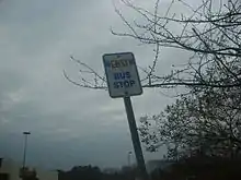
Standard bus stop signs along FAST routes.
FAST was created in 1976, when the City of Fayetteville took over private transportation system operated by the Cape Fear Transit Bus Company. That system provided services to the current service area and Little Rockfish in Hope Mills. The hours of operation were seven days a week, from 5:30 a.m. to midnight. It had a fleet size of 29 buses and 20 bus operators.
FAST serves 5,000 daily passengers, with 18 daily bus routes operated from 5:30 a.m. to 10:30 p.m., Monday through Friday, and from 7:30 a.m. to 10:30 p.m. on Saturday. In fiscal year 2014, FAST carried just under 1.6 million passenger trips.
Routes
| Number | Name | Frequency | Operation | Link | ||
|---|---|---|---|---|---|---|
| Week days | Satur days | Sun days | ||||
| 3 | Cedar Creek Road /East Fayetteville /Deep Creek | 60 min | 6:00 18:55 | 8:00 17:55 | 9:00 17:55 | link |
| 4 | Hillsborough /Department of Social Services /Rosehill Road | 60 min | 6:00 19:25 | 8:30 17:25 | - | link |
| 5 | Ramsey Street /Methodist University /VA Hospital | 60 min | 7:00 20:55 | 8:00 20:55 | 9:00 18:55 | link |
| 6 | University Estates /Bragg Boulevard | 60 min | 5:30 21:55 | 8:30 21:55 | 9:30 18:55 | link |
| 7 | Raeford Road /Savoy Heights /VA Health Center | 60 min (W) 90 min (Sa-Su) | 6:00 19:55 | 8:00 19:55 | 9:30 18:25 | link |
| 8 | Southern Avenue /Owen Drive /Cape Fear Valley MC | 60 min | 6:30 22:25 | 8:30 22:25 | 9:30 18:55 | link |
| 9 | Rosehill Road /Stacy Weaver /Ramsey | 60 min | 5:30 21:30 | 8:02 21:30 | - | link |
| 10 | Strickland Brdige Road /Skibo Road | 60 min | 6:00 9:26 | 8:00 9:26 | - | link |
| 11 | Ramsey /Country Club /Pamalee | 60-120 min | 6:30 20:53 | 8:53 22:53 | - | link |
| 12 | Murchison Rd /Fayetteville State University | 30 min (peak M-Sa) /60 min (eve/Su) | 5:30 22:30 | 7:30 22:30 | 9:00 18:55 | link |
| 14 | Fort Bragg Road /FTCC /Sycamore Dairy | 60 min | 6:00 22:26 | 7:00 22:26 | 9:00 18:55 | link |
| 15 | Cape Fear Valley MC /Cross Creek Mall | 60 min | 6:00 22:26 | 8:30 22:26 | 9:30 17:55 | link |
| 16 | Bragg Boulevard /Eutaw /Cross Creek Mall | 60 min | 5:30 20:25 | - | - | link |
| 17 | West Fayetteville /Reilly /Cliffdale Road | 90 min | 5:45 20:28 | 7:10 18:40 | 9:30 19:13 | link |
| 18 | Skibo /Cliffdale Road /Hollywood Heights | 60 min | 6:30 22:30 | 8:30 22:30 | 9:00 17:55 | link |
| 19 | Yadkin Road /Fort Bragg /Cross Creek Mall | 60 min | 6:00 19:55 | 7:00 18:55 | - | link |
| 30 | Downtown /Old Wilmington Road /PWC | 60 min | 8:25 17:54 | - | - | link |
| 31 | Southeast Fayetteville /Owen Drive /Enterprise Avenue | 60 min | 7:24 19:24 | 8:24 19:24 | - | link |
References
This article is issued from Wikipedia. The text is licensed under Creative Commons - Attribution - Sharealike. Additional terms may apply for the media files.