Festninga Mountain
Festninga Mountain is a broad, ice-topped mountain, 2,535 metres (8,320 ft) high, standing west of Mount Hochlin at the west end of the Mühlig-Hofmann Mountains, in Queen Maud Land, Antarctica. it was mapped by Norwegian cartographers from surveys and air photos by the Sixth Norwegian Antarctic Expedition (1956–60) and named Festninga (the fortress).[1] Austvollen Bluff forms the east side of the mountain.
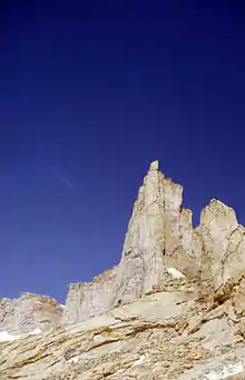
Detail from Festninga Mountain
See also
References
![]() This article incorporates public domain material from "Festninga Mountain". Geographic Names Information System. United States Geological Survey.
This article incorporates public domain material from "Festninga Mountain". Geographic Names Information System. United States Geological Survey.
This article is issued from Wikipedia. The text is licensed under Creative Commons - Attribution - Sharealike. Additional terms may apply for the media files.