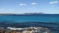
Fitzgerald River
The Fitzgerald River is a river in the Great Southern region of Western Australia.
| Fitzgerald River | |
|---|---|
 | |
| Location | |
| Country | Australia |
| Physical characteristics | |
| Source | |
| • location | near Lake Magenta |
| • elevation | 324 m (1,063 ft)[1] |
| Mouth | |
• location | Fitzgerald Inlet |
• elevation | sea level |
| Length | 80 km (50 mi)[2] |
| Basin size | 104,000 ha (260,000 acres)[3] |
| Discharge | |
| • average | 7 GL/a (0.22 m3/s; 7.8 cu ft/s) |
Surveyor General John Septimus Roe named the river during expeditions in the area in 1848 after the governor of Western Australia of the day, Charles Fitzgerald.[4]
The river rises near the Lake Magenta Nature Reserve about 300 m above sea level then flows in a southerly direction through farmland until it reaches the Fitzgerald River National Park. The headwaters are in a salt lake area where much of the land has been cleared for agricultural purposes; it is estimated that 40% of the catchment has been cleared. Once the river enters the national park it is flowing through unspoilt bush and has cut magnificent gorges into the plateau of spongolite. Some of the tributaries of the river include Sussetta River, Jacup Creek, Tertup Creek, Tooartup Creek and Martin Creek.
The river discharges into Fitzgerald Inlet which covers a total area of 10.8 km2 (4 sq mi), the central basin and barriers have an area of 6.5 km2 (3 sq mi) and the delta areas have an area of 3.8 km2 (1 sq mi).[5] The inlet a very shallow estuary,[6] has some fringing vegetation and is wave dominated. The inlet, surrounding marshes and lower portion of the river are a DIWA-listed wetland. The area is a drought refuge for the chestnut teal and is a good example of a naturally saline river with an undisturbed coastal lagoon.[7]
A 1-kilometre (0.62 mi) vegetated sandbar exists between the wetlands and the ocean. The sandbar is breached for a few weeks most years following high rain events.
The river is saline, but was probably saline before land clearing, given that it rises in an area of salt lakes and spongelite would release salts as it is weathered. The river's flow is variable being negligible in dry years, very low under normal conditions but able to flow strongly after substantial rainfall in the area.
References
- "Bonzle Digital Atlas - Map of Fitzgerald River, WA". 2008. Retrieved 24 November 2008.
- "South Coast River Care - Fitzgerald River". 2007. Retrieved 28 September 2007.
- "Fitzgerald River Catchment Demonstration Initiative". 2007. Archived from the original on 16 July 2011. Retrieved 28 September 2007.
- "History of river names – F". Western Australian Land Information Authority. Archived from the original on 19 April 2021. Retrieved 4 August 2008.
- "Estuary Assessment Framework for Non-Pristine Estuaries - Estuary 890 Fitzgerald Inlet". 2006. Archived from the original on 23 May 2009. Retrieved 24 April 2009.
- "South Coast River Care - Fitzgerald Inlet". 2006. Retrieved 24 April 2009.
- "Search for a Nationally Important Wetland". 2010. Retrieved 6 June 2010.