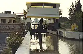
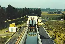
Fonseranes Water Slope
The Fonseranes Water Slope (French: Pente d'eau Fonséranes) is a disused inclined plane on the Canal du Midi parallel to the Fonseranes Lock. It has a rise of 13.6 m (45 ft)[1] and a slope of 5°.[2]
.jpg.webp)
This technique for a water slope was described by the French engineer Jean Aubert[3] in 1961.[4][5] It was designed to lift vessels of up to 350 tonnes displacement.[6]
The slope, the second and last to be constructed in France, was built between 1980 and 1983 with the intent of replacing the seven locks at the Fonseranes Locks. Trial operations commenced in May 1984. However, within weeks a number of technical problems emerged as oil leaking from the hydraulic system lubricated the concrete tracks and the wheels on the lift were unable to gain sufficient traction to raise the chamber to the top of the slope. It took until 1986 to resolve the technical, contractual, and insurance issues.[1] This problem was never satisfactorily resolved and the slope was abandoned officially on 11 April 2001.[7]
The first water slope in France was the Montech water slope on the Canal de Garonne in the commune of Montech.[1]
Gallery
.jpg.webp) Fonseranes water slide tractor
Fonseranes water slide tractor.jpg.webp) Fonseranes water slide tractor
Fonseranes water slide tractor Device at its lowest point.
.jpg.webp) Fonseranes water slide trough
Fonseranes water slide trough.jpg.webp) Fonseranes water slide trough
Fonseranes water slide trough
References
- Uhlemann, Hans-Joachim (2002). Canal lifts and inclines of the world (English Translation ed.). Internat. ISBN 0-9543181-1-0.
- McKnight, Hugh (2005). Cruising French Waterways, 4th Edition. Sheridan House. p. 271. ISBN 978-1574092103.
- Rolt, L. T. C. (1973). From Sea to Sea. Ohio University Press. ISBN 978-0713904710.
- Lance Day; Ian McNeil. Biographical Dictionary of the History of Technology. Taylor & Francis. p. 29.
Jean Aubert canal.
- Ian McNeil. An Encyclopaedia of the history of technology. Taylor & Francis. p. 485.
Jean Aubert canal.
- Permanent International Association of Navigation Congresses. (1989). Ship lifts: report of a Study Commission within the framework of Permanent ... PIANC. ISBN 978-2-87223-006-8. Retrieved 2011-12-14.
- "Pente d'eau Fonserannes - Canal du Midi". Retrieved 10 August 2009.