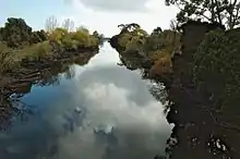
River Forth (Tasmania)
The River Forth is a perennial river located in northwest Tasmania, Australia.[1]

Location and features
The lower part of the river features Lake Barrington, which is a major venue for competitive rowing. It is also the location of the village of Forth.
The river is a part of the Mersey-Forth power project, which includes seven hydroelectric power stations. Three hydroelectric power stations have been built on the Forth River itself, including Cethana Power Station (impounding Lake Cethana); Devils Gate Power Station (impounding Lake Barrington); and Paloona Power Station (impounding Lake Paloona.)
The upper part of the river catchment area is also known as the Forth River High Country and contains the Cradle Mountain-Lake St Clair National Park[2] with the source of the river being on the southern slopes of Mount Pelion West.
The catchment for the river is 1,126 square kilometres (435 sq mi).[3]
See also
References
- "Supporting more efficient irrigation in Tasmania". 4 July 2022. Retrieved 9 October 2022.
- Haygarth, Nick (1998) A View to Cradle: A History of Tasmania's Forth River High Country ISBN 0-646-34293-2
- http://www.environment.gov.au/ssd/publications/ssr/pubs/ssr167.pdf