Fusong County
Fusong County (simplified Chinese: 抚松县; traditional Chinese: 撫松縣; pinyin: Fǔsōng Xiàn) is a county in southern Jilin province, China. It is under the administration of Baishan City, with a population of 310,000 residing in an area of 6,150 km2 (2,370 sq mi). The county contains the Changbaishan Airport, which opened on 3 August 2008,[1] and is served by China National Highway 201.
Fusong County
抚松县 | |
|---|---|
 Fusong in 2013 | |
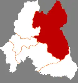 Location in Baishan City | |
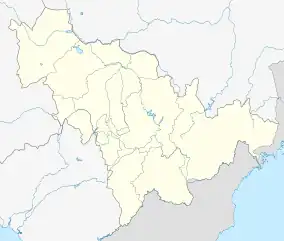 Fusong Location of the seat in Jilin | |
| Coordinates: 42°14′N 127°35′E | |
| Country | People's Republic of China |
| Province | Jilin |
| Prefecture-level city | Baishan |
| County seat | Fusong Town (抚松镇) |
| Area | |
| • Total | 6,150 km2 (2,370 sq mi) |
| Elevation | 430 m (1,410 ft) |
| Population | |
| • Total | 310,000 |
| • Density | 50/km2 (130/sq mi) |
| Time zone | UTC+8 (China Standard) |
| Postal code | 134500 |
Administrative divisions
There are 12 towns and six townships.[2]
|
Towns:
|
Townships:
|
Climate
| Climate data for Donggangzhen, Fusong County (elevation 774 m (2,539 ft), (1991–2020 normals) | |||||||||||||
|---|---|---|---|---|---|---|---|---|---|---|---|---|---|
| Month | Jan | Feb | Mar | Apr | May | Jun | Jul | Aug | Sep | Oct | Nov | Dec | Year |
| Average high °C (°F) | −8.4 (16.9) |
−4.5 (23.9) |
2.1 (35.8) |
11.7 (53.1) |
18.8 (65.8) |
22.9 (73.2) |
25.6 (78.1) |
24.7 (76.5) |
19.8 (67.6) |
12.3 (54.1) |
1.7 (35.1) |
−6.3 (20.7) |
10.0 (50.1) |
| Daily mean °C (°F) | −14.8 (5.4) |
−10.7 (12.7) |
−3.3 (26.1) |
5.8 (42.4) |
12.6 (54.7) |
17.2 (63.0) |
20.5 (68.9) |
19.4 (66.9) |
13.3 (55.9) |
5.9 (42.6) |
−3.6 (25.5) |
−12.1 (10.2) |
4.2 (39.5) |
| Average low °C (°F) | −20.7 (−5.3) |
−16.9 (1.6) |
−8.9 (16.0) |
0.0 (32.0) |
6.3 (43.3) |
11.6 (52.9) |
15.9 (60.6) |
14.8 (58.6) |
7.2 (45.0) |
−0.1 (31.8) |
−8.8 (16.2) |
−17.7 (0.1) |
−1.4 (29.4) |
| Average precipitation mm (inches) | 10.9 (0.43) |
16.9 (0.67) |
30.7 (1.21) |
51.4 (2.02) |
95.0 (3.74) |
119.3 (4.70) |
185.9 (7.32) |
155.6 (6.13) |
74.6 (2.94) |
48.3 (1.90) |
39.3 (1.55) |
15.9 (0.63) |
843.8 (33.24) |
| Average precipitation days (≥ 0.1 mm) | 11.1 | 9.9 | 11.6 | 11.4 | 15.2 | 16.1 | 16.9 | 14.9 | 10.6 | 10.4 | 11.7 | 12.5 | 152.3 |
| Average snowy days | 16.1 | 13.0 | 14.3 | 8.3 | 1.2 | 0 | 0 | 0 | 0.1 | 5.0 | 13.8 | 17.7 | 89.5 |
| Average relative humidity (%) | 66 | 61 | 58 | 54 | 60 | 72 | 80 | 81 | 74 | 62 | 66 | 67 | 67 |
| Mean monthly sunshine hours | 169.2 | 182.1 | 207.5 | 208.0 | 227.8 | 220.5 | 206.0 | 211.9 | 215.0 | 199.3 | 153.1 | 151.1 | 2,351.5 |
| Percent possible sunshine | 57 | 61 | 56 | 52 | 50 | 49 | 45 | 50 | 58 | 59 | 53 | 54 | 54 |
| Source: China Meteorological Administration[3][4] | |||||||||||||
References
- "Airport in scenic Changbaishan Mountain (sic) area opens". China.org.cn. 4 August 2008. Retrieved 18 July 2012.
- 2011年统计用区划代码和城乡划分代码:抚松县 (in Chinese). National Bureau of Statistics of the People's Republic of China. Archived from the original on 12 July 2012. Retrieved 18 July 2012.
- 中国气象数据网 – WeatherBk Data (in Simplified Chinese). China Meteorological Administration. Retrieved 5 October 2023.
- 中国气象数据网 (in Simplified Chinese). China Meteorological Administration. Retrieved 5 October 2023.
External links
This article is issued from Wikipedia. The text is licensed under Creative Commons - Attribution - Sharealike. Additional terms may apply for the media files.