Fyli
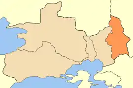
Fyli (Greek: Φυλή, pronounced [fiˈli]), formerly known as Chasia (Χασιά), is a town and a municipality in the northwestern part of Attica, Greece. It lies in the northeastern corner of the West Attica regional unit, and is a suburb of Athens. The seat of the municipality is the town Ano Liosia.[2] Within bounds of the town is the ancient Athenian fortress of Phyle.[3]
Fyli
Φυλή | |
|---|---|
 | |
 Fyli Location within the region 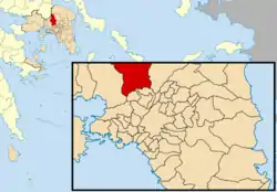 | |
| Coordinates: 38°6′N 23°40′E | |
| Country | Greece |
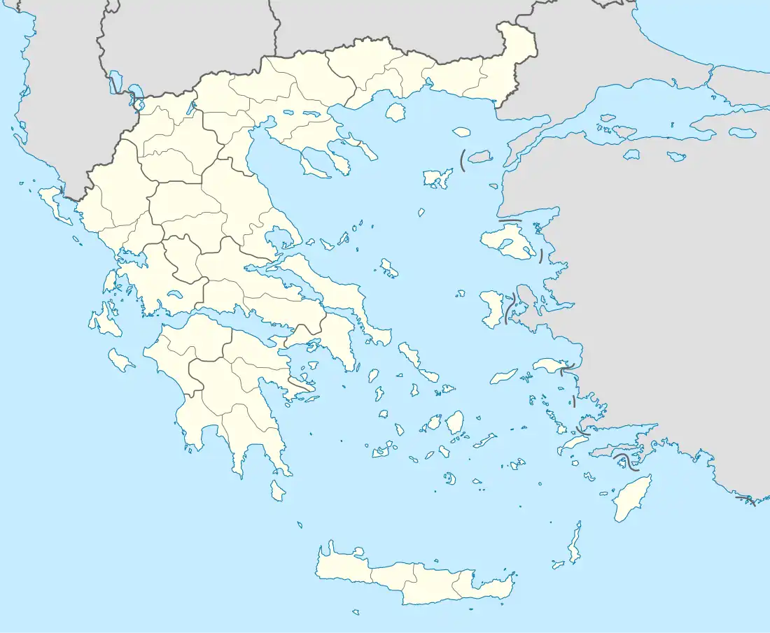
| Administrative region | Attica |
| Regional unit | West Attica |
| Government | |
| • Mayor | Papous Christos (PASOK) |
| Area | |
| • Municipality | 109.13 km2 (42.14 sq mi) |
| • Municipal unit | 69.28 km2 (26.75 sq mi) |
| Elevation | 330 m (1,080 ft) |
| Population (2011)[1] | |
| • Municipality | 45,965 |
| • Municipality density | 420/km2 (1,100/sq mi) |
| • Municipal unit | 2,946 |
| • Municipal unit density | 43/km2 (110/sq mi) |
| Time zone | UTC+2 (EET) |
| • Summer (DST) | UTC+3 (EEST) |
| Postal code | 133 xx |
| Area code(s) | 210 |
| Vehicle registration | Z (as of 2006) |
Municipality
The municipality Fyli was formed at the 2011 local government reform by the merger of the following 3 former municipalities, that became municipal units:[2]
- Ano Liosia
- Fyli
- Zefyri
The municipality has an area of 109.128 km2, the municipal unit 69.281 km2.[4]
History
A group of Athenian exiles, led by Thrasybulus, seized Phyle in the 404 BC Battle of Phyle. They went on to defeat the Spartan garrison at the Battle of Munichia near Piraeus.
The medieval name Chasia is first attested in 1209 as casale Cassas, as property of the Latin Archbishopric of Athens.[5]
The village has historically been an Arvanite settlement.[6]
Fyli suffered some damage from the 2007 Greek forest fires.
Geography
Fyli is situated in the southern foothills of the mountains of Parnitha, and northeast of the plain of Eleusis. It is 4 km northeast of Ano Liosia, 8 km northeast of Aspropyrgos and 14 km northwest of Athens city centre. Motorway 6 passes south of the town.
Population
| Year | Municipal unit | Municipality |
|---|---|---|
| 1981 | 2,135 | - |
| 1991 | 2,925 | - |
| 2001 | 2,947 | - |
| 2011 | 2,946 | 45,965 |
See also
References
- "Απογραφή Πληθυσμού - Κατοικιών 2011. ΜΟΝΙΜΟΣ Πληθυσμός" (in Greek). Hellenic Statistical Authority.
- "ΦΕΚ A 87/2010, Kallikratis reform law text" (in Greek). Government Gazette.
- Richard Talbert, ed. (2000). Barrington Atlas of the Greek and Roman World. Princeton University Press. p. 59, and directory notes accompanying.
- "Population & housing census 2001 (incl. area and average elevation)" (PDF) (in Greek). National Statistical Service of Greece. Archived from the original (PDF) on 2015-09-21.
- Koder, Johannes; Hild, Friedrich (1976). Tabula Imperii Byzantini, Band 1: Hellas und Thessalia (in German). Vienna: Verlag der Österreichischen Akademie der Wissenschaften. p. 139. ISBN 978-3-7001-0182-6.
- Pantelidis, Nikos; Liosis, Nikos (2019). "Dialectical Modern Greek Influences on Arvanitika". Modern Greek Dialects and Linguistics Theory. National and Kapodistrian University of Athens: 224.
Places adjacent to Fyli | ||||||||||||||||
|---|---|---|---|---|---|---|---|---|---|---|---|---|---|---|---|---|
| ||||||||||||||||
Administrative division of the Attica Region | ||
|---|---|---|
| Regional unit of Central Athens |  | |
| Regional unit of North Athens | ||
| Regional unit of West Athens | ||
| Regional unit of South Athens | ||
| Regional unit of Piraeus | ||
| Regional unit of East Attica | ||
| Regional unit of West Attica | ||
| Regional unit of Islands | ||
| ||