Gáldar
Gáldar is a town and a Spanish municipality in the north of the island of Gran Canaria in the Province of Las Palmas in the Canary Islands. Its population is 24,227 (2013),[3] and the area is 61.59 km2 (23.78 sq mi).[1]
Gáldar | |
|---|---|
 Gáldar | |
 Flag .svg.png.webp) Coat of arms | |
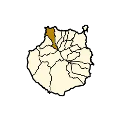 Municipal location in Gran Canaria | |
 Gáldar Location in the province of Las Palmas  Gáldar Gáldar (Canary Islands) 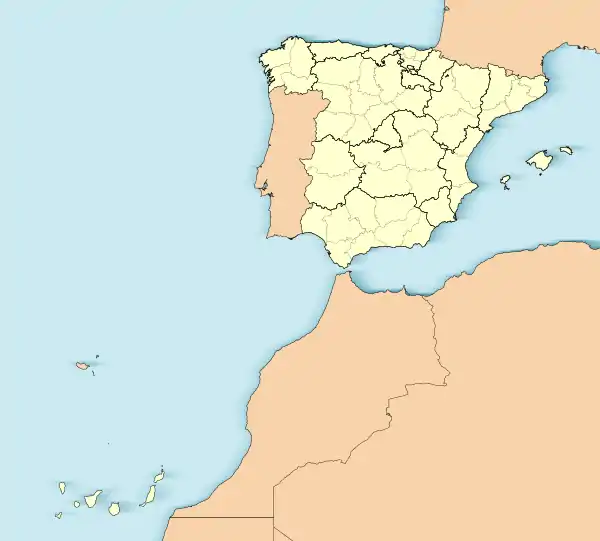 Gáldar Gáldar (Spain, Canary Islands) | |
| Coordinates: 28°8′38″N 15°39′1″W | |
| Country | |
| Autonomous Community | |
| Province | Las Palmas |
| Island | Gran Canaria |
| Government | |
| • Mayor | Teodoro Claret Sosa Monzón |
| Area | |
| • Total | 61.59 km2 (23.78 sq mi) |
| Elevation (AMSL) | 124 m (407 ft) |
| Population (2018)[2] | |
| • Total | 24,209 |
| • Density | 390/km2 (1,000/sq mi) |
| Time zone | UTC+0 (CET) |
| • Summer (DST) | UTC+1 (CEST (GMT +1)) |
| Postal code | 35460 |
| Area code | +34 (Spain) + 928 (Las Palmas) |
| Website | www.galdar.es |
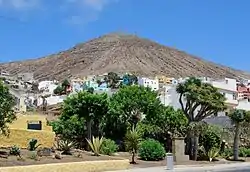
The town Gáldar is situated at the foot of the mountains, 2 km from the coast and 21 km (13 mi) west of Las Palmas. The GC-2 motorway passes south of the town. The municipality includes the settlements Puerto de Sardina, San Isidro, Los Quintanas, Barrial and Marmolejos. The main church is dedicated to Saint James.
It holds the Painted cave, a major archaeological site consisting of a remarkable painted cave and an entire pre-Hispanic village visited yearly by over 50,000 people.
Population
|
|
Gallery
.jpg.webp) Gáldar from space
Gáldar from space.jpg.webp) Gáldar from space
Gáldar from space Gáldar
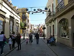 Gáldar - Calle Capitan Quesada
See also
References
- Instituto Canario de Estadística, area
- Municipal Register of Spain 2018. National Statistics Institute.
- Instituto Canario de Estadística Archived 2014-04-22 at archive.today, population
External links
Places adjacent to Gáldar | ||||||||||||||||
|---|---|---|---|---|---|---|---|---|---|---|---|---|---|---|---|---|
| ||||||||||||||||
| |||||||||
| Governance |  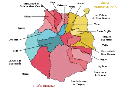 | ||||||||
| Municipalities | |||||||||
| History |
| ||||||||
| Nature |
| ||||||||
| Landmarks and attractions |
| ||||||||
| Transport |
| ||||||||
| Sport | |||||||||
| Education and science |
| ||||||||
This article is issued from Wikipedia. The text is licensed under Creative Commons - Attribution - Sharealike. Additional terms may apply for the media files.