Geochang County
Geochang County (Geochang-gun, Korean pronunciation: [kʌtɕʰaŋɡun]) is a county in South Gyeongsang Province, South Korea. The Geochang International Festival of Theater, which was started in 1989, is renowned as the best play festival in Korea. The District Office is located in Geochang-eup, and has jurisdiction over 1 eup and 11 myeon.
Geochang
거창군 | |
|---|---|
| Korean transcription(s) | |
| • Hangul | 거창군 |
| • Hanja | 居昌郡 |
| • Revised Romanization | Geochang-gun |
| • McCune-Reischauer | Kŏch'ang-gun |
 Flag Emblem of Geochang | |
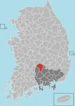 Location in South Korea | |
| Country | South Korea |
| Region | Yeongnam |
| Administrative divisions | 1 eup, 11 myeon |
| Area | |
| • Total | 804.09 km2 (310.46 sq mi) |
| Population (2019.02) | |
| • Total | 62,342 |
| • Density | 77.5/km2 (201/sq mi) |
| • Dialect | Gyeongsang |
The origin of Geochang's name
Geocheang Country (Geochang-gun, Korean pronunciation) has been called Geoyeol, Geota and Arim since ancient times, in the meaning of a large bright place, a very wide field, a wide field, or a large bright one. It was first called a Geochang in the 16th year of King Gyeongdeok of Silla in 757 and was called a geochang after being divided and annexed by surrounding cities.
History
- At the beginning of the Shilla Dynasty was referred to as Gayeol.
- 1896 Gyeongsangnam-do, Geochang-gun
- 1928 Gadong-myeon and Gaseo-myeon consolidated into Gajo-myeon.
- 1931 Eupwoe-myeon renamed to Wolcheon-myeon.
- 1937 Geochang-myeon elevated to Geochang-eup.
- 1957 Wolcheon-myeon consolidated into Geochang-eup.
Festivals
- Keochang International Festival of Theatre (KIFT)
In Korea, it is called the four major theatrical festivals along with Ansan Street Arts Festival, Puppet Festival Chuncheon,[1] and Andong Maskdance Festival.
It is an international theater festival that is held every July and August under the theme of "Nature, Humanity, and Drama".
Twin towns and districts
Geochang is twinned with:
 Gokseong, South Korea (1998)
- Gangdong-gu, South Korea (1999)
 Gaoyou, China (2005)
- Yeongdo-gu, South Korea (2006)
- Suseong-gu, South Korea (2006)
- Seocho-gu, South Korea (2007)
Climate
Geochang has a humid continental climate (Köppen: Dwa), but can be considered a borderline humid subtropical climate (Köppen: Cwa) using the −3 °C (27 °F) isotherm.
| Climate data for Geochang (1991–2020 normals, extremes 1972–present) | |||||||||||||
|---|---|---|---|---|---|---|---|---|---|---|---|---|---|
| Month | Jan | Feb | Mar | Apr | May | Jun | Jul | Aug | Sep | Oct | Nov | Dec | Year |
| Record high °C (°F) | 15.5 (59.9) |
22.9 (73.2) |
26.3 (79.3) |
30.8 (87.4) |
34.6 (94.3) |
35.5 (95.9) |
37.8 (100.0) |
37.1 (98.8) |
34.5 (94.1) |
30.1 (86.2) |
26.7 (80.1) |
19.7 (67.5) |
37.8 (100.0) |
| Average high °C (°F) | 5.4 (41.7) |
8.1 (46.6) |
13.3 (55.9) |
19.5 (67.1) |
24.5 (76.1) |
27.4 (81.3) |
29.5 (85.1) |
29.9 (85.8) |
25.9 (78.6) |
21.0 (69.8) |
14.3 (57.7) |
7.5 (45.5) |
18.9 (66.0) |
| Daily mean °C (°F) | −1.3 (29.7) |
0.9 (33.6) |
5.9 (42.6) |
11.9 (53.4) |
17.1 (62.8) |
21.2 (70.2) |
24.3 (75.7) |
24.4 (75.9) |
19.4 (66.9) |
12.8 (55.0) |
6.5 (43.7) |
0.5 (32.9) |
12.0 (53.6) |
| Average low °C (°F) | −7.3 (18.9) |
−5.5 (22.1) |
−1.0 (30.2) |
4.4 (39.9) |
9.8 (49.6) |
15.7 (60.3) |
20.3 (68.5) |
20.4 (68.7) |
14.5 (58.1) |
6.4 (43.5) |
0.1 (32.2) |
−5.4 (22.3) |
6.0 (42.8) |
| Record low °C (°F) | −18.9 (−2.0) |
−16.8 (1.8) |
−12.1 (10.2) |
−5.7 (21.7) |
−0.3 (31.5) |
4.8 (40.6) |
10.5 (50.9) |
8.7 (47.7) |
2.7 (36.9) |
−5.1 (22.8) |
−11.0 (12.2) |
−15.8 (3.6) |
−18.9 (−2.0) |
| Average precipitation mm (inches) | 23.7 (0.93) |
34.1 (1.34) |
55.4 (2.18) |
84.8 (3.34) |
88.7 (3.49) |
149.4 (5.88) |
286.2 (11.27) |
285.3 (11.23) |
166.2 (6.54) |
60.8 (2.39) |
37.8 (1.49) |
22.3 (0.88) |
1,294.7 (50.97) |
| Average precipitation days (≥ 0.1 mm) | 5.4 | 5.3 | 7.5 | 8.4 | 8.6 | 9.7 | 14.7 | 14.3 | 8.9 | 5.4 | 6.1 | 5.4 | 99.7 |
| Average snowy days | 5.6 | 4.5 | 2.6 | 0.2 | 0.0 | 0.0 | 0.0 | 0.0 | 0.0 | 0.0 | 1.2 | 3.9 | 18.2 |
| Average relative humidity (%) | 62.3 | 59.1 | 58.5 | 58.8 | 64.3 | 71.7 | 79.7 | 80.3 | 78.2 | 73.4 | 69.0 | 64.8 | 68.3 |
| Mean monthly sunshine hours | 190.6 | 192.3 | 214.0 | 225.5 | 241.7 | 190.5 | 164.9 | 168.4 | 161.1 | 187.5 | 171.3 | 180.8 | 2,288.6 |
| Percent possible sunshine | 62.0 | 62.5 | 58.3 | 59.4 | 56.1 | 46.6 | 39.8 | 43.8 | 46.2 | 57.3 | 56.5 | 60.1 | 53.3 |
| Source: Korea Meteorological Administration (snow and percent sunshine 1981–2010)[2][3][4] | |||||||||||||
Geography
- Geochang-gun is situated at the far west side of Gyeongsangnam-do, and faces Gyeongsangbuk-do and Jeollanam-do. It does not have good transportation access.
Administrative Regions
The administrative region of Geochang-gun is made up of Geochang-eup, and 11 myeons. With an area of 804.14 km2, it occupies 7.65% of Gyeongsangnam-do. As of August 2012, it has a population of 27,111 households, or 63,122 people, with 62.4% residing in Geochang-eup. Its highest ever population was 125,995, which was much higher than present day Changwon-si.
| Eup/myeon | Hanja | Number of households | Population | Area |
|---|---|---|---|---|
| Geochang-eup | 居昌邑 | 16,536 | 40,746 | 56.00 |
| Joosang-myeon | 主尙面 | 857 | 1,655 | 50.01 |
| Woongyang-myeon | 熊陽面 | 1,016 | 2,026 | 58.47 |
| Goje-myeon | 高梯面 | 807 | 1,560 | 58.47 |
| Buksang-myeon | 北上面 | 876 | 1,652 | 125.30 |
| Wuicheon-myeon | 渭川面 | 1,096 | 2,162 | 54.75 |
| Mari-myeon | 馬利面 | 1,166 | 2,150 | 46.62 |
| Namsang-myeon | 南上面 | 1,324 | 2,613 | 68.51 |
| Namha-myeon | 南下面 | 828 | 1,528 | 49.83 |
| Sinwon-myeon | 神院面 | 886 | 1,590 | 73.71 |
| Gajo-myeon | 加祚面 | 2,039 | 3,920 | 66.15 |
| Gabuk-myeon | 加北面 | 831 | 1,455 | 96.25 |
| Geochang-gun | 居昌郡 | 28,262 | 63,057 | 804.07 |
Notable people from Geochang County
- Shin Yong-Mok (Hangul: 신용목), South Korean poet
- Choi Ri (Hangul: 최리), South Korean actress
- Shin Mi-hwa (Hangul: 신미화), South Korean bobsledder
- Kim Tae-ho (Hangul: 김태호), South Korean politician
- Shin Dalja (Hangul: 신달자), South Korean poet
- V (Real Name: Kim Tae-hyung, Hangul: 김태형), singer-songwriter, member of K-pop boygroup BTS (Originally from Seo-gu, Daegu, South Korea)
See also
References
- "Puppet Festival Chuncheon 춘천인형극제". cocobau.com. Retrieved 16 March 2019.
- "Climatological Normals of Korea (1991 ~ 2020)" (PDF) (in Korean). Korea Meteorological Administration. Archived from the original (PDF) on 29 January 2022. Retrieved 4 April 2022.
- 순위값 - 구역별조회 (in Korean). Korea Meteorological Administration. Retrieved 4 April 2022.
- "Climatological Normals of Korea" (PDF). Korea Meteorological Administration. 2011. Archived from the original (PDF) on 7 December 2016. Retrieved 8 December 2016.
