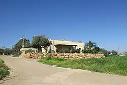
Gitit (Israeli settlement)
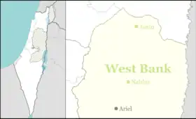
Gitit (Hebrew: גִּתִּית) is an Israeli settlement in the West Bank, organized as a moshav.[2] Located in the Jordan Valley with an area of 1,500 dunams (1.5 km2; 0.58 sq mi), it falls under the jurisdiction of Bik'at HaYarden Regional Council.[2] In 2021 it had a population of 498.[1]
Gitit
גִּתִּית, גיתית | |
|---|---|
 | |
 Gitit | |
| Coordinates: 32°6′3.82″N 35°23′45.59″E | |
| District | Judea and Samaria Area |
| Council | Bik'at HaYarden |
| Region | West Bank |
| Affiliation | Mishkei Herut Beitar |
| Founded | 1972 |
| Founded by | Nahal |
| Population (2021)[1] | 498 |
| Website | www.gittit.co.il |
The international community considers Israeli settlements in the West Bank illegal under international law, but the Israeli government disputes this.[3]
History
_May_2023_(cropped).jpg.webp)
According to ARIJ, Israel confiscated 514 dunams of land from the Palestinian village of Al-Jiftlik in order to construct Gitit[4] in addition to 1,085 dunums from Aqraba for Gitit and Itamar.[5]
After the decision to establish a settlement had been made, land was seized from Aqraba first by declaring a closed military area.[6] When the Palestinian owners refused to vacate the area, their tools were sabotaged.[6] Finally, a crop-duster was used to spray the area with poison, in a joint operation approved by the government of Golda Meir in April 1972, involving the IDF and the Jewish Agency.[6][7] The village was then established in 1972 as a Nahal settlement.[6] It is named for a musical instrument mentioned in the Bible with a similar shape as the area:[8] f.e. Psalm 8:1.
In 1975 it became a civilian community affiliated with Mishkei Herut Beitar.[2] In 1978 it became a moshav shitufi, but later reverted to moshav ovdim status.
References
- "Regional Statistics". Israel Central Bureau of Statistics. Retrieved 22 February 2023.
- Gitit Bik'at HaYarden Regional Council
- "The Geneva Convention". BBC News. 10 December 2009. Retrieved 27 November 2010.
- Al Jiftlik Village Profile p. 17, ARIJ
- Aqraba Town Profile (including Yanun Locality), ARIJ, p. 16
- Aderet, Ofer (23 June 2023). "Israel Poisoned Palestinian Land to Build West Bank Settlement in 1970s, Documents Reveal". Haaretz. Retrieved 24 June 2023.
- Jonathan Ofir, 'New report outlines how Golda Meir’s Israel poisoned Palestinian land in ethnic cleansing operation.' Mondoweiss 25 June 2023.
- Bitan, Hanna: 1948-1998: Fifty Years of 'Hityashvut': Atlas of Names of Settlements in Israel, Jerusalem 1999, Carta, p.19, ISBN 965-220-423-4 (Hebrew)
External links
- Village website
- Primary documents on the establishment of Gitit at Akevot