Givat Shaul
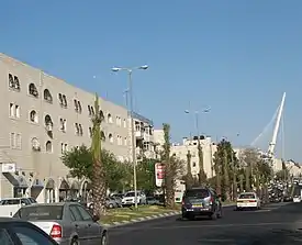
Givat Shaul (Hebrew: גבעת שאול, lit. (Saul's Hill); Arabic: غفعات شاؤول) is a neighborhood in West Jerusalem. The neighborhood is located at the western entrance to the city, east of the neighborhood of Har Nof and north of Kiryat Moshe. Givat Shaul stands 820 meters above sea level.
Name
Givat Shaul is named after the Rishon Lezion, Rabbi Yaakov Shaul Elyashar, the Sephardi Chief Rabbi of Israel,[1] and not, as commonly believed, for the biblical King Saul, whose capital was probably located on the hill Gibeah of Saul near Pisgat Ze'ev, on the way to Ramallah.[2]
History
Givat Shaul was established in 1906 on land purchased from the Arab villages of Deir Yassin and Lifta by a society headed by Rabbi Nissim Elyashar, Arieh Leib and Moshe Kopel Kantrovitz. Difficulties in registering the land delayed construction until 1919. The first residents were needy families who were given small plots to grow fresh produce that was marketed in Jerusalem.[3] These families, mainly Yemenite Jews, were joined by others from Meah Shearim and the Old City.[1] The Ashkenazim built the first public building, Beit Knesset HaPerushim. In 1912, an embroidery and sewing workshop was opened with the help of a Jewish philanthropist, Rabbi Slutzkin. Other industries established in Givat Shaul were the Froumine biscuit factory, a factory for kerosene heaters that manufactured arms for the British army during the British Mandate of Palestine, and a matza factory.[2] In 1927, the Diskin Orphanage moved to Givat Shaul from the Old City. This building, designed by a local architect named Tabachnik, was home to 500 orphan boys.[2]
According to a census conducted in 1931 by the British Mandate authorities, Givat Shaul had a population of 966 inhabitants, in 152 inhabited houses.[4]
A long, dirt track separated Givat Shaul from a cluster of Arab villages, including Deir Yassin, with whom the Jews maintained good relations. In late 1946, the Haganah straightened and paved the dirt track in order to use it as a landing strip. During the Battle for Jerusalem in 1948, the Haganah flew in supplies, armaments, food, and troops on this runway. After the war, this road became known as Kanfei Nesharim Street.[5][6]
In January 1948, the leaders of Givat Shaul met with the mukhtar of Deir Yassin to work out a non-aggression pact: if armed militia entered Deir Yassin, the villagers would hang out laundry in a certain sequence or place lanterns in a particular location. In return, patrols from Givat Shaul guaranteed safe passage to Deir Yassin residents, in vehicles or on foot, passing through their neighborhood on the way to Jerusalem.[7] Over time, Deir Yassin became a halfway site for Arab forces moving from Ein Karem and Malha to al-Qastal and Kolonia, which overlooked the Jerusalem-Tel Aviv highway.
On 9 April 1948, Deir Yassin was attacked by Irgun and Lehi forces[8] and between 100 and 110 villagers were killed during the fights or massacred afterward. The population that had not fled was expelled. The rumours about this massacre also contributed to the trigger of the 1948 Palestinian expulsion and flight.[9]
In 1951, the abandoned buildings were used to house a therapeutic community of 300 patients called the Kfar Shaul Government Work Village for Mental Patients.[10] The majority of patients were Holocaust survivors.[11]
Industrial development
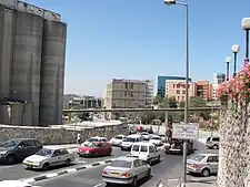
After 1948, the Givat Shaul industrial zone expanded with factories and warehouses. Angel's Bakery moved to its present location here in 1958. The Angel brothers and co-CEOs Avraham, Ovadia, and Danny, commissioned a Texas company to construct a 750-foot pipeline to convey flour directly from the mill to the silo to the bakery. Today this pipeline brings 120 tons of flour to the bakery daily. The invention, initially opposed by the Jerusalem municipality for being above-ground, won the Kaplan Prize for distinction in productivity and efficiency.[12] The bakery's landmark factory store opened in 1984.[13]
Berman's Bakery, founded in 1875 by Mrs. Kreshe Berman as a cottage industry in the Old City, moved to its present location down the road from Angel's in 1965. A new street, Beit Hadfus Street, was constructed to reach the new bakery.[14] This new street was named "Street of the Printing Press" for the many printing establishments also located here.[15] These include two large book publishing houses, Keter Publishing House (established in 1958)[16] and Feldheim Publishers, which established its Israel branch in the 1960s.[17] Old City Press has operated here since 1969.[18]
Since the late 1980s, aging industrial plants have been replaced by housing projects in Givat Shaul Bet.[19]
Demography
The population consists of a mix of Haredi and Religious Zionist Jews. The northernmost part of the neighborhood, directly above Highway 1, is mostly Haredi, while residents of the southern part, bordering Kiryat Moshe, are mostly Modern Orthodox Religious Zionists.
Neighborhoods
Northern Givat Shaul
The northern part of Givat Shaul is populated mainly by Haredim, and the main street is closed to traffic on Shabbat and Jewish holidays. Several major synagogues are located here, including the Pressburg Yeshiva and neighborhood synagogue, and the Zupnik - Ner Yisroel synagogue, and the ivy Yeshiva, Ner Moshe, headed by Rabbi Avraham Gurewitz and Rabbi Shalom Shechter. The population consists of a mix of Hasidic, Litvishe and Sephardi/Mizrahi Haredim, and a small minority of National-Religious Jews. The rabbi of the Zupnik - Ner Yisroel synagogue is Avrohom Yitzchok Ulman, a senior member of the rabbinical high court, or Badatz, of the Edah HaChareidis. Other important rabbis living in Givat Shaul are Rabbi Yehoshua Karlinsky, rabbi of the Beer Avrohom synagogue; Rabbi Tennenbaum, rabbi of the Babad synagogue and Rabbi Shmuel Taussig, Admor of Toldos Shmuel.[20]
Southern Givat Shaul
In the southern part of Givat Shaul, the population predominantly consists of Modern Orthodox Jews, affiliating with Religious Zionism. This section borders Kiryat Moshe and is often also referred to as such. Institutions in this area include the main synagogue of Rabbi Mordechai Eliyahu, a major center of Sephardic Religious Zionism, as well as the primarily Ashkenazi national-religious flagship Mercaz HaRav yeshiva.
Givat Shaul Bet
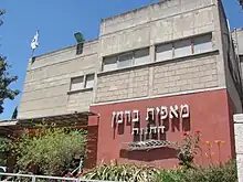
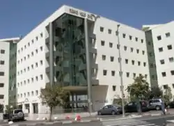
The Givat Shaul industrial zone, sometimes referred to as Givat Shaul Bet, is situated on two parallel streets, Kanfei Nesharim and Beit Hadfus. While Kanfei Nesharim Street has developed into a modern shopping area with many chain stores and stylish office buildings, Beit Hadfus Street remains largely industrial with discount stores and outlets that attract bargain shoppers.[21]
In recent years, low-cost wedding halls servicing the religious population of Jerusalem have opened in several office and industrial buildings on Beit Hadfus Street. Some of these are subsidized by major charity organizations to keep expenses down for low-income families. The Armonot Wolf (Wolf Palaces)[22] wedding halls are affiliated with the Yad Eliezer charity organization, which subsidizes weddings for orphans here through its Adopt-a-Wedding campaign.[23] The Gutnick Halls,[22] funded by Australian philanthropist Joseph Gutnick and managed by Chabad, provide subsidized weddings for 440 needy couples annually through the Colel Chabad charity fund.[24] The Lechaim halls,[22] located into the same industrial complex as Armonot Wolf, are also cheaper than wedding halls in other parts of the city.
Government offices include the Ministry of Environmental Protection, the National Authority of Religious Services,[25] the State Comptroller and Ombudsman,[26] the Israel Securities Authority,[27] the Income Tax Commission,[28] the Israel Central Bureau of Statistics,[29] and the National Parks Authority.[30]
The Israeli branch of Touro College[31] and the Tal Institute, the women's division of the Jerusalem College of Technology,[32] are also located in Givat Shaul.
Givat Shaul cemetery
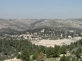
On the northwestern ridge of the neighborhood lies Har HaMenuchot, Jerusalem's largest cemetery. Between the northern section of Givat Shaul and the cemetery is another commercial zone consisting of several large stores and office buildings. The Herzog psychiatric hospital,[33] Egged's bus maintenance facility, and the main depot for the Jerusalem municipality's sanitation services are also located here.
Notable residents
- Mordechai Eliyahu
- Aharon Tausig[20]
- Avrohom Yitzchok Ulman
- Shlomo Wolbe[34]
- Mordechai Zuckerman[35]
Companies based in Givat Shaul
- Angel Bakeries
- Berman's Bakery
- Kramer Electronics, Ltd.
- Feldheim Publishers
- Keter Publishing House
- Yehuda Matzos
References
- "The Givat Shaul Neighborhood in Jerusalem". gojerusalem.com. Retrieved 2010-08-20.
- Yarok Birushalayim, Shechunat Givat Shaul, Society for the Protection of Nature in Israel, Vol. 85, June–July 2007.
- Jerusalem neighborhoods: Givat Shaul
- Mills, 1932, p. 39
- Pinner, Daniel (March 1999). "On Eagles' Wings". Your Jerusalem. Retrieved 7 June 2010.
- "Jerusalem Corner". Beit Knesset Mitzpe Ramot. 3 April 2009. Archived from the original on 10 May 2010. Retrieved 2010-06-14.
- Morris 2004, p. 91; Gelber 2006 Archived 2008-02-27 at the Wayback Machine, p. 308.
- Levitza's account, from ‘Nine Measures’ by Yitzhak Levi ("Levitza") published by ‘Maarachot’ Israel Defense Forces Press, Tel Aviv, 1986 Archived 2012-03-09 at the Wayback Machine
- "Gelber 2006" (PDF). Archived from the original (PDF) on 2008-02-27. Retrieved 2009-08-26.
- Progress in Psychotherapy, American Psychiatric Association, Grune & Stratton, 1949.
- Freidman, Ron. "Challenged children get a bird's-eye view of Masada", The Jerusalem Post, 17 June 2006.
- Elliman, Wendy (25 May 2007). "Family Creates a Baking Dynasty in Israel". jweekly.com. Retrieved 11 August 2010.
- Hasson, Nir (1 December 2009). "Jerusalem's Town Baker". Haaretz. Retrieved 2 August 2010.
- Yosefson, A. (27 October 2004). "Rabbi Alexander (Sender) Uri: Pioneer Ba'al Teshuvoh". Dei'ah VeDibur. Archived from the original on 2006-10-28. Retrieved 2010-08-10.
- Eisenberg, Ronald L. (30 September 2006). The Streets of Jerusalem: Who, What, Why. Devora Publishing. ISBN 978-1-932687-54-5.
- "About Us". Keter Books. 2007. Archived from the original on 7 May 2011. Retrieved 5 September 2010.
- "Incredible Savings From Feldheim Publishers". matzav.com. 20 June 2010. Retrieved 5 September 2010.
- "Old City Press: Company Profile". israelexporter.com. Retrieved 5 September 2010.
- "Givat Shaul". eifermanrealty.com. Retrieved 2010-09-05.
- Sever, Yechiel (1 November 2007). "HaRav Aharon Taussig zt"l". Dei'ah VeDibur. Archived from the original on 25 May 2011. Retrieved 2010-08-20.
- "The Givat Shaul Neighborhood in Jerusalem". gojerusalem.com. Retrieved 6 September 2010.
- "Halls". koogle.co.il. Archived from the original on 22 January 2011. Retrieved 8 September 2010.
- "Adopt-a-Wedding". yadeliezer.org. Retrieved 8 September 2010.
- "Gutnick Wedding Halls". Colel Chabad. 2010. Archived from the original on 20 October 2010. Retrieved 11 September 2010.
- "Addresses, Telephone and Fax Numbers of Government Ministries". Israel Ministry of Foreign Affairs. 2008. Retrieved 2010-06-07.
- "The State Comptroller and Ombudsman". Israel Ministry of Foreign Affairs. 2008. Retrieved 2010-06-07.
- "Israel Securities Authority". Israel Securities Authority. Archived from the original on 2010-11-12. Retrieved 2010-06-07.
- "Ministry of Finance Annual Report". Israel Ministry of Finance. 2001–2002. Retrieved 2010-06-07.
- "Central Bureau Of Statistics Offices". Israel Government Portal. 2002. Retrieved 2010-06-07.
- Gabbay, Shoshana (September 2001). "Nature Conservation in Israel". Israel Ministry of Foreign Affairs. Retrieved 2010-06-07.
- "About Us". touroisrael.org. Archived from the original on 2010-07-12. Retrieved 2010-08-20.
- "Tal Institute". biojerusalem.org. Archived from the original on 21 July 2011. Retrieved 8 September 2010.
- "Sarah Herzog Hospital, Jerusalem". herzoghospital.og. 2001. Retrieved 2010-08-20.
- "Gathering in Givat Shaul to Mark End of Shivoh for HaRav Wolbe, zt"l". Dei'ah VeDibur. 11 May 2005. Archived from the original on 31 March 2006. Retrieved 2010-08-20.
- Kahn, Betzalel (19 November 2003). "HaRav Mordechai Zuckerman, zt"l". Dei'ah VeDibur. Archived from the original on 28 October 2006. Retrieved 2010-08-20.
.jpg.webp)