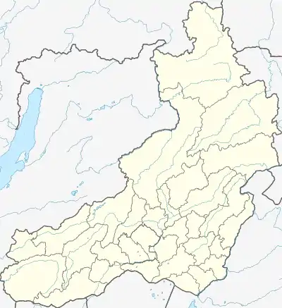
Golets Kropotkin
Golets Kropotkin (Russian: Голец Кропоткина) is a peak in the Olyokma-Stanovik Mountains. Administratively it is part of the Transbaikal Krai, Russian Federation. The peak was named after Peter Kropotkin, who had explored the area in 1864.[2]
| Golets Kropotkin | |
|---|---|
| Голец Кропоткина | |
 Golets Kropotkin | |
| Highest point | |
| Elevation | 1,908 m (6,260 ft)[1] |
| Prominence | 850 m (2,790 ft)[1] |
| Coordinates | 53°43′39″N 117°33′29″E |
| Geography | |
| Location | Transbaikal Krai, Russian Far East |
| Parent range | Muroy Range, Olyokma-Stanovik |
This emblematic summit was declared a natural monument by the Chita Regional Executive Committee order No. 353 on 14 July 1983.[2]
Geography
This 1,908 m (6,260 ft) high mountain is the highest point of the Olyokma-Stanovik, part of the South Siberian System of ranges. It is located in the western part of the highland area, on the border of Tungokochensky District to the west and Tungiro-Olyokminsky District to the east.[3]
Golets Kropotkin is a ‘’golets’’-type of mountain with a bald peak belonging to the Muroy Range, one of the subranges of the Olyokma-Stanovik mountain system.[2]
Flora
The peak has well-defined altitudinal vegetation zones, with mountain taiga in the lower slopes, followed by pre-alpine woodland and an alpine belt further up. Some of the plants found on the southern sides include Erman's birch, golden rhododendron, Cassiope, alpine bearberry[2] and golden dock, among others.[4]
See also
References
- PeakVisor Gora Kropotkina
- "Кропоткина, голец" [Kropotkin, Golets] (in Russian). Энциклопедия Забайкалья. Retrieved 11 November 2021.
- Google Earth
- L. I. Malyschev, ed. Flora of Siberia, Vol. 5: Salicaceae-Amaranthaceae. p. 100