Goodyear Lake
Goodyear Lake is a man-made lake created by the building of the Colliersville Dam. The lake is located southwest of the hamlet of Portlandville in the Town of Milford in Otsego County, New York.
| Goodyear Lake | |
|---|---|
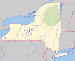
 Goodyear Lake Location within New York  Goodyear Lake Goodyear Lake (the United States) | |
| Location | Otsego County, New York |
| Coordinates | 42°30′35″N 74°59′15″W |
| Type | Reservoir |
| Primary inflows | Susquehanna River, Spring Brook |
| Primary outflows | Susquehanna River |
| Surface area | 234 acres (0.366 sq mi) |
| Average depth | 14 feet (4.3 m) |
| Max. depth | 30 feet (9.1 m) |
| Shore length1 | 9.7 miles (15.6 km) |
| Surface elevation | 1,138 feet (347 m)[1] |
| Settlements | Portlandville, Cliffside |
| 1 Shore length is not a well-defined measure. | |
Fishing
Fish species present in the lake are bluegill, black bullhead, largemouth bass, chain pickerel, pumpkinseed sunfish, rock bass, smallmouth bass, walleye, and yellow perch. The lake is accessed by a state-owned carry down boat launch off NY 28 in Portlandville and one off Silliman Cove Road with parking for 15 cars, as well as various areas to shore fish. There is also hotel accommodations off NY 28 on the west shore of the lake.[2]
References
- "Goodyear Lake". Geographic Names Information System. United States Geological Survey, United States Department of the Interior. Retrieved 2017-12-25.
- Sportsman's Connection (Firm) (2004-01-01), Southeastern New York fishing map guide: includes lakes & streams for the following counties: Albany, Bronx, Columbia, Delaware, Dutchess, Greene, Kings, Montgomery, Nassau, New York, Orange, Otsego, Putnam, Queens, Rensselaer, Richmond, Rockland, Schenectady, Schoharie, Suffolk, Sullivan, Ulster, Westchester, Sportsman's Connection, ISBN 1885010648, OCLC 59148832
This article is issued from Wikipedia. The text is licensed under Creative Commons - Attribution - Sharealike. Additional terms may apply for the media files.