Grade II* listed buildings in West Dorset
There are over 20,000 Grade II* listed buildings in England. This page is a list of these buildings in the district of West Dorset in the county of Dorset.
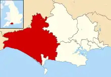
West Dorset shown in Dorset
Locations A–B
| Name | Location | Type | Completed [note 1] | Date designated | Grid ref.[note 2] Geo-coordinates |
Entry number [note 3] | Image |
|---|---|---|---|---|---|---|---|
| Abbott's Walk | Abbotsbury Abbey, Abbotsbury | Abbey building | 14th century | 26 January 1956 | SY5780485177 50°39′53″N 2°35′54″W |
1118746 | 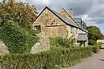 Abbott's Walk |
| Outer Gatehouse with Walling for 5 Metres to West | Abbotsbury Abbey, Abbotsbury | Abbey gatehouse | 14th century | 26 January 1956 | SY5769685208 50°39′54″N 2°36′00″W |
1118741 |  Upload Photo |
| Pigeon House | Abbotsbury Abbey, Abbotsbury | Dovecote | 15th century | 26 January 1956 | SY5787085035 50°39′48″N 2°35′51″W |
1172244 | Upload Photo |
| Rodden House | Rodden, Abbotsbury | House | Early 18th century | 26 January 1956 | SY6111984215 50°39′23″N 2°33′05″W |
1324196 | 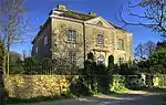 Rodden House |
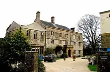
| The Manor House | Abbotsbury | Manor house | Late 16th century | 26 January 1956 | SY5771285245 50°39′55″N 2°35′59″W |
1324227 | .jpg.webp) The Manor House |
| The Pynion End | Abbotsbury Abbey, Abbotsbury | Abbey gable end | Late 14th century | 26 January 1956 | SY5778385146 50°39′52″N 2°35′55″W |
1172220 | 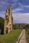 The Pynion End |
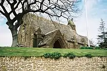
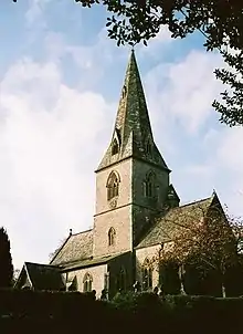
| Parish Church of St Pancras | Alton Pancras | Anglican parish church | 15th-century tower | 26 January 1956 | ST6988002403 50°49′13″N 2°25′44″W |
1118915 | 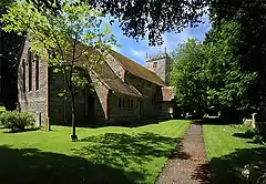 Parish Church of St Pancras |
| The Manor House | Alton Pancras | House | c. 1730–44 | 26 January 1956 | ST6991902384 50°49′13″N 2°25′42″W |
1118879 | 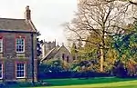 The Manor House |
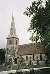
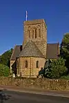
| Parish Church of St Michael | Askerswell | Anglican parish church | 15th-century tower | 5 September 1960 | SY5299492588 50°43′52″N 2°40′03″W |
1213455 | 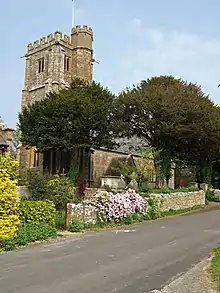 Parish Church of St Michael |
| South Eggardon Farmhouse | South Eggardon Farm, Askerswell | Farmhouse | 16th century or earlier | 7 August 1952 | SY5358093749 50°44′29″N 2°39′33″W |
1118792 |  South Eggardon Farmhouse |
| Dovecote 15 Metres North West of Athelhampton Hall | Athelhampton | Dovecote | Early 16th century | 26 January 1956 | SY7701594289 50°44′52″N 2°19′38″W |
1119127 | 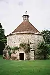 Dovecote 15 Metres North West of Athelhampton Hall |
| Garden Pavilions, Walls and Terraces Immediately South and South West of Athelhampton Hall, Including Wall and Archway Linking Gardens to Stables | Athelhampton | Pavilions | c. 1891 | 10 March 1987 | SY7703394188 50°44′49″N 2°19′37″W |
1323996 | Upload Photo |
| Stables 50 Metres South West of Athelhampton Hall | Athelhampton | Stables | Early 17th century | 10 March 1987 | SY7699694250 50°44′51″N 2°19′39″W |
1119128 | Upload Photo |
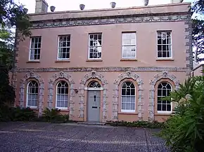
| Barton End, and Attached Walls at Rear | Beaminster | House | Early 18th century | 22 December 1983 | ST4811901566 50°48′41″N 2°44′16″W |
1291242 | 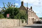 Barton End, and Attached Walls at Rear |
| Champions with Front Wall 30 Metres to South | Beaminster | Town house | Late 17th century | 12 June 1953 | ST4797301402 50°48′35″N 2°44′23″W |
1220584 | 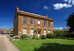 Champions with Front Wall 30 Metres to South |
| Devonia | Beaminster | Detached house | Late 18th century | 12 June 1953 | ST4792301370 50°48′34″N 2°44′26″W |
1220022 | Upload Photo |
| Farrs | Beaminster | Detached house | Early 18th century | 12 June 1953 | ST4819401162 50°48′28″N 2°44′12″W |
1290324 | Upload Photo |
| Front Courtyard and South Terrace Walls and Gazebos, at Parnham | Parnham, Beaminster | Courtyard | c. 1910 | 22 December 1983 | ST4746400279 50°47′59″N 2°44′49″W |
1221181 | Upload Photo |
| Hitts House and Front Walls, Wagon Stones and Continuations to East and West | Beaminster | Detached house | Late 17th century | 12 June 1953 | ST4825701078 50°48′25″N 2°44′09″W |
1210734 | Upload Photo |
| Meerhay Manor | Meerhay, Beaminster | Manor farmhouse | c. 1610 | 12 June 1953 | ST4851402642 50°49′16″N 2°43′56″W |
1290899 | Upload Photo |
| Midland Bank | Beaminster | Town house | 17th century | 12 June 1953 | ST4803801327 50°48′33″N 2°44′20″W |
1290452 | Upload Photo |
| Pines | Beaminster | House | Late 18th century | 12 June 1953 | ST4804601365 50°48′34″N 2°44′19″W |
1118732 | Upload Photo |
| Stable Block 25 Metres East of the Manor House | Beaminster | Stables | c. 1670 | 22 December 1983 | ST4828801405 50°48′36″N 2°44′07″W |
1220908 | Upload Photo |
| Stable Block North of Parnham House (Workshops and Offices) | Parnham, Beaminster | Stable | c. 1910 | 22 December 1983 | ST4752000330 50°48′01″N 2°44′46″W |
1221179 | Upload Photo |
| The Manor House and Stable Block | Beaminster | Manor house | Late 18th century | 12 June 1953 | ST4824401409 50°48′36″N 2°44′09″W |
1220906 | Upload Photo |
| The Yews | Beaminster | Detached house | Late 17th century | 22 December 1983 | ST4821401113 50°48′26″N 2°44′11″W |
1290326 | Upload Photo |
| Attached Service Ranges, West of Manor House, and Brick Wall at Front | Bettiscombe | Service buildings | 18th century | 8 April 1983 | ST4011800322 50°47′58″N 2°51′04″W |
1324079 | Upload Photo |
| Bettiscombe Manor House with Attached South Front Area Wall and Gate-Piers | Bettiscombe | Manor house | Early 18th century | 4 December 1951 | ST4014100322 50°47′58″N 2°51′03″W |
1118973 | Upload Photo |
| Garden Walls Attached on North Side of Manor House | Bettiscombe | Garden walls | 8 April 1983 | ST4012000352 50°47′59″N 2°51′04″W |
1324081 | Upload Photo | |
| Pillar Box at Barnes Cross at ST 693 118 | Cornford Hill, Bishop's Caundle | Pillar box | 1853 | 16 September 1987 | ST6930811775 50°54′17″N 2°26′16″W |
1237251 | 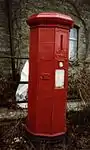 Pillar Box at Barnes Cross at ST 693 118 |
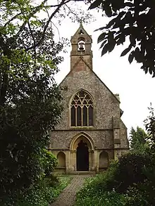
| New Holy Trinity Church | Bothenhampton | Anglican parish church | 1887–89 | 19 December 1984 | SY4703591943 50°43′29″N 2°45′06″W |
1213728 | |
| Smith's Bridge | Bradford Abbas | Road bridge | 16th century | 11 July 1951 | ST5896314032 50°55′27″N 2°35′07″W |
1119407 | 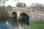 Smith's Bridge |
| Church of St Mary | Bradford Peverell | Anglican parish church | 1849–50 | 26 January 1956 | SY6580293030 50°44′09″N 2°29′09″W |
1324204 | |
| Church of St Swithun | North Allington, Bridport | Anglican parish church | 1826–27 | 28 November 1950 | SY4613793094 50°44′06″N 2°45′53″W |
1216300 | 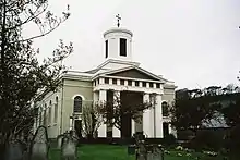 Church of St Swithun |
| Daniel Taylor's Almshouses and Wall of Friends' Burial Place | Bridport | Almshouses | 15th and 16th century | 28 November 1950 | SY4662292577 50°43′49″N 2°45′28″W |
1287414 | Upload Photo |
| Downe Hall | Bridport | House | 18th century | 28 November 1950 | SY4674493207 50°44′10″N 2°45′22″W |
1215760 | Upload Photo |
| Former Literary and Scientific Institute | Bridport | Public library | 19th century | 28 November 1950 | SY4678692918 50°44′00″N 2°45′19″W |
1118999 | .jpg.webp) Former Literary and Scientific Institute |
| Granby House Masonic Hall | Bridport | Houses | 1769 | 28 November 1950 | SY4703592840 50°43′58″N 2°45′07″W |
1118972 | Upload Photo |
| Granville House | Bridport | House | Mid 18th century | 28 November 1950 | SY4649992986 50°44′02″N 2°45′34″W |
1279223 | .jpg.webp) Granville House |
| Messrs Norman Goods Warehouse | West Bay, Bridport | Warehouse | 18th century | 19 September 1975 | SY4636090350 50°42′37″N 2°45′40″W |
1228722 |  Messrs Norman Goods Warehouse |
| The Castle (Museum and Art Gallery) | Bridport | House | Early 16th century | 28 November 1950 | SY4660692823 50°43′57″N 2°45′29″W |
1227857 | .jpg.webp) The Castle (Museum and Art Gallery) |
| The Chantry | Bridport | House | Probably 14th or 15th century | 28 November 1950 | SY4658592424 50°43′44″N 2°45′29″W |
1287219 | Upload Photo |
| The Walls to Garden Behind No 74, East Street | Bridport | House wall | Late 18th century | 28 November 1950 | SY4690092871 50°43′59″N 2°45′14″W |
1118969 | Upload Photo |
| Unitarian Chapel | Bridport | Unitarian chapel | 1794 | 28 November 1950 | SY4678992961 50°44′02″N 2°45′19″W |
1324052 | .jpg.webp) Unitarian Chapel |
| 133–139, North Allington | Allington, Bridport | Houses | 16th or 17th century | 28 November 1950 | SY4609793543 50°44′20″N 2°45′55″W |
1216318 | Upload Photo |
| 34 West Street | Bridport | House | Mid 18th century | 28 November 1950 | SY4645692954 50°44′01″N 2°45′36″W |
1229114 | Upload Photo |
| 27 and 29, West Allington | Allington, Bridport | Houses | Late 18th or early 19th century | 28 November 1950 | SY4614893015 50°44′03″N 2°45′52″W |
1228694 | Upload Photo |
| 9 East Street | Bridport | House | 16th or 17th century | 28 November 1950 | SY4661692948 50°44′01″N 2°45′28″W |
1118996 | Upload Photo |
| 3 Monuments Immediately East of South Tower of Church of St Martin | Broadmayne | Table tombs | 17th century | 27 October 1986 | SY7284386636 50°40′43″N 2°23′09″W |
1323943 | Upload Photo |
| Parish Church of St Martin | Broadmayne | Anglican parish church | Late 13th century | 26 January 1956 | SY7284486645 50°40′44″N 2°23′09″W |
1119258 | 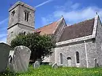 Parish Church of St Martin |
| Barn 20 Metres East of Childhay Manor Farmhouse | Childhay, Broadwindsor | Cruck barn | 16th century or possibly later | 4 December 1951 | ST4096504047 50°49′59″N 2°50′23″W |
1118783 | Upload Photo |
| Bere Chapel Farmhouse | Broadwindsor | Farmhouse | 16th century | 8 October 1973 | ST3917305751 50°50′53″N 2°51′55″W |
1118770 | Upload Photo |
| Childhay Manor Farmhouse | Childhay, Broadwindsor | Farmhouse | Late 15th century | 4 December 1951 | ST4095504011 50°49′57″N 2°50′23″W |
1291153 | 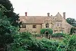 Childhay Manor Farmhouse |
| Old Sandpitts | Sandpit, Broadwindsor | Farmhouse | 15th century | 31 July 1984 | ST4251004524 50°50′15″N 2°49′04″W |
1210321 | Upload Photo |
| Parish Church of St John the Baptist | Broadwindsor | Anglican parish church | Late 12th or early 13th century | 11 November 1966 | ST4377702651 50°49′14″N 2°47′58″W |
1118784 | 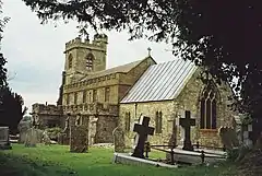 Parish Church of St John the Baptist |
| Park | Broadwindsor | Farmhouse | 16th century | 4 December 1951 | ST4437203330 50°49′37″N 2°47′28″W |
1118777 | Upload Photo |
| Racedown House with Attached Rear Garden Walls, and Gate Pier to North | Birdsmoorgate, Broadwindsor | House | Mid and late 18th century | 4 December 1951 | ST3969401654 50°48′41″N 2°51′26″W |
1118781 | Upload Photo |
| South Dibberford Farmhouse | Broadwindsor | Farmhouse | 17th century | 4 December 1951 | ST4642503733 50°49′50″N 2°45′44″W |
1118771 | Upload Photo |
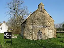
| Church of St Nicholas | Buckland Ripers | Anglican parish church | 15th century | 20 May 1985 | SY6513482538 50°38′29″N 2°29′40″W |
1151971 | 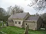 Church of St Nicholas |
| Burstock Grange | Burstock | Farmhouse | c. 15th century | 4 December 1951 | ST4246202428 50°49′07″N 2°49′05″W |
1215390 | Upload Photo |
| Parish Church of St Andrew | Burstock | Anglican parish church | Possibly 12th century | 11 November 1966 | ST4222602914 50°49′22″N 2°49′18″W |
1210375 | 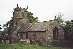 Parish Church of St Andrew |
Locations C–D
| Name | Location | Type | Completed [note 1] | Date designated | Grid ref.[note 2] Geo-coordinates |
Entry number [note 3] | Image |
|---|---|---|---|---|---|---|---|
| Dairy, Immediately North-West of Sherborne Castle | Castleton | Dairy | Late 18th century | 11 July 1951 | ST6487516416 50°56′46″N 2°30′05″W |
1153919 | Upload Photo |
| Greenhouse 60 Metres North-West of Sherborne Castle | Castleton | Greenhouse | c. 1779 | 11 July 1951 | ST6485516456 50°56′47″N 2°30′06″W |
1323883 | Upload Photo |
| Pinford Bridge | Sherborne Park, Castleton | Bridge | Late 18th century | 31 July 1961 | ST6620216968 50°57′04″N 2°28′57″W |
1323885 | Upload Photo |
| The Stables, 300 Metres West-South-West of Sherborne Castle | Sherborne Park, Castleton | Stables | 1759 | 7 November 1951 | ST6463016341 50°56′43″N 2°30′17″W |
1119381 | Upload Photo |
| Two Barns 120 Metres North-West of Wyke House | Wyke, Castleton | Barns | 16th century | 11 July 1951 | ST6001614616 50°55′47″N 2°34′13″W |
1304035 | Upload Photo |
| Wyke House | Wyke, Castleton | Farmhouse | 1650 | 11 July 1951 | ST6010014481 50°55′42″N 2°34′09″W |
1119382 | Upload Photo |
| Parish Church (St Mary) | Catherston Leweston | Anglican parish church | 1857–58 | 10 January 1984 | SY3696594391 50°44′44″N 2°53′41″W |
1213892 | |
| Holway Farmhouse | Cattistock | Farmhouse | Early 17th century | 26 January 1956 | ST5860401094 50°48′28″N 2°35′20″W |
1304977 | Upload Photo |
| Manor Farmhouse | Caundle Marsh | House | 16th century | 11 July 1951 | ST6780413274 50°55′05″N 2°27′34″W |
1324144 |  Manor Farmhouse |
| North Barn 75 Metres North-North-West of the Abbot's Porch | Cerne Abbey, Cerne Abbas | Barn | Early 16th century | 26 January 1956 | ST6647901484 50°48′43″N 2°28′38″W |
1323850 | Upload Photo |
| The New Inn | Cerne Abbas | Coaching inn | Late 17th century | 26 January 1956 | ST6649901131 50°48′32″N 2°28′37″W |
1323837 |  The New Inn |
| The Old Farmhouse | Cerne Abbas | House | Mid 18th century | 26 January 1956 | ST6668801190 50°48′33″N 2°28′27″W |
1119451 | Upload Photo |
| The Old House | Cerne Abbas | House | Early 18th century | 26 January 1956 | ST6657201189 50°48′33″N 2°28′33″W |
1304900 | Upload Photo |
| Forston House and Attached Terrace Walls to West | Forston, Charminster | House | Early 18th century | 26 January 1956 | SY6658195742 50°45′37″N 2°28′31″W |
1119094 | Upload Photo |
| The Riding House | Wolfeton, Charminster | Riding school | Late 16th century | 26 January 1956 | SY6785192254 50°43′44″N 2°27′25″W |
1119102 | Upload Photo |
| Queen's Armes Hotel | Charmouth | Coaching inn | Early 16th century | 7 August 1952 | SY3661093659 50°44′21″N 2°53′59″W |
1324126 | 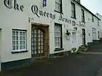 Queen's Armes Hotel |
| Manor Farmhouse with Attached Barn at Rear | Chedington | Farmhouse | 16th century | 12 June 1953 | ST4893605596 50°50′51″N 2°43′36″W |
1210837 | Upload Photo |
| Lyscombe Chapel | Lyscombe, Cheselbourne | Chapel | 16th century | 26 January 1956 | ST7366701066 50°48′31″N 2°22′30″W |
1119105 | 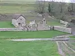 Lyscombe Chapel |
| Old Rectory | Cheselbourne | House | Late 16th century | 26 January 1956 | SY7619799871 50°47′52″N 2°20′21″W |
1324022 | Upload Photo |
| Parish Church of St Peter | Chetnole | Anglican parish church | 13th century | 31 July 1961 | ST6022408190 50°52′19″N 2°34′00″W |
1304234 | 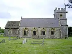 Parish Church of St Peter |
| Spring Cottage | Chetnole | House | Late 15th century | 31 July 1961 | ST6043907734 50°52′04″N 2°33′49″W |
1153488 | Upload Photo |
| The Court | Chetnole | Country house | Mid 18th century | 11 July 1951 | ST6030108266 50°52′21″N 2°33′56″W |
1119188 | Upload Photo |
| The Grange | Chetnole | Villa | Early 19th century | 11 July 1951 | ST6025907979 50°52′12″N 2°33′58″W |
1323990 | Upload Photo |
| Parish Church of St Mary | Chickerell | Anglican parish church | 13th century | 26 January 1956 | SY6438680689 50°37′29″N 2°30′17″W |
1118696 | 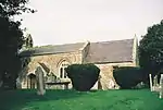 Parish Church of St Mary |
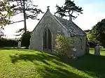
| Mortuary Chapel (Roman Catholic) Including Walls and Gates | Chideock | Mortuary chapel | 1857 | 10 January 1984 | SY4215792908 50°43′58″N 2°49′16″W |
1288009 | 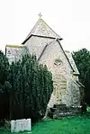 Mortuary Chapel (Roman Catholic) Including Walls and Gates |
| Roman Catholic Church at Chideock Manor | North Chideock | Roman Catholic church | 1874 | 10 January 1984 | SY4203393457 50°44′16″N 2°49′22″W |
1287989 | 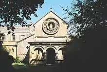 Roman Catholic Church at Chideock Manor |
| Church of the Holy Trinity | Chilfrome | Anglican parish church | 15th century | 26 January 1956 | SY5905298795 50°47′14″N 2°34′56″W |
1288702 | 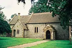 Church of the Holy Trinity |
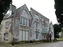
| Building 10 Metres South-East of Clifton House (the Library) | Clifton Maybank | Library | Mid 16th century | 2 June 1986 | ST5765613894 50°55′23″N 2°36′14″W |
1304043 | Upload Photo |
| Church of St Thomas of Canterbury | Compton Valence | Anglican parish church | 15th century tower, rest 1838–39 | 26 January 1956 | SY5928793247 50°44′15″N 2°34′42″W |
1214304 | 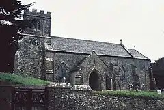 Church of St Thomas of Canterbury |
| Benville Manor | Corscombe | Manor house | Early 17th century | 12 June 1953 | ST5342803708 50°49′52″N 2°39′46″W |
1210861 | Upload Photo |
| Court Farmhouse | Court, Corscombe | Farmhouse | 17th century | 12 June 1953 | ST5261205418 50°50′47″N 2°40′28″W |
1290052 | Upload Photo |
| Tithe Barn 40 Metres North West of Court Farmhouse | Court, Corscombe | Barn | 22 December 1983 | ST5258705450 50°50′48″N 2°40′29″W |
1289993 | Upload Photo | |
| Church of All Saints | Dewlish | Anglican parish church | 16th century | 26 January 1956 | SY7754998177 50°46′58″N 2°19′11″W |
1119107 |  Church of All Saints |
| Manor Farm House | Dewlish | Manor house | Early 17th century | 26 January 1956 | SY7751598176 50°46′58″N 2°19′13″W |
1154326 | Upload Photo |
| Antelope Hotel | Cornhill, Dorchester | Hotel | Early 19th century | 8 May 1950 | SY6923790679 50°42′54″N 2°26′14″W |
1324415 | Upload Photo |
| Church of All Saints. Railings at West End, and Churchyard Steps at South East Corner of Church of All Saints | Dorchester | Anglican parish church | 1843–45 | 8 May 1950 | SY6934490733 50°42′55″N 2°26′08″W |
1110582 | 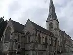 Church of All Saints. Railings at West End, and Churchyard Steps at South East Corner of Church of All Saints |
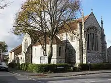
| Church of St Mary | West Fordington, Dorchester | Anglican parish church | 1910–12 | 8 May 1975 | SY6873990074 50°42′34″N 2°26′39″W |
1110596 | |
| Colliton House | Dorchester | House | 16th or 17th century | 8 May 1950 | SY6905290792 50°42′57″N 2°26′23″W |
1324441 | Upload Photo |
| Fordington House. Entrance Gates | Dorchester | House | Mid 18th century | 8 May 1950 | SY6985290242 50°42′40″N 2°25′42″W |
1119036 |  Fordington House. Entrance Gates |
| Kings Arms Hotel | Dorchester | Hotel | Late 18th or early 19th century | 8 May 1950 | SY6932290758 50°42′56″N 2°26′09″W |
1110587 | |
| Municipal Buildings | Dorchester | Town hall | 1847–48 | 8 May 1975 | SY6928290759 50°42′56″N 2°26′11″W |
1110585 | |
| Napper's Mite | Dorchester | Almshouses | 1610 | 8 May 1950 | SY6925090475 50°42′47″N 2°26′13″W |
1219851 | 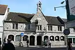 Napper's Mite |
| South Lodge | Dorchester | House | c. 1740–50 | 8 May 1950 | SY6925390387 50°42′44″N 2°26′13″W |
1220609 |  South Lodge |
| 3 Cornhill | Cornhill, Dorchester | House | Late Georgian | 8 May 1950 | SY6927790708 50°42′55″N 2°26′12″W |
1110634 | Upload Photo |
| 42 High West Street | Dorchester | House | Early to mid 18th century | 8 May 1975 | SY6894790704 50°42′54″N 2°26′28″W |
1119064 | Upload Photo |
| 23 and 23A High West Street | Dorchester | House | 1735 | 8 May 1950 | SY6907190701 50°42′54″N 2°26′22″W |
1218838 | Upload Photo |
| 3 Trinity Street | Dorchester | House | Mid 18th century | 8 May 1975 | SY6919090649 50°42′53″N 2°26′16″W |
1220612 | Upload Photo |
| 10 South Street | Dorchester | House | Late 18th century | 8 May 1950 | SY6927790570 50°42′50″N 2°26′11″W |
1291253 | _-_geograph.org.uk_-_661448.jpg.webp) 10 South Street |
| 31–33 High East Street | Dorchester | House | c. 1854 | 8 May 1975 | SY6934490758 50°42′56″N 2°26′08″W |
1291942 | Upload Photo |
| 6 High West Street | Dorchester | House | 17th century | 8 May 1950 | SY6920890717 50°42′55″N 2°26′15″W |
1324037 | 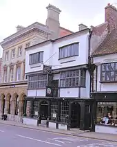 6 High West Street |
_-_geograph.org.uk_-_661451.jpg.webp)
.jpg.webp)
Locations E–L
| Name | Location | Type | Completed [note 1] | Date designated | Grid ref.[note 2] Geo-coordinates |
Entry number [note 3] | Image |
|---|---|---|---|---|---|---|---|
| Lion Gate | Evershot | Gate piers | Late 17th century | 2 June 1986 | ST5752105147 50°50′39″N 2°36′17″W |
1119300 | Upload Photo |
| Church of St Osmund | Evershot | Anglican parish church | 12th century, heavily restored 1852–53 | 11 November 1966 | ST5724904500 50°50′18″N 2°36′31″W |
1153641 | 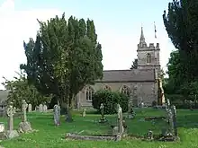 Church of St Osmund |
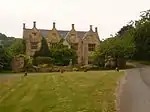
| The Mansion | Evershot | House | Mid 18th century | 4 December 1951 | ST5731004480 50°50′18″N 2°36′27″W |
1153711 | 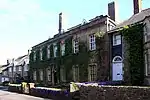 The Mansion |
| Old Parish Church | East Fleet | Anglican parish church | c. 15th century | 26 January 1956 | SY6354580051 50°37′08″N 2°31′00″W |
1118700 | |
| Folke Manor | Folke | Country house | Late 15th or early 16th century | 11 July 1951 | ST6592013279 50°55′05″N 2°29′10″W |
1324147 | 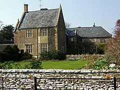 Folke Manor |
| Font Le Roi | Folke | Gatehouse | 15th century | 11 July 1951 | ST6720613620 50°55′16″N 2°28′05″W |
1118865 | Upload Photo |
| Frampton House | Frampton Park, Frampton | House | Early 19th century | 26 January 1956 | SY6260194631 50°45′00″N 2°31′53″W |
1288471 | Upload Photo |
| Peacock Bridge over River Frome, East Drive to Frampton House | Frampton Park, Frampton | Bridge | Late 18th century | 26 January 1956 | SY6327094616 50°45′00″N 2°31′19″W |
1214653 | 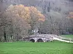 Peacock Bridge over River Frome, East Drive to Frampton House |
| Stable Block and Coach House Immediately North of Frampton House | Frampton Park, Frampton | House | Early 19th century | 26 January 1956 | SY6256494659 50°45′01″N 2°31′55″W |
1214652 | Upload Photo |
| Frome House | Frome St Quintin | Detached house | 1782 | 26 January 1956 | ST5973102661 50°49′19″N 2°34′23″W |
1119410 | Upload Photo |
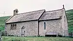
| Church of St Francis | Frome Vauchurch | Anglican parish church | 12th century | 26 January 1956 | SY5994897208 50°46′23″N 2°34′10″W |
1288446 | |
| Pitman Monument 2 Metres North of North Chapel of Church of Holy Trinity | Godmanstone | Table tomb | 1717 | 20 May 1985 | SY6659097384 50°46′30″N 2°28′31″W |
1215084 | Upload Photo |
| Church of St Juthware and St Mary | Halstock | Anglican parish church | 15th century tower | 11 November 1966 | ST5364808374 50°52′23″N 2°39′36″W |
1119266 | 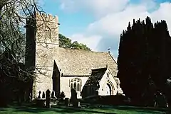 Church of St Juthware and St Mary |
| Church of St Mary | Hermitage | Anglican parish church | 17th century | 31 July 1961 | ST6496806956 50°51′40″N 2°29′57″W |
1118871 | Upload Photo |
| Church of St Nicholas | Hilfield | Anglican parish church | 15th century | 31 July 1961 | ST6351005102 50°50′39″N 2°31′11″W |
1151982 | 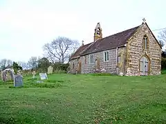 Church of St Nicholas |
| Buckshaw House | Buckshaw, Holwell | House | Mid 18th century | 21 May 1984 | ST6871511328 50°54′02″N 2°26′47″W |
1152103 |  Buckshaw House |
| Cornford Bridge | Holwell | Road bridge | 15th century | 11 July 1951 | ST6916512043 50°54′25″N 2°26′24″W |
1324112 |  Cornford Bridge |
| Manor House | The Borough, Holwell | Country house | 16th century | 11 July 1951 | ST6892410402 50°53′32″N 2°26′36″W |
1118845 | Upload Photo |
| Naish Farmhouse | Holwell | Farmhouse | 15th century | 11 July 1951 | ST7056211225 50°53′59″N 2°25′12″W |
1118847 | Upload Photo |
| The Rectory | The Borough, Holwell | Rectory | Early 18th century | 11 July 1951 | ST6992311908 50°54′21″N 2°25′45″W |
1304902 | Upload Photo |
| Hooke Court | Hooke | Country house | 17th century | 12 June 1953 | ST5310900421 50°48′05″N 2°40′00″W |
1119415 | |
| Kingston Russell Farmhouse | Higher Kingston Russell | Farmhouse | Mid 18th century | 20 May 1985 | SY5818991394 50°43′14″N 2°35′37″W |
1324226 | Upload Photo |
| Langton Cross | Langton Cross, Langton Herring | Cross | Medieval | 26 January 1956 | SY6242182423 50°38′25″N 2°31′58″W |
1118663 | 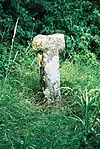 Langton Cross |
| Cromwell Cottage | Leigh | House | Mid–late 16th century | 31 July 1961 | ST6204708608 50°52′33″N 2°32′27″W |
1119163 | Upload Photo |
| Iles Farm House Including Front Boundary Wall | Leigh | Farmhouse | Late 16th – early 17th century | 8 October 1986 | ST6214608598 50°52′32″N 2°32′22″W |
1119164 | Upload Photo |
| Parish Church of St Andrew | Leigh | Anglican parish church | 15th century | 31 July 1961 | ST6178808662 50°52′34″N 2°32′40″W |
1119160 | 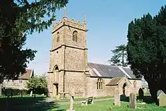 Parish Church of St Andrew |
| St Antony's Convent | Leweston Manor, Leweston | Country house | Late 18th century | 11 July 1951 | ST6364312323 50°54′33″N 2°31′07″W |
1119166 | Upload Photo |
| Barn at Lower Stockbridge Farm 30m East of Lower Stockbridge Farm House | Lillington | Cruck barn | Late 16th – Early 17th century | 8 October 1986 | ST6391411085 50°53′53″N 2°30′52″W |
1323979 | Upload Photo |
| Tythe Barn | Lower Lillington | Barn | c. 1600 | 11 July 1951 | ST6292412727 50°54′46″N 2°31′43″W |
1153984 | 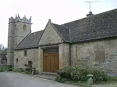 Tythe Barn |
| Bridehead | Bridehead, Littlebredy | Country house | c. 1837 | 26 January 1956 | SY5894188788 50°41′50″N 2°34′58″W |
1324249 | 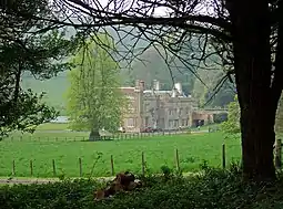 Bridehead |
| Parish Church of St Michael and All Angels | Littlebredy | Anglican parish church | 13th century, rebuilt 1850 | 26 January 1956 | SY5876889028 50°41′58″N 2°35′07″W |
1118668 | 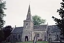 Parish Church of St Michael and All Angels |
| Loders Court | Loders | Manor house | Late 18th century | 5 September 1960 | SY4914494303 50°44′46″N 2°43′20″W |
1288076 |  Loders Court |
| Baglake Farmhouse and Attached Wall to East for 26 Metres | Long Bredy | Farmhouse | 17th century | 26 January 1956 | SY5557090581 50°42′47″N 2°37′50″W |
1304834 | Upload Photo |
| St Luke's Chapel | Ashley Chase, Long Bredy | Chapel | 15th century | 26 January 1956 | SY5579187936 50°41′22″N 2°37′38″W |
1118673 | 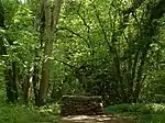 St Luke's Chapel |
| Belmont | Lyme Regis | House | Probably c. 1785 | 27 October 1953 | SY3374892040 50°43′27″N 2°56′24″W |
1230135 | |
| Roman Catholic Church of St Michael and St George. Presbytery. | Lyme Regis | Roman Catholic church | 1835 | 31 January 1974 | SY3376092290 50°43′35″N 2°56′23″W |
1230401 | 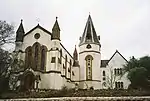 Roman Catholic Church of St Michael and St George. Presbytery. |
| Shelby House | Lyme Regis | House | Early 19th century | 23 April 1952 | SY3416792257 50°43′34″N 2°56′03″W |
1229647 | Upload Photo |
| The Guildhall | Lyme Regis | Guildhall | Rebuilt 1887 | 23 April 1952 | SY3429792110 50°43′30″N 2°55′56″W |
1228691 |
.jpg.webp)
Locations M–O
| Name | Location | Type | Completed [note 1] | Date designated | Grid ref.[note 2] Geo-coordinates |
Entry number [note 3] | Image |
|---|---|---|---|---|---|---|---|
| Village Cross | Maiden Newton | Market cross | 15th century | 26 January 1956 | SY5971797709 50°46′39″N 2°34′22″W |
1216391 | 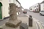 Village Cross |
| West Cruxton Farmhouse | Cruxton, Maiden Newton | Farmhouse | Late 16th century | 26 January 1956 | SY6025896548 50°46′02″N 2°33′54″W |
1287680 | Upload Photo |
| 2 Sets of Gate Piers with Attached Walls and Mounting Block | Mapperton | Gate pier | c. 18th century | 31 July 1984 | SY5032299676 50°47′40″N 2°42′22″W |
1288093 | Upload Photo |
| Dovecote 10 Metres South of Mapperton House | Mapperton | Dovecote | 1665 | 4 December 1951 | SY5035299640 50°47′39″N 2°42′21″W |
1288090 | Upload Photo |
| Enclosure Wall and Gate Piers South and West of Mapperton Church | Mapperton | Gate pier | 19th century | 31 July 1984 | SY5033099646 50°47′39″N 2°42′22″W |
1215504 | 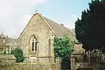 Enclosure Wall and Gate Piers South and West of Mapperton Church |
| Garden Wall, Continuation North of Front Courtyard Wall, Returns West to Orangery | Mapperton House, Mapperton | Garden wall | c. 18th or 19th century | 31 July 1984 | SY5033499714 50°47′41″N 2°42′22″W |
1288055 | Upload Photo |
| Gate Piers with Eagles and Attached Walls 15 Metres West of Mapperton House | Mapperton | Gate piers | 18th century | 31 July 1984 | SY5033099674 50°47′40″N 2°42′22″W |
1215500 | 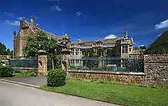 Gate Piers with Eagles and Attached Walls 15 Metres West of Mapperton House |
| Mapperton Rectory | Mapperton | Rectory | 1699–1703 | 4 December 1951 | SY5028999756 50°47′43″N 2°42′24″W |
1288056 | Upload Photo |
| Nash Farmhouse | Marshwood | Farmhouse | c. 1400 | 3 April 1985 | SY3759498928 50°47′12″N 2°53′12″W |
1324121 |  Nash Farmhouse |
| Remains of Marshwood Castle, 50 Metres West of Lodge House Farmhouse | Marshwood | Angle tower | 4 December 1951 | SY4045897698 50°46′33″N 2°50′45″W |
1324105 | Upload Photo | |
| The Manor House and Attached Garden Walls | Melbury Bubb | Manor house | Early 17th century | 11 July 1951 | ST5957706562 50°51′26″N 2°34′32″W |
1154078 | 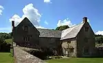 The Manor House and Attached Garden Walls |
| The Old Rectory | Melbury Osmond | Rectory | 17th century | 4 December 1951 | ST5743307808 50°52′06″N 2°36′23″W |
1119284 | Upload Photo |
| The Turret | Melbury House, Melbury Sampford | Garden house | c. 16th century | 2 June 1986 | ST5760405965 50°51′06″N 2°36′13″W |
1154965 | Upload Photo |
| Christ Church | Melplash | Anglican parish church | 1845–46 | 31 July 1984 | SY4844597552 50°46′31″N 2°43′57″W |
1287858 | |
| Dovecote 10 Metres North West of Melplash Court | Melplash | Dovecote | 17th century | 31 July 1984 | SY4832698473 50°47′01″N 2°44′04″W |
1215869 | Upload Photo |
| Melplash Court | Melplash | House | 17th century | 4 December 1951 | SY4834298479 50°47′01″N 2°44′03″W |
1215868 | 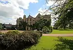 Melplash Court |
| Church of St Andrew | Minterne Magna | Anglican parish church | Early 15th century | 26 January 1956 | ST6595504340 50°50′15″N 2°29′05″W |
1118823 | 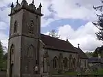 Church of St Andrew |
| Minterne Magna House | Minterne Magna | Country house | 1904–06 | 7 April 1976 | ST6603204184 50°50′10″N 2°29′01″W |
1324164 |  Minterne Magna House |
| Church of St Andrew | Monkton Wyld | Anglican parish church | 1848 | 5 September 1960 | SY3365496340 50°45′46″N 2°56′31″W |
1228490 | |
| 3 Table Tombs 2–5 Metres East of the Chancel. (Horner, Brodrepp, Purchase) | Netherbury | Table tomb | 1690–1829 | 31 July 1984 | SY4705399460 50°47′32″N 2°45′09″W |
1216205 | Upload Photo |
| 5 Table Tombs 5–10 Metres East and South East of South Porch (Clift, Hearn, Crode, Henvill, Defaced) | Netherbury | Table tomb | 1702–1772 | 31 July 1984 | SY4703799444 50°47′32″N 2°45′10″W |
1216096 | Upload Photo |
| Hatchlands | Netherbury | Farmhouse | 17th century | 4 December 1951 | SY4732398970 50°47′16″N 2°44′55″W |
1215922 | Upload Photo |
| Lambrook Farmhouse | Lambrook, Netherbury | Farmhouse | 16th century | 4 December 1951 | SY4745896306 50°45′50″N 2°44′47″W |
1215847 | Upload Photo |
| Limbury Farmhouse | Netherbury | Farmhouse | c. 1700 | 4 December 1951 | SY4549495784 50°45′33″N 2°46′27″W |
1215764 | Upload Photo |
| Slape Manor | Slape Hill, Netherbury | Manor house | 17th century | 4 December 1951 | SY4718798425 50°46′59″N 2°45′02″W |
1216045 |  Slape Manor |
| Wooth Manor | Wooth, Netherbury | Manor house | Early 17th century | 4 December 1951 | SY4723495423 50°45′22″N 2°44′58″W |
1216283 | Upload Photo |
| Remains of Old Church of St Mary Magdalene | North Wootton | Tower | Early 15th century | 31 July 1961 | ST6555214796 50°55′54″N 2°29′30″W |
1303981 |  Remains of Old Church of St Mary Magdalene |
| Barn 50 Metres West of Ivy House Farmhouse | Oborne | Barn | Early 16th century | 31 July 1961 | ST6532817897 50°57′34″N 2°29′42″W |
1119360 | Upload Photo |
| Old Parish Church of St Cuthbert, Oborne | Oborne | Anglican parish church | Early 16th century | 31 July 1961 | ST6534817833 50°57′32″N 2°29′41″W |
1304077 | |
| Charity Farmhouse and Attached Forge | Osmington | Farmhouse | 17th century | 1 November 1985 | SY7239683274 50°38′55″N 2°23′30″W |
1119223 | Upload Photo |
| Parish Church of St Osmund | Osmington | Anglican parish church | 15th century tower | 26 January 1956 | SY7241982980 50°38′45″N 2°23′29″W |
1323965 |  Parish Church of St Osmund |
| Parish Church of St Michael | Owermoigne | Anglican parish church | Early 15th century tower | 26 January 1956 | SY7688685322 50°40′02″N 2°19′42″W |
1119232 |  Parish Church of St Michael |
Locations P–S
| Name | Location | Type | Completed [note 1] | Date designated | Grid ref.[note 2] Geo-coordinates |
Entry number [note 3] | Image |
|---|---|---|---|---|---|---|---|
| The Manor House | Piddletrenthide | Country house | Late 18th century | 26 January 1956 | SY7035299991 50°47′55″N 2°25′19″W |
1304315 |  The Manor House |
| Pilsdon Manor (the Pilsdon Community) | Pilsdon | Manor house | Mid 17th century | 11 November 1966 | SY4150199597 50°47′35″N 2°49′53″W |
1216404 |  Pilsdon Manor (the Pilsdon Community) |
| Purcombe Farmhouse | Pilsdon | House | Early 16th century | 4 December 1951 | SY4110999065 50°47′17″N 2°50′13″W |
1153145 |  Purcombe Farmhouse |
| Attached Walls and 2 Sets of Gate-Piers South-West of Waddon Manor | Waddon, Portesham | Walls | Early 18th century | 26 January 1956 | SY6197285772 50°40′13″N 2°32′22″W |
1118648 | 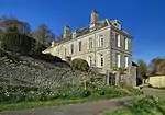 Attached Walls and 2 Sets of Gate-Piers South-West of Waddon Manor |
| Cart Shed and Stables 10 Metres South of Waddon House, Part Premises of Hardye Tweeds | Waddon, Portesham | Cart shed | 1702 | 26 January 1956 | SY6200785759 50°40′13″N 2°32′20″W |
1152606 | _-_geograph.org.uk_-_402349.jpg.webp) Cart Shed and Stables 10 Metres South of Waddon House, Part Premises of Hardye Tweeds |
| Chapel of St Bartholomew | Corton, Portesham | Chapel | 13th century | 26 January 1956 | SY6359285484 50°40′04″N 2°31′00″W |
1118639 | |
| Manor House and Stables | Portesham | Manor house | Mid 17th century | 26 January 1956 | SY6014885849 50°40′15″N 2°33′55″W |
1304769 | Upload Photo |
| Cider House 10 Metres South West of the Manor House | Mappercombe, Powerstock | Cider house | 1736 | 31 July 1984 | SY5117595116 50°45′13″N 2°41′37″W |
1287653 | Upload Photo |
| Cottage 10 Metres North West of the Manor House | Mappercombe, Powerstock | Detached house | 1698 | 31 July 1984 | SY5117495143 50°45′14″N 2°41′37″W |
1216413 | Upload Photo |
| Dovecote 15 Metres East of the Manor House | Mappercombe, Powerstock | Dovecote | 1747 | 31 July 1984 | SY5123095131 50°45′13″N 2°41′34″W |
1216482 | Upload Photo |
| Barn, at North West Corner of Farmyard | Manor Farm, Poxwell | Barn | Late 16th century | 26 January 1956 | SY7413384163 50°39′24″N 2°22′02″W |
1323934 | Upload Photo |
| Gatehouse and Attached Garden Walls Immediately East of Poxwell House | Poxwell | Gatehouse | 1634 | 26 January 1956 | SY7416084005 50°39′19″N 2°22′01″W |
1153834 | Upload Photo |
| The Court House | Poyntington | Farmhouse | Late 14th century | 11 July 1951 | ST6499019978 50°58′41″N 2°30′00″W |
1119325 | Upload Photo |
| The Manor House | Poyntington | Manor house | Late 15th century | 11 July 1951 | ST6509920063 50°58′44″N 2°29′55″W |
1323898 | 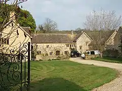 The Manor House |
| Ilsington House | Ilsington, Puddletown | Country house | Late 17th – early 18th century | 26 January 1956 | SY7600394364 50°44′54″N 2°20′29″W |
1324049 | Upload Photo |
| The Old Vicarage Including Garden Walls Adjoining Islington House | Puddletown | Semi-detached house | c. 1600 | 26 January 1956 | SY7594394367 50°44′54″N 2°20′32″W |
1154384 | Upload Photo |
| 8 The Square | Puddletown | Semi-detached house | c. 1722 | 26 January 1956 | SY7593294367 50°44′54″N 2°20′33″W |
1303784 |  8 The Square |
| Looke Farmhouse | Puncknowle | Farmhouse | 1700 | 7 August 1952 | SY5482288812 50°41′50″N 2°38′28″W |
1287947 | 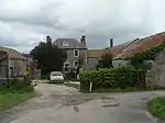 Looke Farmhouse |
| Puncknowle Manor House | Puncknowle | Manor house | c. 1600 | 7 August 1952 | SY5348088628 50°41′44″N 2°39′36″W |
1288106 | 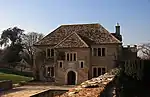 Puncknowle Manor House |
| Village Cross in Churchyard 4 Metres North East of Parish Church Chancel | Puncknowle | Cross | c. late 15th century | 5 September 1960 | SY5351788652 50°41′44″N 2°39′34″W |
1287939 | 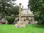 Village Cross in Churchyard 4 Metres North East of Parish Church Chancel |
| Churchyard Cross 3 Metres North of North Aisle of Church of St Michael | Rampisham | Cross | Late 15th century | 19 November 1985 | ST5615902217 50°49′04″N 2°37′25″W |
1119421 | Upload Photo |
| Glebe Cottage and Attached Walls | Ringstead | House | 13th century | 26 January 1956 | SY7473181764 50°38′06″N 2°21′31″W |
1119231 | Upload Photo |
| Parish Church of St Hypolite | Ryme Intrinseca | Anglican parish church | 13th century | 31 July 1961 | ST5817910825 50°53′43″N 2°35′46″W |
1119143 | 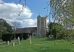 Parish Church of St Hypolite |
| Barn 40 Metres West of Jerrards | Sandford Orcas | Cruck barn | Late 16th century | 11 July 1951 | ST6201220484 50°58′57″N 2°32′33″W |
1119336 | Upload Photo |
| Jerrards, with Attached Service Range and Pigeon-house | Sandford Orcas | House | 16th century | 11 July 1951 | ST6206220489 50°58′57″N 2°32′31″W |
1119335 | Upload Photo |
| Abbeylands | Sherborne | House | 1649 | 28 November 1950 | ST6381716662 50°56′54″N 2°30′59″W |
1324329 |  Abbeylands |
| Church of St Mary Magdalene | Sherborne | Anglican parish church | 1715 | 28 November 1950 | ST6462616814 50°56′59″N 2°30′18″W |
1152050 | 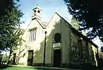 Church of St Mary Magdalene |
| Emerenciana | Coombe, Sherborne | Farmhouse | 17th century | 28 November 1950 | ST6343817037 50°57′06″N 2°31′19″W |
1110756 | Upload Photo |
| Former Church House, Half Moon Street | Sherborne | House | 1530–34 | 28 November 1950 | ST6386516478 50°56′48″N 2°30′57″W |
1110736 | Upload Photo |
| Former Hospice of Saint Julian | Sherborne | Hospice | Late medieval | 28 November 1950 | ST6376016922 50°57′02″N 2°31′02″W |
1324341 | 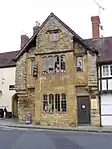 Former Hospice of Saint Julian |
| Gates and Gate Piers at South Entrance to Abbey Close | Sherborne | Gates | 4 October 1973 | ST6379116436 50°56′46″N 2°31′00″W |
1324348 | Upload Photo | |
| Greenhill House | Sherborne | House | 17th century | 28 November 1950 | ST6371116867 50°57′00″N 2°31′05″W |
1110763 | Upload Photo |
| No 101 Newland, Including Outbuilding to South-East | Sherborne | House | 17th century | 4 October 1973 | ST6432016821 50°56′59″N 2°30′33″W |
1110660 | Upload Photo |
| No 9 and No 11 Cheap Street | Sherborne | House | Late 18th or early 19th century | 28 November 1950 | ST6380216850 50°57′00″N 2°31′00″W |
1152083 | Upload Photo |
| Oak Room at Sherborne School | Sherborne | Library | 1670 | 28 November 1950 | ST6384116520 50°56′49″N 2°30′58″W |
1110793 | Upload Photo |
| Old Bank House | Sherborne | House | 16th to early 17th century | 28 November 1950 | ST6398016538 50°56′50″N 2°30′51″W |
1110719 | Upload Photo |
| Riverside. Riverside Lodge. Riverside Works. | Sherborne | House | 18th century, probably post–1755 | 28 November 1950 | ST6355615925 50°56′30″N 2°31′12″W |
1110647 | Upload Photo |
| The Cedars | Sherborne | House | Early 19th century | 4 October 1973 | ST6429716709 50°56′55″N 2°30′35″W |
1110714 | Upload Photo |
| The Parade | Sherborne | Bank | Probably 1818 | 28 November 1950 | ST6386016578 50°56′51″N 2°30′57″W |
1152194 | Upload Photo |
| The Red House. Grey Lodge. Forecourt Walls and Railings to the Red House. | Sherborne | House | Late 17th century | 28 November 1950 | ST6411716631 50°56′53″N 2°30′44″W |
1152478 | Upload Photo |
| Tudor Rose | Sherborne | Timber framed house | Late medieval | 28 November 1950 | ST6394316548 50°56′50″N 2°30′53″W |
1324372 | Upload Photo |
| Parish Church of St Martin | Shipton Gorge | Anglican parish church | Early 15th century tower | 5 September 1960 | SY4980691459 50°43′14″N 2°42′45″W |
1215781 | 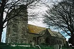 Parish Church of St Martin |
| Pickett Farmhouse | South Perrott | Farmhouse | 17th century | 12 June 1953 | ST4718105479 50°50′47″N 2°45′06″W |
1211820 | Upload Photo |
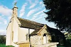
| Chapel of St Gabriel | Stanton St Gabriel | Chapel of ease | 14th century | 5 September 1960 | SY4020892409 50°43′42″N 2°50′55″W |
1215956 | 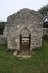 Chapel of St Gabriel |
| Court Orchard | Stoke Abbott | Farmhouse | 1751 | 11 November 1966 | ST4531200647 50°48′10″N 2°46′39″W |
1287140 | Upload Photo |
| Manor Farmhouse | Stoke Abbott | Farmhouse | Mid 18th century | 4 December 1951 | ST4526400800 50°48′15″N 2°46′41″W |
1228420 | Upload Photo |
| Churchyard Cross 10 Metres North of Nave of Church of St Mary | Stratton | Cross | 15th century | 20 May 1985 | SY6510993790 50°44′34″N 2°29′45″W |
1287606 | Upload Photo |
| East House | Sydling St Nicholas | Detached house | Mid – late 18th century | 26 January 1956 | SY6314399425 50°47′36″N 2°31′27″W |
1119396 | Upload Photo |
| Sydling Court | Sydling St Nicholas | Manor house | Late 18th century | 26 January 1956 | SY6301099326 50°47′32″N 2°31′34″W |
1119425 | Upload Photo |
| The Old Vicarage | Sydling St Nicholas | House | 1640 | 26 January 1956 | SY6316399386 50°47′34″N 2°31′26″W |
1119395 | Upload Photo |
| Tithe Barn | Sydling St Nicholas | Tithe barn | 16th century | 26 January 1956 | SY6304899237 50°47′29″N 2°31′32″W |
1119426 | Upload Photo |
| Ilchester Arms | Symondsbury | Public house | 15th century | 7 August 1952 | SY4449393510 50°44′19″N 2°47′17″W |
1216501 | Upload Photo |
| Broomhills Farm | Symondsbury | House | 17th century | 10 January 1984 | SY4611791661 50°43′19″N 2°45′53″W |
1216084 | Upload Photo |
| Oakhayes, Formerly Listed As Rectory | Symondsbury | Rectory | c. 1730 | 7 August 1952 | SY4440593591 50°44′21″N 2°47′21″W |
1216432 | Upload Photo |
Locations T–Y
| Name | Location | Type | Completed [note 1] | Date designated | Grid ref.[note 2] Geo-coordinates |
Entry number [note 3] | Image |
|---|---|---|---|---|---|---|---|
| Forde Grange, the Barn with Attached Farmbuildings to North | Thorncombe | Cruck barn | Early 16th century | 8 April 1983 | ST3661804612 50°50′15″N 2°54′05″W |
1118937 | Upload Photo |
| Sadborow House | Sadborow, Thorncombe | Country house | 1773–75 | 8 April 1983 | ST3733402022 50°48′52″N 2°53′27″W |
1118930 | Upload Photo |
| Parish Church of St Mary Magdalene | Thornford | Anglican parish church | 14th century | 31 July 1961 | ST6030513270 50°55′03″N 2°33′58″W |
1303905 | 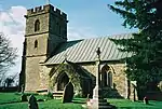 Parish Church of St Mary Magdalene |
| Church of St Basil | Toller Fratrum | Anglican parish church | Mid 19th century | 26 January 1956 | SY5786697397 50°46′29″N 2°35′56″W |
1228873 | 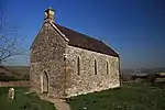 Church of St Basil |
| Little Toller Farmhouse | Toller Fratrum | Manor farmhouse | Mid 16th century | 26 January 1956 | SY5781997410 50°46′29″N 2°35′59″W |
1228875 | Upload Photo |
| Stable block immediately south east of Little Toller Farm | Toller Fratrum | Stable | Mid 16th century | 26 January 1956 | SY5784497381 50°46′28″N 2°35′57″W |
1228876 | Upload Photo |
| Church of St Peter | Toller Porcorum | Anglican parish church | 14th century | 26 January 1956 | SY5621497993 50°46′47″N 2°37′21″W |
1228957 | 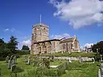 Church of St Peter |
| The Manor House | Toller Whelme | Manor house | 17th century | 12 June 1953 | ST5171901489 50°48′39″N 2°41′12″W |
1290014 | _-_geograph.org.uk_-_698153.jpg.webp) The Manor House |
| Former Methodist Chapel to East of Martyrs' Cottages | Tolpuddle | Methodist chapel | 1818 | 4 July 1989 | SY7951794410 50°44′56″N 2°17′30″W |
1119849 | Upload Photo |
| James Hammett Monument, East of the North West Corner of the Church Yard of the Church of Saint John | Tolpuddle | Headstone | 1934 | 10 March 1987 | SY7903494514 50°44′59″N 2°17′55″W |
1323627 | 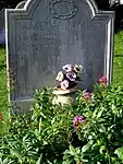 James Hammett Monument, East of the North West Corner of the Church Yard of the Church of Saint John |
| Tolpuddle Manor House | Tolpuddle | Manor house | 1696 | 26 January 1956 | SY7908894446 50°44′57″N 2°17′52″W |
1323641 | 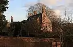 Tolpuddle Manor House |
| Flamberts | Trent | House | 16th century | 11 July 1951 | ST5967618606 50°57′56″N 2°34′32″W |
1154391 | Upload Photo |
| The Rectory and Glebe House | Trent | Houses | 17th century | 11 July 1951 | ST5906818566 50°57′54″N 2°35′03″W |
1323928 | 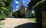 The Rectory and Glebe House |
| Hummer Farmhouse | Hummer, Trent | Farmhouse | Late 15th century | 11 July 1951 | ST5889319758 50°58′33″N 2°35′13″W |
1119317 |  Hummer Farmhouse |
| Rigg Lane Farmhouse | Trent | Farmhouse | Second half of 15th century or early 16th century | 11 July 1951 | ST5968918731 50°58′00″N 2°34′32″W |
1303847 | Upload Photo |
| Church of Unknown Dedication | Up Cerne | Anglican parish church | Possibly 15th century | 26 January 1956 | ST6583002742 50°49′24″N 2°29′11″W |
1304283 | 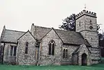 Church of Unknown Dedication |
| Up Cerne Manor House | Up Cerne | Manor house | Early 17th century | 26 January 1956 | ST6581702683 50°49′22″N 2°29′12″W |
1118810 | 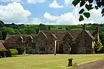 Up Cerne Manor House |
| Upton Manor Farmhouse | Uploders | Farmhouse | 16th century | 7 August 1952 | SY5113193530 50°44′22″N 2°41′38″W |
1214893 | Upload Photo |
| Berry Farmhouse | Walditch | Cruck house | 16th century | 19 December 1984 | SY4828392815 50°43′57″N 2°44′03″W |
1213863 | Upload Photo |
| Church of the Holy Trinity | Warmwell | Anglican parish church | 13th century | 26 January 1956 | SY7527685798 50°40′17″N 2°21′04″W |
1119203 | 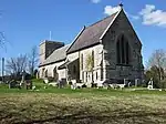 Church of the Holy Trinity |
| Barn 80 Metres South West of Lower Lewell Farmhouse | Lower Lewell, West Knighton | Barn | 1704 | 26 January 1956 | SY7418589663 50°42′22″N 2°22′01″W |
1323959 | Upload Photo |
| Tower, Remains of West Milton Chapel | West Milton | Tower | c. 1500 | 11 November 1966 | SY5030596371 50°45′53″N 2°42′22″W |
1227969 | 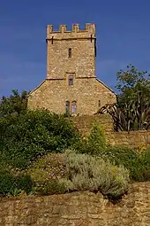 Tower, Remains of West Milton Chapel |
| Higher Abbott's Wootton Farmhouse | Whitchurch Canonicorum | Farmhouse | Mid 15th century | 7 August 1952 | SY3794696463 50°45′52″N 2°52′52″W |
1216622 | Upload Photo |
| Herringston House | Winterborne Herringston | Courtyard house | 14th century | 26 January 1956 | SY6890988092 50°41′30″N 2°26′29″W |
1119179 | |
| Parish Church of St Simon and St Jude | Winterborne Monkton | Anglican parish church | 13th century | 26 January 1956 | SY6757187741 50°41′18″N 2°27′38″W |
1119180 | 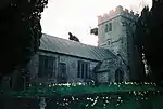 Parish Church of St Simon and St Jude |
| Manor Farmhouse | Winterbourne Steepleton | Manor farmhouse | Early 17th century | 26 January 1956 | SY6271189838 50°42′25″N 2°31′46″W |
1229228 | 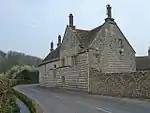 Manor Farmhouse |
| Sherring Monument 3 Metres South of Chancel of Church of St Michael | Winterbourne Steepleton | Table tomb | Early 18th century | 20 May 1985 | SY6292089799 50°42′24″N 2°31′35″W |
1279268 | Upload Photo |
| Wootton Fitzpaine Parish Church | Wootton Fitzpaine | Anglican parish church | 15th century | 5 September 1960 | SY3714495641 50°45′25″N 2°53′33″W |
1228551 |  Wootton Fitzpaine Parish Church |
| Bennett Monument One Metre East of Chancel of Church of St Mary | Lower Wraxall | Table tomb | Early 18th century | 19 November 1985 | ST5758200824 50°48′19″N 2°36′12″W |
1119405 | 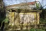 Bennett Monument One Metre East of Chancel of Church of St Mary |
| Wraxall Manor with Attached Front Walls, Piers, Gates | Wraxall | Manor house | Early 17th century | 4 December 1957 | ST5664001139 50°48′29″N 2°37′00″W |
1302719 | |
| Manor Farmhouse | Wynford Eagle | Manor house | 1630 | 26 January 1956 | SY5838396017 50°45′44″N 2°35′29″W |
1229230 | 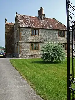 Manor Farmhouse |
| Hamlet House, Including Attached Maltings and Outbuildings | Hamlet, Yetminster | House | 17th century | 11 July 1951 | ST6000508686 50°52′35″N 2°34′11″W |
1119153 | Upload Photo |
| Manor House, Including Front Boundary Wall | Yetminster | House | Early 17th century | 11 July 1951 | ST5941910856 50°53′45″N 2°34′42″W |
1154493 | 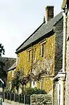 Manor House, Including Front Boundary Wall |
| Upbury Farm House | Yetminster | Farmhouse | 15th century | 11 July 1951 | ST5939710611 50°53′37″N 2°34′43″W |
1119148 | 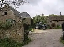 Upbury Farm House |
See also
Notes
- The date given is the date used by Historic England as significant for the initial building or that of an important part in the structure's description.
- Sometimes known as OSGB36, the grid reference is based on the British national grid reference system used by the Ordnance Survey.
- The "List Entry Number" is a unique number assigned to each listed building and scheduled monument by Historic England.
External links
This article is issued from Wikipedia. The text is licensed under Creative Commons - Attribution - Sharealike. Additional terms may apply for the media files.