Grade I listed buildings in West Oxfordshire
There are over 9,000 Grade I listed buildings in England. This page is a list of these buildings in the district of West Oxfordshire in Oxfordshire.
List of buildings
| Name | Location | Type | Completed [note 1] | Date designated | Grid ref.[note 2] Geo-coordinates |
Entry number [note 3] | Image |
|---|---|---|---|---|---|---|---|
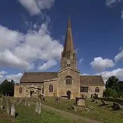
| Church of St Mary | Bampton | Church | 10th/11th century | 12 September 1955 | SP3126203325 51°43′40″N 1°32′56″W |
1053559 | |
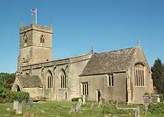
| Church of St Mary the Virgin | Black Bourton | Church | Early 12th century | 12 September 1955 | SP2865704231 51°44′10″N 1°35′11″W |
1367683 | 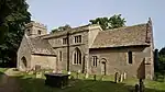 Church of St Mary the Virgin |
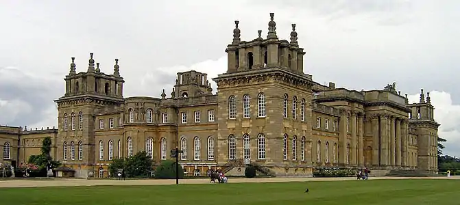
| Blenheim Palace | Blenheim, Woodstock | Country house | 1706–29 | 27 August 1957 | SP4412416054 51°50′29″N 1°21′39″W |
1052912 | |
| Hensington Gate | Blenheim, Woodstock | Gateway | 1706–10 | 27 August 1957 | SP4476316567 51°50′45″N 1°21′06″W |
1368005 | 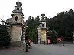 Hensington Gate |
| New Bridge | Blenheim | Bridge | 1773 | 27 August 1957 | SP4440015244 51°50′03″N 1°21′25″W |
1368023 | 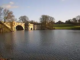 New Bridge |
| Water Terrace Gardens, Bernini Fountain on West Terrace | Blenheim Palace | Statue | Late 17th century | 27 August 1957 | SP4398216000 51°50′27″N 1°21′47″W |
1052889 | 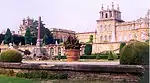 Water Terrace Gardens, Bernini Fountain on West Terrace |
| Woodstock Gate | Blenheim | Arch | 1723 | 27 August 1957 | SP4426416716 51°50′50″N 1°21′32″W |
1203507 | 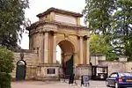 Woodstock Gate |
| Church of St Peter and St Paul | Broadwell | Church | 12th century | 12 September 1955 | SP2521904162 51°44′08″N 1°38′10″W |
1199110 | 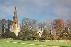 Church of St Peter and St Paul |
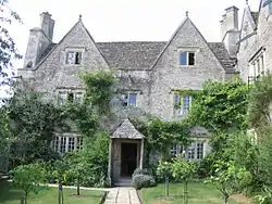
| Burford Priory and Chapel | Burford | House | Late 16th century | 12 September 1955 | SP2497612354 51°48′33″N 1°38′21″W |
1224759 | 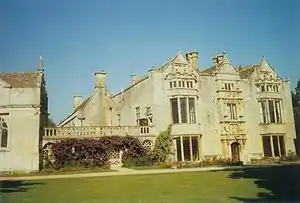 Burford Priory and Chapel |
| Church of St John the Baptist | Burford | Church | Late 15th century | 12 September 1955 | SP2531312402 51°48′35″N 1°38′03″W |
1053287 | |
| Church of St Peter | Cassington | Church | Pre-1123 | 12 September 1955 | SP4547410604 51°47′32″N 1°20′31″W |
1367949 | 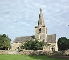 Church of St Peter |
| Church of St Mary | Charlbury | Church | 12th–16th century | 27 August 1956 | SP3556019427 51°52′20″N 1°29′06″W |
1053232 | 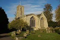 Church of St Mary |
| Chastleton House | Chastleton | Country house | 1603–18 | 15 December 1954 | SP2482729093 51°57′35″N 1°38′24″W |
1197988 | |
| Church of St Mary | Chipping Norton | Church | c.1485 (nave) | 23 April 1952 | SP3117127350 51°56′38″N 1°32′53″W |
1052637 | 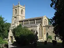 Church of St Mary |
| Church of St Laurence | Combe | Church | Early 12th century | 27 August 1957 | SP4138715879 51°50′24″N 1°24′02″W |
1283757 | |
| Cornbury House | Cornbury and Wychwood | House | Late 16th century | 27 August 1957 | SP3503118126 51°51′38″N 1°29′34″W |
1053113 | |
| Church of St Bartholomew | Ducklington | Church | Late 12th century | 12 September 1955 | SP3590807592 51°45′57″N 1°28′52″W |
1183324 | 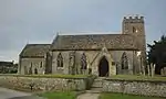 Church of St Bartholomew |
| Old Radcot Bridge (that part in Grafton and Radcot parish) | Grafton and Radcot | Bridge | 13th and 14th century | 30 March 1989 | SU2856099410 51°41′34″N 1°35′18″W |
1053405 |  Old Radcot Bridge (that part in Grafton and Radcot parish) |
| Radcot Bridge (that part in town of Great Faringdon) | Great Faringdon | Bridge | Early 14th century | 21 November 1966 | SU2856199405 51°41′34″N 1°35′18″W |
1048414 | Radcot Bridge (that part in town of Great Faringdon) |
| Church of St Michael and All Angels | Great Tew | Church | Late 12th century | 27 August 1956 | SP3992628874 51°57′25″N 1°25′13″W |
1193136 | 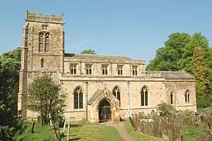 Church of St Michael and All Angels |
| Church of St Peter and St Paul | Church Hanborough, Hanborough | Church | Early 12th century | 12 September 1955 | SP4258212837 51°48′45″N 1°23′01″W |
1052991 | 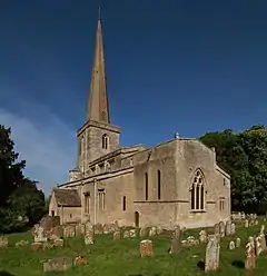 Church of St Peter and St Paul |
| Church of St Nicholas | Idbury | Church | 12th century | 27 August 1957 | SP2361220041 51°52′42″N 1°39′30″W |
1367780 | 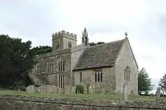 Church of St Nicholas |
| Kelmscott Manor | Kelmscott | Manor house | c.1570 | 12 September 1955 | SU2509698888 51°41′17″N 1°38′18″W |
1199373 | |
| Church of St Matthew | Langford | Church | Mid–late 11th century | 12 September 1955 | SP2491102530 51°43′15″N 1°38′27″W |
1053385 | |
| Church of Saint Kenelm | Minster Lovell | Church | Mid-15th century | 12 September 1955 | SP3240211371 51°48′00″N 1°31′53″W |
1053434 | 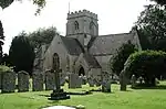 Church of Saint Kenelm |
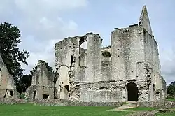
| Minster Lovell Manor Ruins | Minster Lovell | Courtyard house | c.1431–42 | 12 September 1955 | SP3244211344 51°47′59″N 1°31′51″W |
1053431 | |
| Church of St Mary | North Leigh | Church | Early 11th century | 12 September 1955 | SP3873313657 51°49′13″N 1°26′22″W |
1283536 | |
| Church of St Denys | Northmoor | Church | Early 13th century | 12 September 1955 | SP4211002874 51°43′23″N 1°23′30″W |
1048936 | 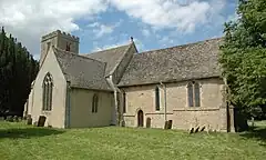 Church of St Denys |
| New Bridge and flanking walls (that part in Northmoor civil parish) | Northmoor | Bridge | 14th century | 12 September 1955 | SP4036501404 51°42′36″N 1°25′02″W |
1368262 | 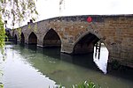 New Bridge and flanking walls (that part in Northmoor civil parish) |
| Church of St Andrew | Great Rollright, Rollright | Church | Late 12th century | 27 August 1957 | SP3268931496 51°58′51″N 1°31′32″W |
1052792 | _-_geograph.org.uk_-_407564.jpg.webp) Church of St Andrew |
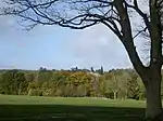
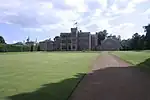
| Rousham House | Rousham | Country house | c.1635 | 27 August 1957 | SP4783424221 51°54′52″N 1°18′22″W |
1052944 | |
| Church of St Mary | Shipton-under-Wychwood | Church | Early 13th century | 27 August 1956 | SP2796617980 51°51′35″N 1°35′43″W |
1182700 |  Church of St Mary |
| Church of St James | South Leigh | Church | Late 12th century | 12 September 1955 | SP3940109016 51°46′42″N 1°25′49″W |
1199106 | 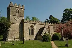 Church of St James |
| Ditchley House including flanking pavilions | Ditchley Park, Spelsbury | Country house | 1722 | 27 August 1957 | SP3902021190 51°53′16″N 1°26′04″W |
1251422 | 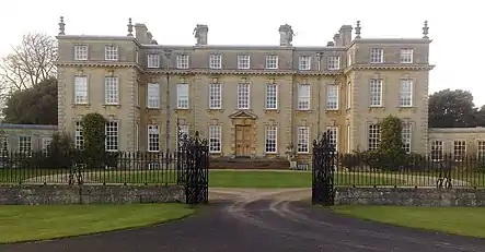 Ditchley House including flanking pavilions |
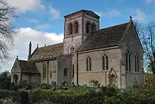
| Church of St Michael | Stanton Harcourt | Church | Mid-12th century | 12 September 1955 | SP4167405653 51°44′53″N 1°23′52″W |
1053164 | 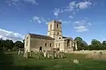 Church of St Michael |
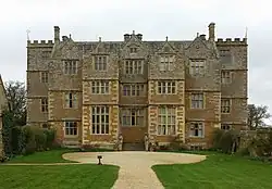
| Manor Farmhouse approximately 70 metres south of Harcourt House | Stanton Harcourt | House | 15th century | 12 September 1955 | SP4161105588 51°44′51″N 1°23′55″W |
1283234 | .jpg.webp) Manor Farmhouse approximately 70 metres south of Harcourt House |
| Pope's Tower, approximately 35 metres south east of Harcourt House | Stanton Harcourt | Clerical dwelling | c.1470–71 | 12 September 1955 | SP4163105637 51°44′52″N 1°23′54″W |
1053134 | 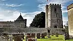 Pope's Tower, approximately 35 metres south east of Harcourt House |
| The Great Kitchen, approximately 40 metres south of Harcourt House | Stanton Harcourt | Kitchen | c.1485 | 12 September 1955 | SP4160405607 51°44′51″N 1°23′56″W |
1053135 | The Great Kitchen, approximately 40 metres south of Harcourt House |
| Church of St Mary | Westwell | Church | 12th century | 12 September 1955 | SP2230910054 51°47′19″N 1°40′41″W |
1357134 | 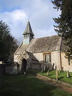 Church of St Mary |
| Church of St Mary | Cogges, Witney | Church | Late 12th century | 3 March 1988 | SP3610309629 51°47′03″N 1°28′41″W |
1053065 | 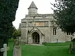 Church of St Mary |
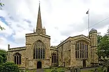
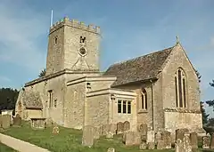
| Church of St Mary the Virgin | Witney | Church | Mid-13th century | 14 May 1952 | SP3562109248 51°46′51″N 1°29′06″W |
1053046 | 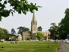 Church of St Mary the Virgin |
See also
Notes
- The date given is the date used by Historic England as significant for the initial building or that of an important part in the structure's description.
- Sometimes known as OSGB36, the grid reference is based on the British national grid reference system used by the Ordnance Survey.
- The "List Entry Number" is a unique number assigned to each listed building and scheduled monument by Historic England.
External links
This article is issued from Wikipedia. The text is licensed under Creative Commons - Attribution - Sharealike. Additional terms may apply for the media files.