Grandidier Channel
Grandidier Channel (65°35′S 64°45′W) is a navigable channel between the west coast of Graham Land, Antarctica, and the north end of the Biscoe Islands, extending from Penola Strait southwestward to the vicinity of Larrouy Island. It was first charted by the French Antarctic Expedition, 1903–05, and named by Jean-Baptiste Charcot for Alfred Grandidier, President of the Paris Geographical Society. Charcot applied the name to the entire body of water between the mainland and the Biscoe Islands but the name has since been restricted to the navigable portion described.[1]
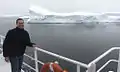 Cruising Grandidier Channel in January 2014
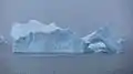 Iceberg in Grandidier Channel
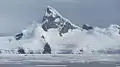 Grandidier Channel
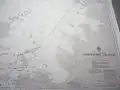 Nautical chart of Grandidier Channel
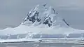 Grandidier Channel
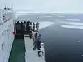 Akademik Ioffe cruises Grandidier Channel in January 2014
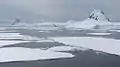 Grandidier Channel in January 2014
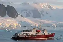 MV Polar Star in Grandidier Channel, 2006
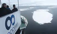
Akademik Ioffe cruises Grandidier Channel in January 2014
References
![]() This article incorporates public domain material from "Grandidier Channel". Geographic Names Information System. United States Geological Survey.
This article incorporates public domain material from "Grandidier Channel". Geographic Names Information System. United States Geological Survey.
This article is issued from Wikipedia. The text is licensed under Creative Commons - Attribution - Sharealike. Additional terms may apply for the media files.