Gu'an County
Gu'an County (Chinese: 固安县; pinyin: Gù'ān Xiàn) is a county of Hebei province, China, bordering Beijing to the north. It is under the jurisdiction of Langfang City, with direct access to central Beijing via both G45 Daqing–Guangzhou Expressway and China National Highway 106.
Gu'an County
固安县 Kuan | |
|---|---|
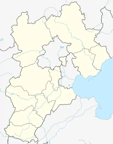 Gu'an Location of the seat in Hebei | |
| Coordinates: 39°27′N 116°18′E | |
| Country | China |
| Province | Hebei |
| Prefecture-level city | Langfang |
| Seat | Gu'an Town |
| Area | |
| • Total | 697 km2 (269 sq mi) |
| Elevation | 26 m (86 ft) |
| Population (2009) | |
| • Total | 400,000 |
| • Density | 570/km2 (1,500/sq mi) |
| Time zone | UTC+8 (China Standard) |
| Postal code | 065500 |
| Area code | 0316 |
| Website | http://www.lfguan.gov.cn/ |
Administrative divisions
The county administers five towns and four townships.[1]
Towns:
- Gu'an Town (固安镇), Gongcun (宫村镇), Liuquan (柳泉镇), Niutuo (牛驼镇), Mazhuang (马庄镇)
Townships:
- Dongwan Township (东湾乡), Pengcun Township (彭村乡), Qugou Township (渠沟乡), Lirangdian Township (礼让店乡)
Climate
| Climate data for Gu'an (1991–2020 normals, extremes 1981–2010) | |||||||||||||
|---|---|---|---|---|---|---|---|---|---|---|---|---|---|
| Month | Jan | Feb | Mar | Apr | May | Jun | Jul | Aug | Sep | Oct | Nov | Dec | Year |
| Record high °C (°F) | 14.7 (58.5) |
19.7 (67.5) |
30.2 (86.4) |
33.2 (91.8) |
38.3 (100.9) |
39.4 (102.9) |
40.3 (104.5) |
36.4 (97.5) |
34.2 (93.6) |
30.7 (87.3) |
22.3 (72.1) |
14.8 (58.6) |
40.3 (104.5) |
| Average high °C (°F) | 2.2 (36.0) |
6.2 (43.2) |
13.5 (56.3) |
21.2 (70.2) |
27.2 (81.0) |
31.0 (87.8) |
31.8 (89.2) |
30.4 (86.7) |
26.5 (79.7) |
19.5 (67.1) |
10.3 (50.5) |
3.6 (38.5) |
18.6 (65.5) |
| Daily mean °C (°F) | −4.1 (24.6) |
−0.1 (31.8) |
7.0 (44.6) |
14.6 (58.3) |
20.6 (69.1) |
24.8 (76.6) |
26.7 (80.1) |
25.2 (77.4) |
20.1 (68.2) |
12.7 (54.9) |
4.2 (39.6) |
−2.3 (27.9) |
12.4 (54.4) |
| Average low °C (°F) | −9.1 (15.6) |
−5.4 (22.3) |
1.2 (34.2) |
8.2 (46.8) |
14.1 (57.4) |
19.2 (66.6) |
22.3 (72.1) |
21.0 (69.8) |
15.0 (59.0) |
7.3 (45.1) |
−0.6 (30.9) |
−6.9 (19.6) |
7.2 (45.0) |
| Record low °C (°F) | −23.2 (−9.8) |
−19.1 (−2.4) |
−10.5 (13.1) |
−4.5 (23.9) |
3.9 (39.0) |
9.9 (49.8) |
15.0 (59.0) |
11.6 (52.9) |
2.3 (36.1) |
−6.1 (21.0) |
−12.4 (9.7) |
−20.3 (−4.5) |
−23.2 (−9.8) |
| Average precipitation mm (inches) | 1.8 (0.07) |
5.2 (0.20) |
6.9 (0.27) |
24.2 (0.95) |
33.7 (1.33) |
67.2 (2.65) |
177.6 (6.99) |
114.9 (4.52) |
55.5 (2.19) |
29.9 (1.18) |
12.7 (0.50) |
1.8 (0.07) |
531.4 (20.92) |
| Average precipitation days (≥ 0.1 mm) | 1.2 | 1.9 | 2.7 | 4.9 | 6.3 | 8.8 | 11.8 | 10.5 | 7.1 | 5.0 | 2.8 | 1.1 | 64.1 |
| Average snowy days | 2.2 | 2.1 | 0.9 | 0.1 | 0 | 0 | 0 | 0 | 0 | 0 | 1.6 | 2.3 | 9.2 |
| Average relative humidity (%) | 54 | 50 | 46 | 50 | 55 | 64 | 76 | 80 | 74 | 68 | 63 | 58 | 62 |
| Mean monthly sunshine hours | 158.2 | 162.1 | 212.6 | 231.8 | 259.0 | 212.5 | 180.3 | 197.4 | 196.3 | 181.9 | 150.3 | 149.6 | 2,292 |
| Percent possible sunshine | 52 | 53 | 57 | 58 | 58 | 48 | 40 | 47 | 53 | 53 | 51 | 51 | 52 |
| Source: China Meteorological Administration[2][3] | |||||||||||||
References
- 2011年统计用区划代码和城乡划分代码:固安县 (in Chinese). National Bureau of Statistics of the People's Republic of China. Retrieved 2012-07-20.
- 中国气象数据网 – WeatherBk Data (in Simplified Chinese). China Meteorological Administration. Retrieved 26 August 2023.
- 中国气象数据网 (in Simplified Chinese). China Meteorological Administration. Retrieved 26 August 2023.
External links
This article is issued from Wikipedia. The text is licensed under Creative Commons - Attribution - Sharealike. Additional terms may apply for the media files.