Gundabooka, Yanda
Gundabooka Parish is a civil parish,[1] of Yanda County, a cadasteral division of New South Wales;[2] a Cadastral division of New South Wales.[3][4][5][6]
| Gundabooka Parish New South Wales | |
|---|---|
 Gundabooka Parish | |
| Coordinates | 30°32′0″S 145°47′0″E |
| Postcode(s) | 2840 |
| Elevation | 100 m (328 ft) |
| LGA(s) | Bourke Shire |
| State electorate(s) | Barwon |
| Federal division(s) | Parkes |
Location
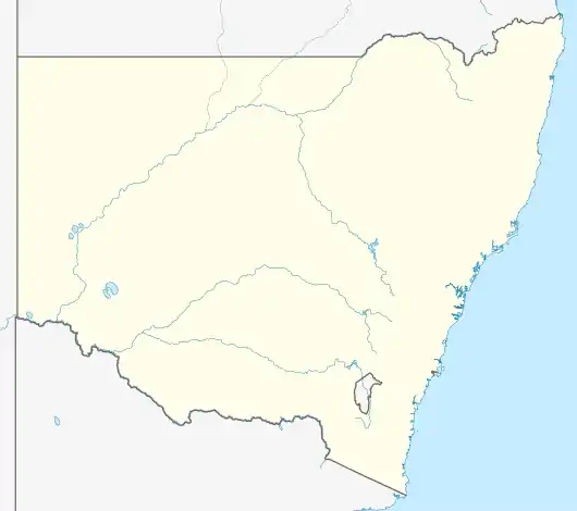
The Parish is on the Darling River upstream of Louth, New South Wales[7][8] and down stream of Bourke, New South Wales and is located at 30°48′57″S 145°48′36″E.
- Images from the park
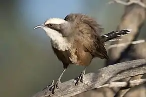 Grey-crowned babbler in the park
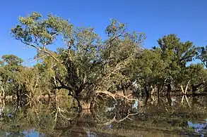 Floodwaters near Yanda campground
Geography
The topography is flat with a Köppen climate classification of BsK (Hot semi arid).[9] The climate is characterised by hot summers and mild winters. The annual average rainfall is 350 mm, although this is highly variable.[10]
Much of the Parish is in the Gundabooka National Park and adjoining conservation area.[11][12]
Etymology
Gunderbooka is believed to be derived from a local Aboriginal word and is also the name of Gundabook Station.[13]
History
The traditional owners of the area are the Ngamba and Barkindji peoples.[14][15]
The first European to the area was Thomas Mitchell.
See also
References
- Map of the County of Yanda, Western Division, NSW 1918.
- [cartographer] C.A. Orwin, [https://nla.gov.au/nla.obj-233873384/view Map of the County of Rankin : Western Division, Land Districts of Bourke, Cobar and Wilcannia, N.S.W. 1912 (New South Wales. Department of Lands Title, Sydney N.S.W. 1914).
- "Rankin". Geographical Names Register (GNR) of NSW. Geographical Names Board of New South Wales. Retrieved 4 August 2013.
- The New atlas of Australia (John Sands, 1886) map 24.
- Yanda County Archived 6 May 2018 at the Wayback Machine, GEOGRAPHICAL NAMES REGISTER EXTRACT.
- / The New atlas of Australia, (John Sands, 1886), map 24.
- [cartographer] C.A. Orwin, [https://nla.gov.au/nla.obj-233873384/view Map of the County of Rankin : Western Division, Land Districts of Bourke, Cobar and Wilcannia, N.S.W. 1912 (New South Wales. Department of Lands Title, Sydney N.S.W. 1914).
- The New atlas of Australia (John Sands, 1886) map 24.
- Peel, M. C.; Finlayson, B. L.; McMahon, T. A. (2007). "Updated world map of the Köppen–Geiger climate classification". Hydrol. Earth Syst. Sci. 11: 1633–1644. doi:10.5194/hess-11-1633-2007. ISSN 1027-5606. (direct: Final Revised Paper)
- Gundabooka National Park Plan of Management page 2.
- Gundabooka National Park at NSW National Parks.
- Gundabooka-national-park at visit NSW.
- "Gunderbooka". Geographical Names Register (GNR) of NSW. Geographical Names Board of New South Wales. Retrieved 6 January 2012.
- Norman Tindale's Catalogue of Australian Aboriginal Tribes
- Aboriginal Australia Map, David Horton (ed.), 1994 published in The Encyclopedia of Aboriginal Australia by AIATSIS.