Haflong
Haflong is a town and headquarters of Dima Hasao district (formerly North Cachar Hills district) in the state of Assam in India. It is the only hill station in Assam.[3]
Haflong
The White Ant Hills Town | |
|---|---|
Town | |
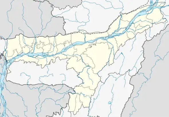 Haflong  Haflong 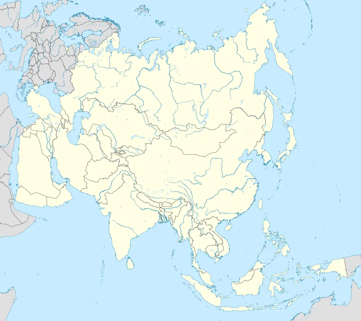 Haflong | |
| Coordinates: 25.169°N 93.016°E | |
| Country | |
| State | Assam |
| District | Dima Hasao |
| Government | |
| • Body | Haflong Municipal Board |
| Area | |
| • Total | 12.79 km2 (4.94 sq mi) |
| Elevation | 966.216 m (3,170.000 ft) |
| Population (2011)[1] | |
| • Total | 43,756 |
| • Density | 3,400/km2 (8,900/sq mi) |
| Languages | |
| • Lingua franca | Haflong Hindi[2] |
| • Medium of instruction | Assamese, Bengali, English[2] |
| • Most common | Bengali, Dimasa[2] |
| Time zone | UTC+5:30 (IST) |
| PIN | 788819 & 788820 |
| Telephone code | 03673 |
| ISO 3166 code | IN-AS |
| Vehicle registration | AS 08-X XXXX |
Climate
Haflong has a subtropical highland climate (Köppen climate classification Cwb), falling just short of a tropical savanna climate (Köppen climate classification Aw). In May 2022, Haflong witnessed torrential rain fall and recorded the highest up to 451 mm on May 14, 2022 as compared to the maximum 190 mm to 200 mm reported annually.[5]
| Climate data for Haflong | |||||||||||||
|---|---|---|---|---|---|---|---|---|---|---|---|---|---|
| Month | Jan | Feb | Mar | Apr | May | Jun | Jul | Aug | Sep | Oct | Nov | Dec | Year |
| Record high °C (°F) | 28.8 (83.8) |
25.2 (77.4) |
28.4 (83.1) |
29.0 (84.2) |
20.0 (68.0) |
28.3 (82.9) |
26.5 (79.7) |
28.2 (82.8) |
25.8 (78.4) |
24.3 (75.7) |
26.0 (78.8) |
18.1 (64.6) |
29.0 (84.2) |
| Average high °C (°F) | 19.6 (67.3) |
20.2 (68.4) |
21.0 (69.8) |
22.2 (72.0) |
22.2 (72.0) |
25.7 (78.3) |
24.9 (76.8) |
23.2 (73.8) |
22.7 (72.9) |
22.3 (72.1) |
21.6 (70.9) |
20.7 (69.3) |
22.2 (72.0) |
| Average low °C (°F) | 8.3 (46.9) |
12.0 (53.6) |
15.9 (60.6) |
20.0 (68.0) |
22.7 (72.9) |
20.9 (69.6) |
20.6 (69.1) |
20.6 (69.1) |
21.7 (71.1) |
21.9 (71.4) |
16.7 (62.1) |
11.8 (53.2) |
17.8 (64.0) |
| Record low °C (°F) | 3.7 (38.7) |
4.1 (39.4) |
6.3 (43.3) |
12.0 (53.6) |
13.2 (55.8) |
15.4 (59.7) |
18.4 (65.1) |
18.1 (64.6) |
15.7 (60.3) |
10.6 (51.1) |
8.3 (46.9) |
5.0 (41.0) |
3.7 (38.7) |
| Average rainfall mm (inches) | 11.9 (0.47) |
18.3 (0.72) |
55.8 (2.20) |
147.9 (5.82) |
244.2 (9.61) |
316.4 (12.46) |
345.4 (13.60) |
264.3 (10.41) |
185.9 (7.32) |
91.2 (3.59) |
18.7 (0.74) |
7.1 (0.28) |
1,707.1 (67.22) |
| Average rainy days | 1.8 | 2.9 | 5.8 | 13.1 | 17.0 | 19.6 | 22.3 | 18.5 | 15.2 | 7.4 | 2.8 | 1.3 | 127.7 |
| Average relative humidity (%) | 69 | 55 | 47 | 48 | 55 | 51 | 53 | 52 | 53 | 52 | 52 | 52 | 53 |
| Mean monthly sunshine hours | 106.3 | 174.7 | 180.1 | 181.0 | 152.2 | 102.0 | 104.0 | 121.2 | 98.0 | 104.6 | 131.0 | 132.5 | 1,587.6 |
| Source 1: World Meteorological Organization.[6] NOAA (extremes & humidity, 1971–1990)[7] | |||||||||||||
| Source 2: Hong Kong Observatory.[8] | |||||||||||||
Demographics
Population
As of 2011 India census, Haflong has a population of 43,756. Males constitute 45% of the population and females 55%. Haflong has an average literacy rate of 92%, higher than the national average of 59.5%: male literacy is 85%, and female literacy is 75%. In Haflong, 12% of the population is under 6 years of age.
Languages
Haflong town having a population of 43,756 as of 2011.[1] Bengali is the most spoken language of the town with a population of 9,710, followed by Dimasa (7,855).[9][2] Haflong Hindi is the lingua franca of the town.[2] Other languages with significant population include Hmar (4,921), Zemi (3,426), Kuki (3,027), Hindi (2,781) and Assamese (1,236).[9]
Politics
Haflong is part of Autonomous District (Lok Sabha constituency). It is the headquarter of N.C. Hills Autonomous Council.
References
- "Haflong City Population Census 2011 - Assam". www.census2011.co.in.
- Col. Ved Prakash (2007). Encyclopaedia of North-East India. Atlantic Publishers & Dist. pp. 574–575. ISBN 9788126907045. Retrieved 27 June 2019.
- Haflong - Assam's Hill Station Archived 26 August 2014 at the Wayback Machine, India-north-east.com
- "The tourist destinations of magi". diprnchills.gov.in. Archived from the original on 26 August 2017. Retrieved 2 October 2017.
- "Assam Floods: Inter-Ministerial Central Team assess damage in Dima Hasao".
- World Weather Information Service-Guwahati, World Meteorological Organization. Retrieved 24 July 2012.
- "Haflong Climate Normals 1971-1990". National Oceanic and Atmospheric Administration. Retrieved 22 December 2012.
- Climatological Information for Haflong, India, Hong Kong Observatory. Retrieved 24 July 2013.
- "C-16 Population By Mother Tongue - Haflong". censusindia.gov.in. Retrieved 16 August 2020.
- "Census of India, 1951. Vol. X: Assam, Manipur and Tripura. Part I-A: Report".
- "Assam (India): Districts, Cities and Towns - Population Statistics, Charts and Map".
External links
- Dima Hasao Website Archived 3 October 2019 at the Wayback Machine