Hanimaadhoo (Haa Dhaalu Atoll)
Hanimaadhoo (Dhivehi: ހަނިމާދޫ) is one of the inhabited islands of Haa Dhaalu Atoll administrative division and geographically part of Thiladhummathi Atoll in the north of the Maldives.
Hanimaadhoo | |
|---|---|
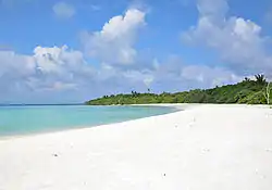 Beach, north Hanimaadhoo | |
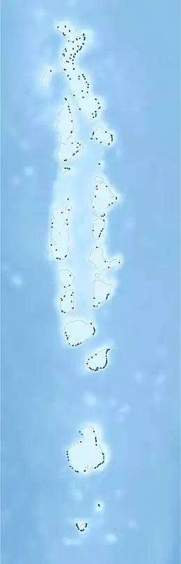 Hanimaadhoo Location in Maldives | |
| Coordinates: 06°45′57″N 73°10′33″E | |
| Country | Maldives |
| Geographic atoll | Thiladhummathi Atoll |
| Administrative atoll | Haa Dhaalu Atoll |
| Distance to Malé | 288.84 km (179.48 mi) |
| Dimensions | |
| • Length | 6.800 km (4.225 mi) |
| • Width | 0.730 km (0.454 mi) |
| Population (2014)[1] | |
| • Total | 1,951 (including foreigners) |
| Time zone | UTC+05:00 (MST) |
Geography
The island is 288.84 km (179 mi; 156 nmi) north of the country's capital, Malé.[2]
Climate
The Hanomaadhoo Meteorological Observatory is located on this island. Many flight scientific research such as those investigating aerosol concentrations in the atmosphere and the Brown Cloud phenomenon have been initiated from Hanimaadhoo.
On 16 April 2016, Hanimaadhoo recorded a temperature of 34.9 °C (94.8 °F), which is the highest temperature to have ever been recorded in the Maldives.[3]
| Climate data for Hanimaadhoo, 1998–2017 | |||||||||||||
|---|---|---|---|---|---|---|---|---|---|---|---|---|---|
| Month | Jan | Feb | Mar | Apr | May | Jun | Jul | Aug | Sep | Oct | Nov | Dec | Year |
| Average high °C (°F) | 30.9 (87.6) |
31.3 (88.3) |
32.1 (89.8) |
32.6 (90.7) |
32.0 (89.6) |
31.1 (88.0) |
30.8 (87.4) |
30.7 (87.3) |
30.7 (87.3) |
30.8 (87.4) |
30.9 (87.6) |
30.7 (87.3) |
31.2 (88.2) |
| Average low °C (°F) | 24.6 (76.3) |
24.5 (76.1) |
25.7 (78.3) |
26.7 (80.1) |
26.4 (79.5) |
25.8 (78.4) |
25.5 (77.9) |
25.4 (77.7) |
25.4 (77.7) |
25.3 (77.5) |
24.8 (76.6) |
24.5 (76.1) |
25.4 (77.7) |
| Average precipitation mm (inches) | 45.3 (1.78) |
34.2 (1.35) |
38.3 (1.51) |
59.2 (2.33) |
252.0 (9.92) |
215.9 (8.50) |
233.5 (9.19) |
220.5 (8.68) |
184.5 (7.26) |
205.8 (8.10) |
146.3 (5.76) |
116.8 (4.60) |
1,752.3 (68.98) |
| Average precipitation days | 3.4 | 3.3 | 3.2 | 5.3 | 14.2 | 16.6 | 15.0 | 15.4 | 14.2 | 12.1 | 10.2 | 7.4 | 120.3 |
| Source: World Meteorological Organization[4] | |||||||||||||
Demography
Islanders from Hathifushi and Hondaidhoo have been relocated to Hanimaadhoo in the recent years.
| Year | Pop. | ±% |
|---|---|---|
| 2006 | 1,184 | — |
| 2014 | 1,618 | +36.7% |
| 2006-2014: Census populations Source: [5] | ||
Economy
The island is planned to be one of the developmental centres of the newly planned Mathi-Uthuru Province.
Transport
The island is the site of Hanimaadhoo Airport, one of the few domestic airports of the Maldives.
Gallery
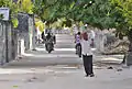 Main street
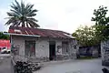 Old house made of coral bricks
 West coast
 West coast
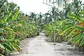 Banana plant alley, north island
References
- "Table PP5: Resident Population by sex, nationality and locality (administrative islands), 2014" (PDF). Population and Households Census 2014. National Bureau of Statistics. p. 33. Retrieved 10 August 2018.
- "Coordinate Distance Calculator". Boulter.com. Retrieved 10 August 2018.
- "Exceptional Heat Wave 2016". Meteo France. Archived from the original on 28 April 2016. Retrieved 29 April 2016.
- "World Weather Information Service". World Meteorological Organization – Hanimaadhoo. Retrieved November 3, 2022.
- "Table 3.3: Total Maldivian Population by Islands" (PDF). National Bureau of Statistics. Retrieved 10 August 2018.