Crane, Oregon
Crane is a census-designated place and unincorporated community in Harney County, Oregon, United States, northeast of Malheur Lake on Oregon Route 78. Its population was 116 at the 2020 census.[4]
Crane, Oregon | |
|---|---|
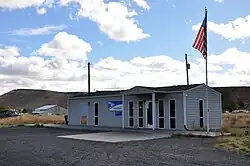 Crane Post Office | |
 Crane  Crane | |
| Coordinates: 43°24′55″N 118°34′42″W | |
| Country | United States |
| State | Oregon |
| County | Harney |
| Area | |
| • Total | 10.42 sq mi (26.98 km2) |
| • Land | 10.42 sq mi (26.98 km2) |
| • Water | 0.00 sq mi (0.00 km2) |
| Elevation | 4,134 ft (1,260 m) |
| Population | |
| • Total | 116 |
| • Density | 11.14/sq mi (4.30/km2) |
| Time zone | UTC-8 (PST) |
| • Summer (DST) | UTC-7 (PDT) |
| ZIP code | 97732 |
| Area code | 541 |
| FIPS code | 41-16450 |
| Coordinates and elevation from United States Geological Survey[3] | |
History
Crane was named for the prominent local features Crane Creek and Crane Creek Gap.[5] Crane Creek Gap is the pass between the Harney Basin and the drainage basin of the South Fork Malheur River.[5] Crane Creek is probably named for the sandhill crane, which was once abundant in eastern Oregon.[5] Crane post office was established in 1895 and discontinued in 1903.[5] When the Union Pacific Railroad[6] was completed from Ontario, Oregon, in 1916, the post office was reopened.[5]
Until the railroad was finished to Burns in 1924, Crane was an important livestock shipping point,[5] and the town was thriving with its five restaurants, four hotels, three garages, two general merchandise stores, a warehouse, a lumber yard, livery stables, a dance hall, a newspaper, a bank and a movie theater.[6] After a series of fires, the latest in 1938, however, the town never returned to its former prosperity.[6] As of 2011, the businesses in Crane included a post office, a gas station, which is combined with a café and tavern, a farm supply store, and a local realtor.[6]
Geography
Crane is in eastern Harney County along Oregon Route 78 (Steens Highway), which leads northwest 29 miles (47 km) to Burns, the county seat, and southeast 64 miles (103 km) to U.S. Route 95 at Burns Junction.
According to the U.S. Census Bureau, the Crane CDP has an area of 10.4 square miles (27.0 km2), all of it land. It is 6 miles (10 km) northeast of Malheur Lake and 26 miles (42 km) by road northeast of the main entrance to Malheur National Wildlife Refuge.
Demographics
As of the 2020 census, there were 116 people, 65 housing units, and 52 families. There were 110 White people, 1 person from some other race, and 5 people from two or more races. 4 people were Hispanic or Latino.[7]
The ancestry was 35.1% Irish, 27.7% German, 24.5% English, 21.3% Scottish, and 2.1% French.[7]
The median age was 56.5 years old. 22.3% of the population were older than 65, with 14.9% between the ages of 65 to 74, and 7.4% older than 85.[7]
The median household income was $31,389. 24.5% of the population were in poverty.[7]
| Census | Pop. | Note | %± |
|---|---|---|---|
| 2020 | 116 | — | |
| U.S. Decennial Census[8][2] | |||
Education
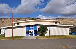
Crane Union High School and Crane Elementary School are in Crane. The high school, which draws students from a large rural district, is a boarding school.[6]
Harney County is not in a community college district but has a "contract out of district" (COD) with Treasure Valley Community College.[9] TVCC operates the Burns Outreach Center in Burns.[10]
Climate
According to the Köppen Climate Classification system, Crane has a semi-arid climate, abbreviated "BSk" on climate maps.[11]
References
- "ArcGIS REST Services Directory". United States Census Bureau. Retrieved October 12, 2022.
- "Census Population API". United States Census Bureau. Retrieved October 12, 2022.
- "Crane". Geographic Names Information System. United States Geological Survey, United States Department of the Interior. November 28, 1980. Retrieved November 3, 2010.
- "Geographic Identifiers: 2020 Census Summary File 1 (G001): Crane CDP, Oregon". American Factfinder. U.S. Census Bureau. Archived from the original on February 13, 2020. Retrieved January 17, 2018.
- McArthur, Lewis A.; Lewis L. McArthur (2003) [1928]. Oregon Geographic Names (7th ed.). Portland, Oregon: Oregon Historical Society Press. p. 245. ISBN 0-87595-277-1.
- "Crane Rural Community: A Brief History". Harney County Economic Development. Archived from the original on March 7, 2016. Retrieved July 24, 2011.
- "Explore Census Data". data.census.gov. Retrieved May 23, 2023.
- "Census of Population and Housing". Census.gov. Retrieved June 4, 2016.
- "Oregon Community Colleges and Community College Districts" (PDF). Oregon Department of Community Colleges & Workforce Development. Retrieved July 17, 2022.
- "Burns Outreach Center". Treasure Valley Community College. Retrieved July 17, 2022.
- Climate Summary for Crane, Oregon
External links
- Historic photo of Crane railroad depot from Salem Public Library
Municipalities and communities of Harney County, Oregon, United States | ||
|---|---|---|
| Cities |  Harney County map | |
| CDP | ||
| Other communities | ||
| Indian reservation | ||
| Ghost towns | ||
| Desert | ||