Hawthorne Bomb Plot
Hawthorne Bomb Plot[2] is a Formerly Used Defense Site that had a Strategic Air Command (SAC) AUTOTRACK radar station during the Cold War. Operations began at a temporary RBS train site for RBS Express #2 was at the Hawthorne area in December 1961,[3] and the 11th Radar Bomb Scoring Squadron[4] subsequently established the fixed military installation for Radar Bomb Scoring in Babbitt, Nevada, the military housing community near the local Navy/Army depot.[1]
| Hawthorne Bomb Plot | |
|---|---|
Navy Fallon RBS | |
| Babbitt, Nevada Near Hawthorne, Nevada | |
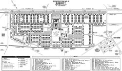 Map of Babbitt, with the station to the east | |
| Coordinates | 38°32′10.84″N 118°38′2.73″W |
| Site information | |
| Operator | United States Air Force |
| Site history | |
| Fate | Demolished |
| Garrison information | |
| Past commanders | Unknown-1966 Lt Col Hollacher[1] 1966-Unknown Lt Col McHan |
Detachment 12 operated and maintained the radars, e.g., c. 1977-2000, Reeves AN/MSQ-77 Bomb Directing Central (serial number 10) was at the Hawthorne Bomb Plot after use for Guam RBS and Vietnam Combat Skyspot bombing. The unit was reassigned to 1CEVG's RBS Division in 1966 and tracked training sorties at the Nellis Air Force Range (e.g., during the Vietnam War)[5] and scored SAC bombers. Hawthorne's Oil Burner route ("OB-10 Hawthorne") for SAC low-level bomber flights extended from a "point west of Elko, Nevada, running southwest to Mina, Nevada" at flight level "FL130-140"[6] (the Tonopah "SAC Targets 1 and 2"[7] were at South Antelope Lake.)[8]
The USAF detachment publicized their 1985 move to the Havre Radar Bomb Scoring Site,[9] but the Hawthorne radar station was still used by NAS Fallon in 1993, and the Whiskey Flats RV park was established in the general location of the former radar station[10] in 2004.
References
- "Young Men To Enter Academies". Mineral County Independent News. June 22, 1966. Archived from the original on June 29, 2022. Retrieved July 9, 2012.
Lt. Col. … Hollacher has been in command of the SAC Radar Bomb Scoring unit located in Babbitt.
- "Mineral County Independent-News - Google News Archive Search". Archived from the original on June 29, 2022. Retrieved December 2, 2020.
- "Hawthorne "Bombed" Daily". Nevada State Journal. December 14, 1961. Retrieved June 20, 2012.
- Babbitt, NV Historical Calendar, Mineral County Museum, 2007 [2006]
- "Mineral County Independent-News - Google News Archive Search". Archived from the original on June 29, 2022. Retrieved December 2, 2020.
- Proposed IAO/DTE Resource Availability (PDF) (Report). c. 1970. Retrieved April 18, 2013.
OB-10-Hawthorne: A point west of Elko, Nevada, running southwest to Nuna, Nevada FL130-140)
- Closure Report for Corrective Action Unit 408: Bomblet Target Area Tonopah Test Range (TTR), Nevada (PDF) (Report). Vol. DOE/NV--1409. Nevada Environmental Restoration Project. September 2010. Archived from the original on June 29, 2022. Retrieved May 19, 2013.
SAC I & II Targets contained forty-five (45) 100m x 100m grids. … the boundary for the SAC Target locations encompassed an area of approximately 72 acres
- Tonopah Test Range…Corrective Action Sites (Report). Vol. DOE/NV/25946--1036.
CAS TA-55-002-TAB2 (Bomblet Target Areas) consists of six separate locations [that] include Mid Target, BLU-63 area, SAC Target, South Antelope Lake, and Tomahawk Targets 1 and 2 … CAS RG-52-007-TAML (Davis Gun Penetrator Test) consists of Davis Gun testing locations on Antelope, Brownes, Pedro, and Main Lakes, and Antelope Tuff 1, Antelope Tuff 2, Sidewinder Tuff, Myers Ridge, and Mt Helen (Nellis Range 75). The only location with land use restrictions is Antelope Lake.
(for SAC Targets 1 and 2, see DOE/NV--1409) - "Air Force Group Bids Farewell to Hawthorne" (Google News Archive). Mineral County Independent-News. May 29, 1985. Archived from the original on June 29, 2022. Retrieved May 16, 2013.
…the majority of the personnel will be moving with the radar equipment to Havre, Montana.
cf. Baker RBS Site (MT89799F06160), Forsythe RBS Site (FUDS B08MT0282), Poplar RBS Site (MT89799F0660001), & Wibaux RBS Site (MT89799F07020) - "Babbitt (13)" (caption for town photograph). flickr. November 8, 2011. Archived from the original on February 4, 2016. Retrieved July 8, 2012.