Hazlehurst, Georgia
Hazlehurst is a city in and the county seat of Jeff Davis County, Georgia, United States.[4] The population was 4,226 at the 2010 census.
Hazlehurst, Georgia
Howardhurst | |
|---|---|
 Hazlehurst City Hall | |
| Motto: "Come linger' longer" | |
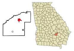 Location in Jeff Davis County and the state of Georgia | |
| Coordinates: 31°51′58″N 82°35′58″W | |
| Country | United States |
| State | Georgia |
| County | Jeff Davis |
| Named for | George Hazlehurst |
| Area | |
| • Total | 4.81 sq mi (12.45 km2) |
| • Land | 4.73 sq mi (12.26 km2) |
| • Water | 0.08 sq mi (0.20 km2) |
| Elevation | 249 ft (76 m) |
| Population (2020) | |
| • Total | 4,088 |
| • Density | 863.72/sq mi (333.48/km2) |
| Time zone | UTC-5 (Eastern (EST)) |
| • Summer (DST) | UTC-4 (EDT) |
| ZIP code | 31539 |
| Area code | 912 |
| FIPS code | 13-37564[2] |
| GNIS feature ID | 0315266[3] |
| Website | http://www.hazlehurstga.gov |
History
Hazlehurst was founded circa 1880 as a depot on the Macon and Brunswick Railroad.[5] The community was named for railroad surveyor Col. George Hazlehurst.[6]
Geography
Hazlehurst is located in southeast Georgia, and is served by U.S. routes 23, 221 and 341.
Climate
| Climate data for Hazlehurst, Georgia, 1991–2020 normals, extremes 1918–2015 | |||||||||||||
|---|---|---|---|---|---|---|---|---|---|---|---|---|---|
| Month | Jan | Feb | Mar | Apr | May | Jun | Jul | Aug | Sep | Oct | Nov | Dec | Year |
| Record high °F (°C) | 85 (29) |
84 (29) |
93 (34) |
95 (35) |
102 (39) |
105 (41) |
107 (42) |
104 (40) |
106 (41) |
97 (36) |
88 (31) |
85 (29) |
107 (42) |
| Average high °F (°C) | 60.3 (15.7) |
64.1 (17.8) |
70.9 (21.6) |
77.8 (25.4) |
85.1 (29.5) |
89.7 (32.1) |
92.4 (33.6) |
91.4 (33.0) |
86.6 (30.3) |
78.7 (25.9) |
69.8 (21.0) |
62.5 (16.9) |
77.4 (25.2) |
| Daily mean °F (°C) | 49.1 (9.5) |
52.4 (11.3) |
58.8 (14.9) |
65.5 (18.6) |
73.3 (22.9) |
79.2 (26.2) |
82.1 (27.8) |
81.2 (27.3) |
76.3 (24.6) |
66.9 (19.4) |
57.5 (14.2) |
51.4 (10.8) |
66.1 (19.0) |
| Average low °F (°C) | 37.9 (3.3) |
40.7 (4.8) |
46.7 (8.2) |
53.2 (11.8) |
61.5 (16.4) |
68.8 (20.4) |
71.7 (22.1) |
71.0 (21.7) |
66.0 (18.9) |
55.2 (12.9) |
45.2 (7.3) |
40.3 (4.6) |
54.9 (12.7) |
| Record low °F (°C) | 10 (−12) |
18 (−8) |
20 (−7) |
29 (−2) |
40 (4) |
47 (8) |
58 (14) |
56 (13) |
45 (7) |
28 (−2) |
19 (−7) |
15 (−9) |
10 (−12) |
| Average precipitation inches (mm) | 4.15 (105) |
4.21 (107) |
4.41 (112) |
3.65 (93) |
3.30 (84) |
5.28 (134) |
4.50 (114) |
6.87 (174) |
4.47 (114) |
2.95 (75) |
2.98 (76) |
4.09 (104) |
50.86 (1,292) |
| Average snowfall inches (cm) | 0.0 (0.0) |
0.1 (0.25) |
0.0 (0.0) |
0.0 (0.0) |
0.0 (0.0) |
0.0 (0.0) |
0.0 (0.0) |
0.0 (0.0) |
0.0 (0.0) |
0.0 (0.0) |
0.0 (0.0) |
0.0 (0.0) |
0.1 (0.25) |
| Average precipitation days (≥ 0.01 in) | 10.4 | 10.2 | 9.1 | 7.6 | 7.1 | 12.5 | 12.4 | 13.3 | 11.4 | 8.6 | 7.1 | 9.7 | 119.4 |
| Average snowy days (≥ 0.1 in) | 0.0 | 0.1 | 0.0 | 0.0 | 0.0 | 0.0 | 0.0 | 0.0 | 0.0 | 0.0 | 0.0 | 0.0 | 0.1 |
| Source 1: NOAA[7] | |||||||||||||
| Source 2: XMACIS2[8] | |||||||||||||
Demographics
| Census | Pop. | Note | %± |
|---|---|---|---|
| 1890 | 290 | — | |
| 1900 | 793 | 173.4% | |
| 1910 | 1,181 | 48.9% | |
| 1920 | 1,383 | 17.1% | |
| 1930 | 1,378 | −0.4% | |
| 1940 | 1,732 | 25.7% | |
| 1950 | 2,687 | 55.1% | |
| 1960 | 3,699 | 37.7% | |
| 1970 | 4,065 | 9.9% | |
| 1980 | 4,298 | 5.7% | |
| 1990 | 4,202 | −2.2% | |
| 2000 | 3,787 | −9.9% | |
| 2010 | 4,226 | 11.6% | |
| 2020 | 4,088 | −3.3% | |
| U.S. Decennial Census[9] | |||
2020 census
| Race | Num. | Perc. |
|---|---|---|
| White (non-Hispanic) | 2,078 | 50.83% |
| Black or African American (non-Hispanic) | 1,359 | 33.24% |
| Native American | 9 | 0.22% |
| Asian | 22 | 0.54% |
| Pacific Islander | 3 | 0.07% |
| Other/Mixed | 123 | 3.01% |
| Hispanic or Latino | 494 | 12.08% |
As of the 2020 United States census, there were 4,088 people, 1,494 households, and 894 families residing in the city.
2000 census
At the census[2] of 2000, there were 3,787 people in 1,513 households, including 1,039 families, in the city. There were 1,810 housing units. The racial makeup of the city was 68.55% White, 27.67% African American, 0.42% Native American, 0.74% Asian, 1.66% from other races, and 0.95% from two or more races. Hispanic or Latino of any race were 3.43% of the population.
Of the 1,513 households 30.7% had children under the age of 18 living with them; 44.7% were married couples living together; 19.8% had a female householder with no husband present; and 31.3% were non-families. 28.0% of households were one person and 12.2% were one person aged 65 or older. The average household size was 2.44 and the average family size was 2.95.
The age distribution was 26.2% under the age of 18, 9.1% from 18 to 24, 24.0% from 25 to 44, 24.8% from 45 to 64, and 16.0% 65 or older. The median age was 38 years. For every 100 females, there were 85.1 males. For every 100 females age 18 and over, there were 79.1 males.
The median household income was $24,306 and the median family income was $27,890. Males had a median income of $27,436 versus $18,304 for females. The per capita income for the city was $12,996. About 21.1% of families and 26.4% of the population were below the poverty line, including 40.0% under age 18 and 25.7% age 65 or over.
Education
Jeff Davis County School District
The Jeff Davis County School District consists of two elementary schools, a middle school, and a high school.[11] The district has 149 full-time teachers and over 2,624 students.[12]
- Jeff Davis Elementary School
- Jeff Davis Primary School
- Jeff Davis Middle School
- Jeff Davis High School
References
- "2020 U.S. Gazetteer Files". United States Census Bureau. Retrieved December 18, 2021.
- "U.S. Census website". United States Census Bureau. Retrieved January 31, 2008.
- "US Board on Geographic Names". United States Geological Survey. October 25, 2007. Retrieved January 31, 2008.
- "Find a County". National Association of Counties. Retrieved June 7, 2011.
- Hellmann, Paul T. (May 13, 2013). Historical Gazetteer of the United States. Routledge. p. 233. ISBN 978-1135948597. Retrieved November 30, 2013.
- Krakow, Kenneth K. (1975). Georgia Place-Names: Their History and Origins (PDF). Macon, GA: Winship Press. p. 106. ISBN 0-915430-00-2.
- "U.S. Climate Normals Quick Access – Station: Hazlehurst, GA". National Oceanic and Atmospheric Administration. Retrieved February 27, 2023.
- "xmACIS2". National Oceanic and Atmospheric Administration. Retrieved February 27, 2023.
- "Census of Population and Housing". Census.gov. Retrieved June 4, 2015.
- "Explore Census Data". data.census.gov. Retrieved December 18, 2021.
- Georgia Board of Education, Retrieved June 20, 2010.
- School Stats, Retrieved June 20, 2010.
Municipalities and communities of Jeff Davis County, Georgia, United States | ||
|---|---|---|
| Cities | 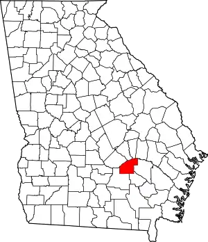 Map of Georgia highlighting Jeff Davis County | |
| CDP | ||
| Unincorporated community | ||
| Ghost town | ||