Shire of Hepburn
The Shire of Hepburn is a local government area in Victoria, Australia, located in the central part of the state. It covers an area of 1,473 square kilometres (569 sq mi) and, in the 2021 Census the shire had a population of 16,604.[1]
| Hepburn Shire Council Victoria | |||||||||||||||
|---|---|---|---|---|---|---|---|---|---|---|---|---|---|---|---|
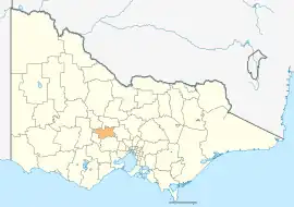 Location in Victoria | |||||||||||||||
| Population | 16,604 (2021)[1] | ||||||||||||||
| • Density | 11.272/km2 (29.195/sq mi) | ||||||||||||||
| Established | 1995 | ||||||||||||||
| Gazetted | 19 January 1995[2] | ||||||||||||||
| Area | 1,473 km2 (568.7 sq mi)[1] | ||||||||||||||
| Mayor | Brian Hood | ||||||||||||||
| Council seat | Daylesford | ||||||||||||||
| Region | Grampians | ||||||||||||||
| State electorate(s) | |||||||||||||||
| Federal division(s) | Ballarat | ||||||||||||||
| Website | Hepburn Shire Council | ||||||||||||||
| |||||||||||||||
It includes the towns of Clunes, Creswick, Daylesford, Hepburn Springs and Trentham and the villages of Glenlyon, Allendale, Kingston, Leonard's Hill, Lyonville, Newlyn, Denver and Smeaton.
It was formed in 1995 from the amalgamation of the Shire of Creswick, Shire of Daylesford and Glenlyon and parts of the Shire of Kyneton and Shire of Talbot and Clunes.[2]
The Shire is governed and administered by the Hepburn Shire Council; its seat of local government and administrative centre is located at the council headquarters in Daylesford, it also has a service centre located in Creswick. The Shire is named after an early squatter named John Hepburn, who established the Smeaton Hill pastoral run, which was located a few kilometres north of present-day Creswick.[3]
Council
Current composition
The council is composed of five wards and seven councillors, with two councillors per ward elected to represent each of the Creswick and Birch wards, and one councillor per remaining ward elected to represent each of the other wards. As of 2020, the current councillors are:[4]
| Ward | Party | Councillor | Notes | |
|---|---|---|---|---|
| Birch | Independent | Jen Bray | ||
| Independent | Lesley Hewitt | |||
| Cameron | Independent | Tessa Halliday | ||
| Coliban | Independent | Brian Hood | ||
| Creswick | Independent | Don Henderson | ||
| Independent | Tim Drylie | |||
| Holcombe | Independent | Juliet Simpson | ||
Administration and governance
The council meets in the council chambers at the council headquarters in the Daylesford Municipal Offices, which is also the location of the council's administrative activities. It also provides customer services at both its administrative centre in Daylesford, and its service centre in Creswick.
Townships and localities
The 2021 census, the shire had a population of 16,604 up from 15,330 in the 2016 census[5]
| Population | ||
|---|---|---|
| Locality | 2016 | 2021 |
| Allendale | 166 | 185 |
| Bald Hills^ | 107 | 114 |
| Basalt | 10 | 23 |
| Blampied | 212 | 237 |
| Broomfield | 228 | 213 |
| Bullarook^ | 99 | 77 |
| Bullarto | 73 | 89 |
| Bullarto South^ | 33 | 48 |
| Bung Bong^ | 51 | 63 |
| Cabbage Tree | 18 | 10 |
| Campbelltown^ | 55 | 51 |
| Clunes | 1,728 | 1,844 |
| Clydesdale | 58 | 62 |
| Coomoora | 252 | 308 |
| Creswick^ | 3,170 | 3,279 |
| Creswick North | 58 | 55 |
| Daylesford | 2,548 | 2,781 |
| Dean | 120 | 132 |
| Denver^ | 150 | 148 |
| Drummond^ | 283 | 294 |
| Population | ||
|---|---|---|
| Locality | 2016 | 2021 |
| Drummond North^ | 187 | 203 |
| Dry Diggings | 25 | 41 |
| Eganstown | 203 | 206 |
| Elevated Plains | 37 | 39 |
| Evansford^ | 131 | 147 |
| Fern Hill^ | 104 | 125 |
| Franklinford^ | 66 | 71 |
| Glengower^ | 13 | 15 |
| Glenlyon | 389 | 431 |
| Guildford^ | 333 | 330 |
| Hepburn | 599 | 631 |
| Hepburn Springs | 329 | 368 |
| Kingston | 177 | 190 |
| Kooroocheang | 28 | 41 |
| Korweinguboora^ | 168 | 196 |
| Langdons Hill | 21 | 23 |
| Lawrence | 17 | 8 |
| Leonards Hill | 45 | 47 |
| Lillicur^ | 29 | 85 |
| Population | ||
|---|---|---|
| Locality | 2016 | 2021 |
| Little Hampton | 62 | 74 |
| Lyonville | 175 | 189 |
| Malmsbury^ | 831 | 905 |
| Mollongghip^ | 89 | 105 |
| Mount Beckworth | 9 | 15 |
| Mount Cameron^ | 9 | 15 |
| Mount Franklin | 89 | 99 |
| Mount Prospect | 41 | 41 |
| Musk | 150 | 177 |
| Musk Vale | 132 | 170 |
| Newbury | 71 | 84 |
| Newlyn | 128 | 136 |
| Newlyn North | 174 | 230 |
| North Blackwood | 51 | 50 |
| Porcupine Ridge | 122 | 149 |
| Rocklyn | 62 | 43 |
| Sailors Falls | 62 | 79 |
| Sailors Hill | 81 | 72 |
| Shepherds Flat | 66 | 71 |
| Population | ||
|---|---|---|
| Locality | 2016 | 2021 |
| Smeaton | 231 | 245 |
| Smokeytown | 31 | 32 |
| Spring Hill^ | 198 | 200 |
| Springmount | 181 | 184 |
| Stony Creek | 6 | 0 |
| Strangways^ | 87 | 101 |
| Sulky^ | 232 | 234 |
| Taradale^ | 448 | 524 |
| Tarilta^ | 21 | 26 |
| Trentham^ | 1,180 | 1,382 |
| Trentham East^ | 153 | 181 |
| Tylden^ | 535 | 645 |
| Tylden South | * | # |
| Ullina | 34 | 25 |
| Wattle Flat^ | 97 | 104 |
| Waubra^ | 275 | 308 |
| Werona^ | 46 | 43 |
| Wheatsheaf | 241 | 252 |
| Yandoit | 154 | 181 |
^ - Territory divided with another LGA
* - Not noted in 2016 Census
# - Not noted in 2021 Census
Traditional owners
The traditional owners of the Shire of Hepburn are the Dja Dja Wurrung.[6]
References
- "3218.0 – Regional Population Growth, Australia, 2017-18: Population Estimates by Local Government Area (ASGS 2018), 2017 to 2018". Australian Bureau of Statistics. Australian Bureau of Statistics. 27 March 2019. Retrieved 25 October 2019. Estimated resident population, 30 June 2018.
- Victoria Government Gazette – Online Archive (1837–1997). "S2 of 1995: Order estg (Part 6) the Shire of Hepburn". State Library of Victoria. State Government of Victoria (published 19 January 1995). p. 3. Retrieved 10 January 2014.
- Hepburn Shire Council. "Hepburn Shire – A Brief Profile". Hepburn Shire Council. Retrieved 14 December 2013.
- "Hepburn Shire Council election results 2020". www.vec.vic.gov.au. Retrieved 11 November 2020.
- "Census | Australian Bureau of Statistics". www.abs.gov.au. 11 January 2023.
- "Cultural Diversity & Heritage". Hepburn Shire Council. Retrieved 2 May 2021.
External links
Localities in the Shire of Hepburn | ||
|---|---|---|
| Town | ||
| Locality |
| |
^ - Territory divided with another LGA | ||