Hidden Lake (Flathead County, Montana)
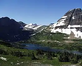
Hidden Lake is located in Glacier National Park, in the U.S. state of Montana. The lake is surrounded by several peaks, including Bearhat Mountain to the southwest, Dragons Tail to the south, Clements Mountain to the north, and Reynolds Mountain to the east.[2] It is a popular destination for hikers, with the Hidden Lake Overlook Trail leading to the lake.
| Hidden Lake | |
|---|---|
 Hidden Lake from the Hidden Lake overlook. Bearhat Mountain rises above the lake at right. | |
 Hidden Lake  Hidden Lake | |
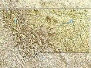
| Location | Glacier National Park, Flathead County, Montana, US |
| Coordinates | 48°40′35″N 113°44′29″W[1] |
| Lake type | Natural |
| Primary outflows | Hidden Creek |
| Basin countries | United States |
| Max. length | 2 mi (3.2 km) |
| Max. width | .40 mi (0.64 km) |
| Surface elevation | 6,375 ft (1,943 m) |
Location and Features
Hidden Lake is situated in Glacier National Park, Flathead County, Montana, US. The lake is 1.4 miles (2.25 km) long and 0.40 miles (0.64 km) wide, with a surface elevation of 6,375 feet (1,943 m).[3] The primary outflow from the lake is Hidden Creek.[4]
Hidden Lake Overlook Trail
The Hidden Lake Overlook Trail is a 2.7-mile out-and-back trail that provides visitors an opportunity to experience the beauty of Hidden Lake.[5] The trail starts at the Logan Pass Visitor Center and is suitable for individuals of all fitness levels. As the trail ascends in elevation, hikers are treated to mesmerizing views of the landscape, including a meadow known as the Hanging Gardens where wildflowers bloom and wildlife is abundant.
Wildlife
Hidden Lake Overlook Trail offers a diverse range of wildlife. The trail serves as a migration route for several wild creatures. Mountain goats and bighorn sheep are commonly spotted along the trail. Bears also frequent this area, and hikers are advised to be vigilant when they come across signs of bear activity such as claw marks or footprints.
_8633.jpg.webp)
References
- "Hidden Lake". Geographic Names Information System. United States Geological Survey, United States Department of the Interior. Retrieved 2011-02-20.
- "Hidden Lake, MT - N48.67447° W113.74080°". www.topoquest.com. Retrieved 2023-08-01.
- "Google Earth". earth.google.com. Retrieved 2023-08-01.
- "FISHMT :: Waterbody Details". myfwp.mt.gov. Retrieved 2023-08-01.
- Glacier, Mailing Address: PO Box 128 West; Us, MT 59936 Phone: 406-888-7800 Contact. "Hiking St. Mary - Glacier National Park (U.S. National Park Service)". www.nps.gov. Retrieved 2023-08-01.