North Wingfield
North Wingfield is a large village and civil parish in the North East Derbyshire district in the county of Derbyshire, England. Located approximately 4½ miles south-east of Chesterfield, and 1 mile north-east of Clay Cross. The population of the civil parish as of the 2011 census was 6,505.[1] The A6175 road from the M1 motorway to the A61 road runs through the village.
| North Wingfield | |
|---|---|
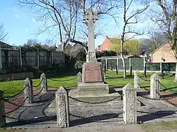
 War memorial | |
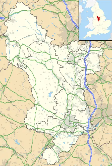
 North Wingfield Location within Derbyshire | |
| Population | 6,505 (2011) |
| OS grid reference | SK409651 |
| Civil parish |
|
| District | |
| Shire county | |
| Region | |
| Country | England |
| Sovereign state | United Kingdom |
| Post town | CHESTERFIELD |
| Postcode district | S42 |
| Dialling code | 01246 |
| Police | Derbyshire |
| Fire | Derbyshire |
| Ambulance | East Midlands |
| UK Parliament | |
The village contains the former hamlets of Hepthorne Lane, Hillyfields, Highfields and Church Hill. The Hepthorne Lane area is still called by its name by local residents, as are the Highfields and Church Hill areas. The River Rother flows through the village at the bottom of Hepthorne Lane, next to the Midland Main Line.
Brief history
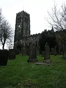
During the Domesday Survey in 1086 the manor of North Wingfield was recorded as Winnefelt. It was noted that there was a church and a priest. Parts of the current church, dedicated to St. Lawrence, date from the Norman era, with some features being Anglo-Saxon in origin.
At that time the manor of North Wingfield was in the possession of Walter De Ayncourt. The name eventually became shortened to Deincourt, which was used by the village's secondary school, Deincourt Community School from 1953 until it closed in 2010.
Both North Wingfield and South Wingfield have forms of the same place-name, formed from "winn" (pasture) and "feld" (open land). The earlier forms of each are not distinguished but in 1284 a Middle English form of South Wingfield occurs. (North) Wingfield is found in Anglo-Saxon records, while the records of (South) Wingfield begin with the Domesday Book.[2]
The village
Located in the former coalfields, the village was served by several collieries for most of its recent history. Now, partly due to its location near to the M1 motorway and its school, the village has experienced an influx of residents in recent years, and many housing developments have taken place.
The village now only has a primary school, following the closure of Deincourt Community School.
Schools
There was a secondary school in North Wingfield – Deincourt Community School - from 1953 to 2010.[3] In November 2007, Ofsted placed Deincourt Community School under 'special measures', due to inspectors' concerns about falling standards at the school. This gave Derbyshire County Council the opportunity to implement plans to close the school, which, with only 473 students at that time, they felt to be too small to be viable. The proposal was to transfer the students to Tibshelf School, which would be re-built on a new larger site under the Building Schools for the Future scheme. This school building scheme was scrapped by Educational Minister Michael Gove when a Conservative-led coalition Government was elected in 2010. Between 2008 and 2010, Deincourt School was in a ‘federation', that is to say a loose merger, with Tibshelf School. Despite the cancellation of the Building Schools for the Future Scheme, and the fact that in its 2009 Inspection report the school was rated as a ‘Good’ School,[4] the process of closing the school was continued. The school therefore closed in July 2010, and was integrated into Tibshelf School. Because of the lack of space at Tibshelf School, students continued to be taught at the Deincourt Site in North Wingfield until June 2012. Because of the overcrowding caused by the merger with the already overcrowded Tibshelf school, Derbyshire County Council itself funded a new build school in Tibshelf, which opened in November 2013.[5][6]
North Wingfield Primary School was founded in Victorian times; it was formerly an infant and junior school on a split site. The original Victorian building has now been demolished and a new school has been built on the old Deincourt site.
Neighbouring settlements
Neighbouring settlements are Tupton, Grassmoor, Holmewood, Pilsley, Danesmoor and Clay Cross. North Wingfield is quite a distance away from its counterpart South Wingfield, which is around 11 miles southwards.
Facilities
- Pharmacy
- Two GP surgeries
- Newsagents
- Post office
- Midlands Co-operative Society supermarket
- Sure Start centre[7]
- Community Resource Centre[8]
- Various locally-run shops
- Recycling facilities
References
- "Civil parish population 2011". Neighbourhood Statistics. Office for National Statistics. Retrieved 29 March 2016.
- Ekwall, Eilert (1940). The Concise Dictionary of English Place-names; 2nd ed. Oxford: Clarendon Press. p. 499
- "A fond farewell to Deincourt". Derbyshire Times. 14 July 2010. Retrieved 19 August 2015.
- "Deincourt Community School Ofsted Report".
- "Tibshelf school celebrates £14.5m building success". BBC News. 17 October 2011. Retrieved 19 August 2015.
- "New 750-pupil Tibshelf Community School opens in Derbyshire". Derby Telegraph. 14 December 2014. Retrieved 19 August 2015.
- "Sure Start centre". Archived from the original on 12 March 2007. Retrieved 1 August 2006.
- "Community Resource Centre". Archived from the original on 12 March 2007. Retrieved 1 August 2006.
