Hirschau (Tübingen)
Hirschau is a village in Tübingen district in Baden-Württemberg, Germany. Since 1971, it is an outer district of the city of Tübingen.
Hirschau | |
|---|---|
Location of Hirschau within Tübingen 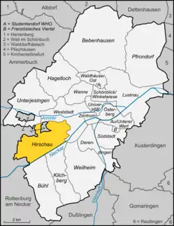 | |
 Hirschau 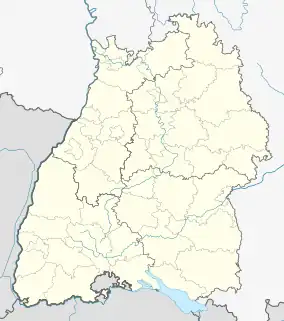 Hirschau | |
| Coordinates: 48°30′05″N 8°59′40″E | |
| Country | Germany |
| State | Baden-Württemberg |
| District | Tübingen |
| Town | Tübingen |
| Area | |
| • Total | 6.17 km2 (2.38 sq mi) |
| Highest elevation | 475 m (1,558 ft) |
| Lowest elevation | 330 m (1,080 ft) |
| Population (2020-12-31)[1] | |
| • Total | 3,297 |
| • Density | 530/km2 (1,400/sq mi) |
| Time zone | UTC+01:00 (CET) |
| • Summer (DST) | UTC+02:00 (CEST) |
Tübingen-Hirschau
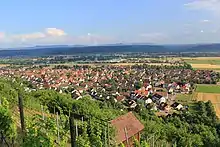
Hirschau has a population of 3297 (2020) on an area of 6.17 km2. It is the westernmost district of Tübingen. Hirschau lies to the north of the Neckar river, about 3 km to the east of Wurmlingen, which is a part of Rottenburg am Neckar, and about 6 km to the east of the town centre of Rottenburg am Neckar as well as to the west of the city centre of Tübingen.
The highest point is the Spitzberg at 475 m above mean sea level.
Unlike most of Tübingen, Hirschau is, like neighbouring Rottenburg, mostly Roman Catholic.
References
- "Hirschau". Universitätsstadt Tübingen. Retrieved 24 September 2021.
This article is issued from Wikipedia. The text is licensed under Creative Commons - Attribution - Sharealike. Additional terms may apply for the media files.