List of Historic Sites of Japan (Kanagawa)
National Historic Sites
As of 1 August 2019, sixty-three Sites have been designated as being of national significance, including the Old Hakone Road, which spans the prefectural borders with Shizuoka.[2][3][4]
| Site | Municipality | Comments | Image | Coordinates | Type | Ref. |
|---|---|---|---|---|---|---|
| Isehara Hachimandai Stone Age Dwelling Site 伊勢原八幡台石器時代住居跡 Isehara Hachimandai sekki-jidai jūkyo ato |
Isehara | Jomon period settlement trace | 35°23′20″N 139°18′31″E | 1 | 792 | |
| Isshōmasu Site 一升桝遺跡 Isshōmasu iseki |
Kamakura | Kamakura period earthworks beside the road, half a kilometre from Gokuraku-ji[5] | 35°18′53″N 139°31′39″E | 2, 6 | 00003514 | |
| Inamuragasaki 稲村ヶ崎 (新田義貞徒渉伝説地) Inamuragasaki |
Kamakura | Kamakura period site where Nitta Yoshisada entered Kamakura during the Siege of Kamakura (1333) | 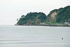 Inamuragasaki |
35°18′07″N 139°31′32″E | 8 | 790 |
| Egara Tenjin Shrine Precinct 荏柄天神社境内 Egara Tenjin-sha keidai |
Kamakura | Shinto shrine submitted for inscription on the UNESCO World Heritage List as one of the Temples, Shrines and other structures of Ancient Kamakura;[6][7] the ICP honden dates to 1316[8] | 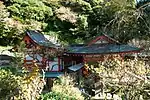 Egara Tenjin Shrine Precinct |
35°19′33″N 139°33′52″E | 3 | 00003454 |
| Yōfuku-ji ruins 永福寺跡 Yōfukuji ato |
Kamakura | Buddhist temple ruins submitted for inscription on the UNESCO World Heritage List as one of the Temples, Shrines and other structures of Ancient Kamakura[6][7] | 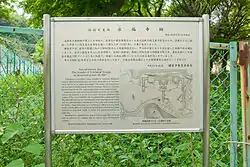 Yōfukuji ruins |
35°19′38″N 139°34′08″E | 3 | 804 |
| Engaku-ji Precinct 円覚寺境内 Engakuji keidai |
Kamakura | Buddhist temple submitted for inscription on the UNESCO World Heritage List as one of the Temples, Shrines and other structures of Ancient Kamakura[6][7] |  Engakuji Precinct |
35°20′16″N 139°32′52″E | 3 | 808 |
| Engaku-ji Gardens 円覚寺庭園 Engakuji teien |
Kamakura | Buddhist temple garden; also a Place of Scenic Beauty; submitted for inscription on the UNESCO World Heritage List as one of the Temples, Shrines and other structures of Ancient Kamakura[6][7] | 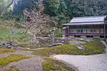 Engakuji Gardens |
35°20′12″N 139°32′43″E | 8 | 788 |
| Shimoterao Kanga site 下寺尾官衙遺跡群 Shimoterao kanga iseki-gun |
Chigasaki | Nara / Heian period local administration complex ruins | 35°21′46″N 139°23′48″E | 2 | 00003890 | |
| Kewaizaka Pass 仮粧坂 Kehaizaka |
Kamakura | Kamakura period sites submitted for inscription on the UNESCO World Heritage List as one of the Temples, Shrines and other structures of Ancient Kamakura[6][7] | 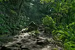 Kewaizaka Pass |
35°19′37″N 139°32′44″E | 6 | 814 |
| Natsushima Shell Mound 夏島貝塚 Natsushima kaizuka |
Yokosuka | Jomon period shell midden | 35°19′21″N 139°38′58″E | 1 | 817 | |
| Kakuon-ji Precinct 覚園寺境内 Kakuonji keidai |
Kamakura | Buddhist temple submitted for inscription on the UNESCO World Heritage List as one of the Temples, Shrines and other structures of Ancient Kamakura[6][7] | 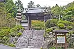 Kakuonji Precinct |
35°19′59″N 139°33′49″E | 3 | 809 |
| Kamakura Daibutsuden 鎌倉大仏殿跡 Kamakura daibutsuden ato |
Kamakura | Buddhist temple submitted for inscription on the UNESCO World Heritage List as one of the Temples, Shrines and other structures of Ancient Kamakura[6][7] | 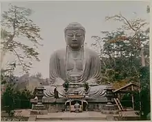 Kamakura Daibutsuden ruins |
35°19′00″N 139°32′09″E | 3 | 3385 |
| Kamegayatsuzaka Pass 亀ヶ谷坂 Kamegayatsuzaka |
Kamakura | Kamakura period site submitted for inscription on the UNESCO World Heritage List as one of the Temples, Shrines and other structures of Ancient Kamakura[6][7] | 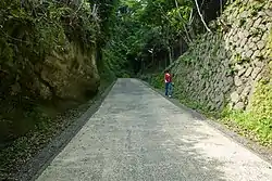 Kamegayatsuzaka Pass |
35°19′51″N 139°33′01″E | 6 | 812 |
| Tachibana Kanga site 橘樹官衙遺跡群 Tachibana kanga iseki-gun |
Kawasaki | Nara / Heian period local administration complex ruins | 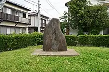 Tachibana Kanga ruins |
35°34′42″N 139°37′09″E | 2 | 00003889 |
| Former Yokohama Specie Bank Head Office 旧横浜正金銀行本店 kyū-Yokohama Shōkin Ginkō honten kaizuka |
Yokohama | established in 1880, the ICP honkan (main building) dates to 1904 and is used for the Kanagawa Prefectural Museum of Cultural History[9] | 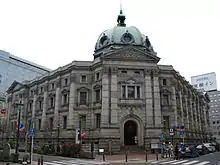 Former Yokohama Specie Bank Head Office |
35°26′57″N 139°38′11″E | 6 | 824 |
| Sagami River Bridge ruins 旧相模川橋脚 kyū-Sagami-gawa kyōkyaku |
Chigasaki | also a Natural Monument |  Sagami River Bridge ruins |
35°19′55″N 139°23′04″E | 6 | 777 |
| Kobukurozaka Pass 巨福呂坂 Kobukurozaka |
Kamakura | Kamakura period | 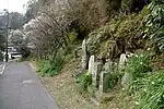 Kobukurozaka Pass |
35°19′39″N 139°33′16″E | 6 | 813 |
| Gokuraku-ji Precinct - Tomb of Ninshō 極楽寺境内・忍性墓 Gokurakuji keidai・Ninshō no haka |
Kamakura | Buddhist temple submitted for inscription on the UNESCO World Heritage List as one of the Temples, Shrines and other structures of Ancient Kamakura[6][7] | 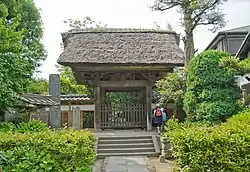 Gokurakuji Precinct - Tomb of Ninshō |
35°18′36″N 139°31′44″E | 7 | 781 |
| Kenchō-ji Precinct 建長寺境内 Kenchōji keidai |
Kamakura | Buddhist temple submitted for inscription on the UNESCO World Heritage List as one of the Temples, Shrines and other structures of Ancient Kamakura[6][7] |  Kenchōji Precinct |
35°19′54″N 139°33′17″E | 3 | 805 |
| Kenchō-ji Gardens 建長寺庭園 Kenchōji teien |
Kamakura | Buddhist temple gardens; also a Place of Scenic Beauty; submitted for inscription on the UNESCO World Heritage List as one of the Temples, Shrines and other structures of Ancient Kamakura[6][7] | 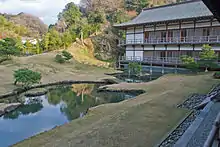 Kenchōji Gardens |
35°19′56″N 139°33′20″E | 8 | 787 |
| Moto-Hakone Stone Buddhas 元箱根石仏群 Moto-Hakone sekibutsu |
Hakone | Kamakura period monuments; designation includes three gorintō, one dating to 1295, and a hōkyōintō of 1296; the ICP sculptures date from the late C13/early C14[10][11][12] | 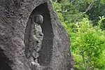 Moto-Hakone Stone Buddhas |
35°13′02″N 139°02′19″E | 3 | 797 |
| Goryōgaidai Shell Mound 五領ヶ台貝塚 Goryōgaidai kaizuka |
Hiratsuka | Jomon period shell midden | 35°21′16″N 139°18′02″E | 1 | 818 | |
| Grave of William Adams 三浦安針墓 Miura Anjin no haka |
Yokosuka | Edo Period personage | _and_his_wife_01.jpg.webp) Grave of William Adams |
35°16′45″N 139°38′27″E | 7 | 774 |
| Santonodai Site 三殿台遺跡 Santonodai iseki |
Yokohama | Yayoi period settlement trace | .JPG.webp) Santonodai Site |
35°25′14″N 139°36′39″E | 1 | 802 |
| Wakamiya Ōji 若宮大路 Wakamiya Ōji |
Kamakura | Kamakura period site submitted for inscription on the UNESCO World Heritage List as one of the Temples, Shrines and other structures of Ancient Kamakura[6][7] | 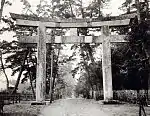 Wakamiya Ōji |
35°18′58″N 139°33′01″E | 3, 6 | 793 |
| Jufuku-ji Precinct 寿福寺境内 Jufukuji keidai |
Kamakura | Buddhist temple submitted for inscription on the UNESCO World Heritage List as one of the Temples, Shrines and other structures of Ancient Kamakura[6][7] | 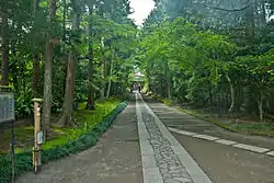 Jufukuji Precinct |
35°19′27″N 139°32′57″E | 3 | 801 |
| Akibayama Kofun Cluster 秋葉山古墳群 Akibayama kofun-gun |
Ebina | Konfun period tumuli | 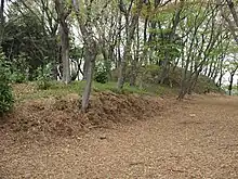 Akibayama Kofun Cluster |
35°28′12″N 139°24′15″E | 1 | 00003453 |
| Katsusaka Site 勝坂遺跡 Katsusaka iseki |
Sagamihara | Jomon period settlement trace | 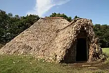 Katsusaka Site |
35°30′32″N 139°23′18″E | 1 | 819 |
| Odawara Castle ruins 小田原城跡 Odawara-jō ato |
Odawara | Sengoku / Edo period castle | 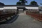 Odawara Castle ruins |
35°15′03″N 139°09′13″E | 2 | 794 |
| Shōmyō-ji Precinct 称名寺境内 Shōmyōji keidai |
Yokohama | Buddhist temple submitted for inscription on the UNESCO World Heritage List as one of the Temples, Shrines and other structures of Ancient Kamakura[6][7] | 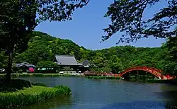 Shōmyōji Precinct |
35°20′38″N 139°37′49″E | 3 | 773 |
| Jōkōmyō-ji Precinct - Grave of Reizei Tamesuke 浄光明寺境内・冷泉為相墓 Jōkōmyōji keidai・Reizei Tamesuke haka |
Kamakura | Buddhist temple submitted for inscription on the UNESCO World Heritage List as one of the Temples, Shrines and other structures of Ancient Kamakura[6][7] | 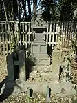 Jōkōmyōji Precinct |
35°19′37″N 139°33′05″E | 3, 7 | 780 |
| Jōchi-ji Precinct 浄智寺境内 Jōchiji keidai |
Kamakura | Buddhist temple founded in Kamakura period | 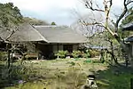 Jōchiji Precinct |
35°20′00″N 139°32′48″E | 3 | 800 |
| Jōmyō-ji Precinct 浄妙寺境内 Jōmyōji keidai |
Kamakura | Buddhist temple founded in Kamakura period | 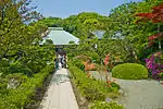 Jōmyōji Precinct |
35°19′21″N 139°34′16″E | 3 | 806 |
| Kanzaki Site 神崎遺跡 Kanzaki iseki |
Ayase | Yayoi period settlement trace | 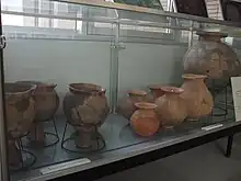 Kanzaki Site |
35°24′37″N 139°24′26″E | 1 | 00003699 |
| Zuisen-ji Precinct 瑞泉寺境内 Zuisenji keidai |
Kamakura | Buddhist temple, submitted for inscription on the UNESCO World Heritage List as one of the Temples, Shrines and other structures of Ancient Kamakura[6][7] | 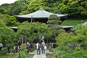 Zuisenji Precinct |
35°19′21″N 139°34′16″E | 3 | 815 |
| Suara Stone Age Site 寸沢嵐石器時代遺跡 Suara shisekki-jidai iseki |
Sagamihara | Jomon period settlement trace | 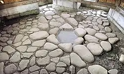 Suara Stone Age Site |
35°36′00″N 139°13′24″E | 1 | 785 |
| Mount Ishigaki 石垣山 Ishigaki-yama |
Odawara | site of Sengoku period Ishigakiyama Ichiya Castle |  Mount Ishigaki |
35°14′08″N 139°07′39″E | 2 | 799 |
| Kawajiri Stone Age Site 川尻石器時代遺跡 Kawajiri shisekki-jidai iseki |
Sagamihara | Jomon period settlement trace | 35°35′30″N 139°18′01″E | 1 | 786 | |
| Sagami Kokubun-ji ruins 相模国分寺跡 Sagami Kokubunji ato |
Ebina | Nara period provincial temple of Sagami Province |  Sagami Kokubunji ruins |
35°27′16″N 139°23′52″E | 3 | 771 |
| Sagami Kokubun-niji ruins 相模国分尼寺跡 Sagami Kokubunniji ato |
Ebina | Nara period provincial nunnery of Sagami Province | 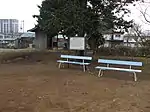 Sagami Kokubunniji ruins |
35°27′38″N 139°23′53″E | 3 | 825 |
| Ōmachi Shakadō Pass Site 大町釈迦堂口遺跡 Ōmachi Shakado-guchi iseki |
Kamakura | Kamakura period | 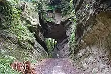 Ōmachi Shakadō Pass Site |
35°19′02″N 139°33′54″E | 3 | 00003681 |
| Ōtsuka-Saikachido Site 大塚・歳勝土遺跡 Ōtsuka-Saikachido iseki |
Yokohama | Yayoi period settlement trace |  Ōtsuka-Saikachido Site |
35°33′02″N 139°34′50″E | 1 | 823 |
| Daibutsu Pass 大仏切通 Daibutsu kiridōshi |
Kamakura | Kamakura period site submitted for inscription on the UNESCO World Heritage List as one of the Temples, Shrines and other structures of Ancient Kamakura[6][7] | 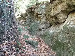 Daibutsu Pass |
35°19′38″N 139°31′59″E | 6 | 820 |
| Asaina Pass 朝夷奈切通 Asaina kiridōshi |
Kamakura | Kamakura period site submitted for inscription on the UNESCO World Heritage List as one of the Temples, Shrines and other structures of Ancient Kamakura[6][7] | 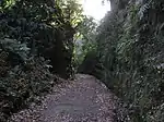 Asaina Pass |
35°19′51″N 139°35′28″E | 6 | 811 |
| Nagae-Sakurayama Kofun Cluster 長柄桜山古墳群 Nagae-Sakurayama kofun-gun |
Zushi, Hayama | Kofun period tumuli cluster | 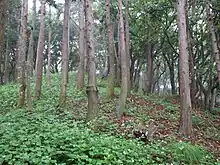 Nagae-Sakurayama Kofun Cluster |
35°17′14″N 139°35′05″E | 1 | 3351 |
| Tsurugaoka Hachiman-gū Precinct 鶴岡八幡宮境内 Tsurugaoka Hachimangū keidai |
Kamakura | Shinto shrine submitted for inscription on the UNESCO World Heritage List as one of the Temples, Shrines and other structures of Ancient Kamakura[6][7] | 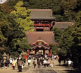 Tsurugaoka Hachimangū Precinct |
35°19′31″N 139°33′21″E | 3 | 807 |
| Grave of Uesugi Norikata 伝上杉憲方墓 den-Uesugi Norikata no haka |
Kamakura | Kamakura period tomb | 35°18′34″N 139°31′47″E | 7 | 782 | |
| Tanamukaihara Site 田名向原遺跡 Tanamukaihara iseki |
Sagamihara | Japanese Paleolithic Site | 35°31′46″N 139°21′18″E | 1 | 3244 | |
| Tōshō-ji Site 東勝寺跡 Tōshōji ato |
Kamakura | Buddhist temple ruins submitted for inscription on the UNESCO World Heritage List as one of the Temples, Shrines and other structures of Ancient Kamakura[6][7] | 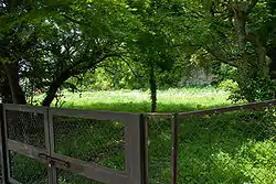 Tōshōji Site |
35°19′14″N 139°33′35″E | 2, 3 | 3213 |
| Fujisawa Memorial Tower to Friends and Foe 藤沢敵御方供養塔 Fujisawa tekimikata kuyōtō |
Fujisawa | Sengoku period monument erected to commemorate those who fell in the Uesugi Zenshū Rebellion (上杉禅秀の乱) of Ōei 23 (1416); on the grounds of Shōjōkō-ji (清浄光寺)[13] | 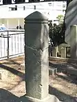 Fujisawa Memorial Tower to Friends and Foe |
35°20′51″N 139°29′19″E | 3 | 776 |
| Grave of Hino Toshimoto 日野俊基墓 Hino Toshimoto no haka |
Kamakura | Kamakura period | 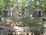 Grave of Hino Toshimoto |
35°19′41″N 139°32′35″E | 7 | 779 |
| Hakone Barrier Site 箱根関跡 Hakone no seki ato |
Hakone | Edo Period | 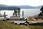 Hakone Barrier Site |
35°11′33″N 139°01′34″E | 6 | 772 |
| Buppō-ji Site 仏法寺跡 Buppōji ato |
Kamakura | Buddhist temple submitted for inscription on the UNESCO World Heritage List as one of the Temples, Shrines and other structures of Ancient Kamakura[6][7] | 35°18′26″N 139°31′52″E | 3 | 00003501 | |
| Hokkedō Site 法華堂跡 (源頼朝墓・北条義時墓) Hokkedō ato (Minamoto Yoritomo no haka・Hōjō Yoshitoki no haka) |
Kamakura | designation includes the tomb of Minamoto no Yoritomo and the tomb of Hōjō Yoshitoki | 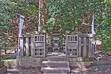 Hokkedō Site |
35°19′33″N 139°33′40″E | 3, 7 | 778 |
| Hōjō Clan Tokiwa Residence Site 北条氏常盤亭跡 Hōjō-shi Tokiwa-tei ato |
Kamakura | submitted for inscription on the UNESCO World Heritage List as one of the Temples, Shrines and other structures of Ancient Kamakura[6][7] | 35°19′24″N 139°31′55″E | 2 | 821 | |
| Nagoe Pass 名越切通 Nagoe kiridōshi |
Kamakura | Kamakura period site submitted for inscription on the UNESCO World Heritage List as one of the Temples, Shrines and other structures of Ancient Kamakura[6][7] | 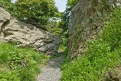 Nagoe Pass |
35°18′27″N 139°33′53″E | 6 | 803 |
| Meigetsu-in Precinct 明月院境内 Meigetsuin keidai |
Kamakura | Buddhist temple | 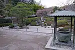 Meigetsuin Precinct |
35°20′06″N 139°33′05″E | 3 | 822 |
| Wakae Island 和賀江嶋 Wakaejima |
Kamakura, Zushi | Kamakura period site submitted for inscription on the UNESCO World Heritage List as one of the Temples, Shrines and other structures of Ancient Kamakura[6][7] | 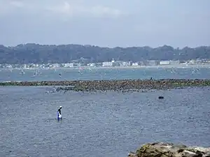 Wakae Island |
35°18′01″N 139°33′05″E | 3, 5, 6 | 810 |
| Akasaka Site 赤坂遺跡 Akasaka iseki |
Miura | Yayoi period settlement trace | 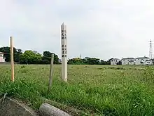 Akasaka Site |
35°10′28″N 139°38′03″E | 1 | 00003779 |
| Old Hakone Road 箱根旧街道 Hakone kyū-kaidō |
Hakone | stretch of the old Tōkaidō; the designation includes areas of Mishima and Kannami in Shizuoka Prefecture | 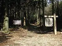 Old Hakone Road |
35°11′36″N 139°01′35″E | 6 | 798 |
| Tokyo Bay Fortress Sites 東京湾要塞跡 Tōkyō-wan yōsai ato |
Yokosuka | designation includes the sites of Sarushima Battery (猿島砲台跡) and Chiyogasaki Battery (千代ヶ崎砲台跡) | 35°17′10″N 139°41′38″E | 2 | 00003891 | |
| Stone Quarries for Edo Castle Site 江戸城石垣石丁場跡 Edo-jō ishigaki ishi-chōba ato |
Odawara | designation includes areas of Atami and Itō in Shizuoka Prefecture | 35°14′08″N 139°07′40″E | 6 | 00003930 | |
| Shimoterao Nishikata Site 下寺尾西方遺跡 Shimoterao Nishikata iseki |
Chigasaki | Yayoi period settlement trace | 35°21′49″N 139°24′01″E | 1 | 00003890 |
Prefectural Historic Sites
As of 1 August 2019, twenty-five Sites have been designated as being of prefectural importance.[4][14][15]
| Site | Municipality | Comments | Image | Coordinates | Type | Ref. |
|---|---|---|---|---|---|---|
| Hayakawa Castle Site 早川城跡 Hayakawa-jō ato | Ayase | 35°26′14″N 139°25′10″E | 'for all refs see | |||
| Ichigao Cave Tomb Cluster 市ヶ尾横穴古墳群 Ichigao ōketsu kofun-gun | Yokohama |  | 35°33′27″N 139°32′24″E | |||
| Shinano Ichirizuka 品濃一里塚 Shinano ichirizuka | Yokohama | on the old Tōkaidō | 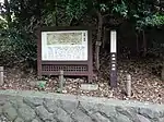 | 35°25′57″N 139°33′52″E | ||
| Inarimae Kofun Cluster 稲荷前古墳群 Inarimae kofun-gun | Yokohama | 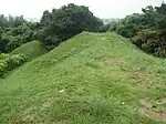 | 35°33′35″N 139°31′55″E | |||
| Shibokuchi Shell Mound 子母口貝塚 Shibokuchi kaizuka | Kawasaki | 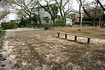 | 35°34′28″N 139°37′31″E | |||
| Higashi Takane Site 東高根遺跡 Higashi Takane iseki | Kawasaki | Yayoi- to Kofun-period settlement, now protected within Higashi Takane Forest Park (東高根森林公園) | 35°36′16″N 139°35′11″E | |||
| Maginu Kofun 馬絹古墳 Maginu kofun | Kawasaki | 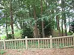 | 35°35′01″N 139°36′05″E | |||
| Saifukuji Kofun 西福寺古墳 Saifukuji kofun | Kawasaki | 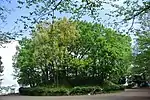 | 35°34′59″N 139°36′29″E | |||
| Kayama Shell Mound 茅山貝塚 Kayama kaizuka | Yokosuka | 35°14′02″N 139°41′38″E | ||||
| Yoshii Shell Mound and associated site 吉井貝塚を中心とした遺跡 Yoshii kaizuka wo chūshin to shita iseki | Yokosuka | late-Heian yamashiro and a Jōmon midden | 35°14′18″N 139°42′07″E | |||
| Dankazura 段葛 Dankazura | Kamakura | pathway along Wakamiya Ōji leading to Tsurugaoka Hachiman-gū |  | 35°19′11″N 139°33′09″E | ||
| Hyakuhachi Yagura 百八やぐら Hyakuhachi Yagura | Kamakura | yagura near Kakuon-ji (覚園寺) | 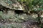 | 35°19′51″N 139°33′52″E | ||
| Yoichi-zuka and Bunzōdō on the Ishibashiyama Battlefield 石橋山古戦場のうち与一塚及び文三堂 Ishibashiyama ko-senjō no uchi Yoichi-zuka oyobi bunzōdō | Odawara | Yoichi-zuka is the burial mound of Sanada Yoshitada (佐奈田義忠) | 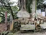 | 35°13′16″N 139°08′25″E | ||
| Tsutsumi Shell Mound 堤貝塚 Tsutsumi kaizuka | Chigasaki | 35°21′46″N 139°25′26″E | ||||
| Bishamon Caves Yayoi Dwelling Sites 毘沙門洞窟弥生時代住居阯群 Bishamon dōkutsu Yayoi-jidai jūkyoshi-gun | Miura | 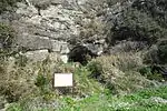 | 35°08′23″N 139°39′18″E | |||
| Futagozuka Kofun 二子塚古墳 Futagozuka kofun | Hadano | 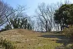 | 35°21′34″N 139°16′00″E | |||
| Mediaeval Architecture of Kami-Hamada 上浜田中世建築遺構群 Kami-Hamada chūsei kenchiku ikō-gun | Ebina | 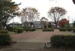 | 35°26′40″N 139°24′08″E | |||
| Kamaguchi Kofun 釜口古墳 Kamaguchi kofun | Ōiso | 35°19′03″N 139°19′07″E | ||||
| Tarekoyatonishi Cave Tomb Cluster たれこ谷戸西横穴群 Tarekoyatonishi ōketsu-gun | Ōiso | 35°19′02″N 139°16′14″E | ||||
| Shōgakubo Cave Tomb Cluster 庄ケ久保横穴群 Shōgakubo ōketsu-gun | Ōiso | 35°18′49″N 139°17′22″E | ||||
| Yōkokujiyato Cave Tomb Cluster 楊谷寺谷戸横穴群 Yōkokujiyato ōketsu-gun | Ōiso | 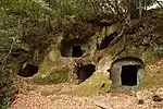 | 35°19′15″N 139°18′49″E | |||
| Kawamura Castle Site 河村城跡 Kawamura-jō ato | Yamakita | 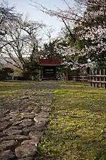 | 35°21′20″N 139°04′38″E | |||
| Dohi Sugiyama Cave 土肥椙山厳窟(伝源頼朝隠潜地) Tohi Sugiyama gankutsu (den-Minamoto no Yoritomo insenchi) | Yugawara | said to have been the hiding place of Minamoto no Yoritomo after the Battle of Ishibashiyama |  | 35°09′53″N 139°04′31″E | ||
| Dohi Clan Graves 土肥一族の墓所 Tohi ichizoku no bosho | Yugawara |  | 35°08′52″N 139°06′08″E | |||
| Enoshima 江ノ島 Enoshima | Fujisawa | also a Prefectural Place of Scenic Beauty | 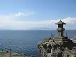 | 35°17′59″N 139°28′49″E | ||
Municipal Historic Sites
As of 1 May 2019, a further one hundred and thirty-one Sites have been designated as being of municipal importance.[4][16]
Registered Historic Sites
As of 1 August 2019, one Monument has been registered (as opposed to designated) as an Historic Site at a national level.[4][17]
| Place | Municipality | Comments | Image | Coordinates | Type | Ref. |
|---|---|---|---|---|---|---|
| Soya Waterworks 曽屋水道 Soya suidō | Hadano | 35°22′45″N 139°13′15″E | ||||
See also
Wikimedia Commons has media related to National historic sites in Kanagawa prefecture.
Wikimedia Commons has media related to Prefectural Historic Sites in Kanagawa Prefecture.
References
- "Cultural Properties for Future Generations". Agency for Cultural Affairs. Retrieved 27 August 2019.
- 史跡名勝天然記念物 [Number of Monuments of Japan by Prefecture] (in Japanese). Agency for Cultural Affairs. 1 August 2019. Retrieved 27 August 2019.
- "Database of National Cultural Properties: 史跡名勝天然記念物 (史跡, 特別史跡 神奈川県 2県以上)" (in Japanese). Agency for Cultural Affairs. Archived from the original on 30 June 2019. Retrieved 27 August 2019.
- 文化財の指定等の状況 [Status of Cultural Properties] (PDF). Kanagawa Prefecture. 1 August 2019. Retrieved 27 August 2019.
- 一升桝遺跡 [Isshōmasu Site] (in Japanese). Kanagawa Prefecture. Retrieved 22 June 2012.
- "Temples, Shrines and other structures of Ancient Kamakura". UNESCO. Retrieved 22 June 2012.
- "「武家の古都・鎌倉」の世界文化遺産推薦について(案)" [Concerning the World Heritage Nomination "Kamakura, Home of the Samurai"] (PDF). Ministry of Land, Infrastructure, Transport and Tourism. Retrieved 22 June 2012.
- 荏柄天神社本殿 [Egara Tenjin Shrine Honden] (in Japanese). Agency for Cultural Affairs. Retrieved 22 June 2012.
- 旧横浜正金銀行本店本館 [Former Yokohama Specie Bank Head Office Main Building] (in Japanese). Agency for Cultural Affairs. Retrieved 23 June 2012.
- 元箱根磨崖仏 [Moto-Hakone magaibutsu] (in Japanese). Agency for Cultural Affairs. Retrieved 23 June 2012.
- 地藏菩薩立像 [Jizō Bosatsu] (in Japanese). Agency for Cultural Affairs. Retrieved 23 June 2012.
- 元箱根磨崖仏 [Moto-Hakone magaibutsu] (in Japanese). Agency for Cultural Affairs. Retrieved 23 June 2012.
- 藤沢敵御方供養塔 [Memorial Tower to Friends and Foe] (in Japanese). Agency for Cultural Affairs. Archived from the original on 19 December 2012. Retrieved 23 June 2012.
- 都道府県別指定等文化財件数(都道府県分) [Number of Prefectural Cultural Properties by Prefecture] (in Japanese). Agency for Cultural Affairs. 1 May 2019. Retrieved 27 August 2019.
- 文化財をさがす [Cultural Property Search] (in Japanese). Kanagawa Prefecture. Retrieved 27 August 2019.
- 都道府県別指定等文化財件数(市町村分) [Number of Municipal Cultural Properties by Prefecture] (in Japanese). Agency for Cultural Affairs. 1 May 2019. Retrieved 27 August 2019.
- 登録文化財 [Number of Registered Cultural Properties by Prefecture] (in Japanese). Agency for Cultural Affairs. 1 July 2019. Retrieved 27 August 2019.
External links
- (in Japanese) Cultural Properties in Kanagawa Prefecture
This article is issued from Wikipedia. The text is licensed under Creative Commons - Attribution - Sharealike. Additional terms may apply for the media files.


