Hjartdøla
Hjartdøla is a river in Hjartdal municipality in Vestfold og Telemark, Norway. The 26-kilometre (16 mi) long river is part of the Skien watershed. The river is formed at the confluence of the river Bjordøla and some smaller rivers coming from the lakes Skjesvatnet and Breidvatnet, about 5 kilometres (3.1 mi) north of the village of Hjartdal. From here, it runs through the village of Hjartdal, then through the lake Hjartsjåvatnet, and through the village of Sauland. At Sauland, the river meets the river Skogsåa and after this confluence, the two rivers form the river Heddøla which then continues on to Heddal and the lake Heddalsvatnet.[1][2]
| Hjartdøla | |
|---|---|
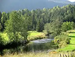 View of the river near Hjartdal Church | |
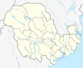 Location of the river 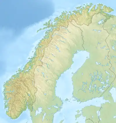 Hjartdøla (Norway) | |
| Location | |
| Country | Norway |
| County | Vestfold og Telemark |
| Municipalities | Hjartdal Municipality |
| Physical characteristics | |
| Source | |
| • location | Stusshøl, Hjartdal |
| • coordinates | 59.63730°N 8.58828°E |
| • elevation | 620 metres (2,030 ft) |
| Mouth | Heddøla river |
• location | Sauland, Hjartdal |
• coordinates | 59.61366°N 8.955423°E |
• elevation | 78 metres (256 ft) |
| Length | 26 km (16 mi) |
| Basin size | 825 km2 (319 sq mi) |
See also
References
- Lundbo, Sten, ed. (24 May 2023). "Hjartdøla". Store norske leksikon (in Norwegian). Kunnskapsforlaget. Retrieved 14 August 2023.
- "Heddøla-hjartdøla". nve.no (in Norwegian). Retrieved 14 August 2023.
This article is issued from Wikipedia. The text is licensed under Creative Commons - Attribution - Sharealike. Additional terms may apply for the media files.