Poraiti
Poraiti is a suburb on the western outskirts of the city of Napier, in the Hawke's Bay region of New Zealand's eastern North Island.[3] For a long time it was a semi-rural locality on low hills, but has now been extended to include a new residential subdivision developed on the plain in the 2000s.
Poraiti | |
|---|---|
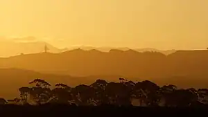 Sunset over Poraiti Hills | |
| Coordinates: 39.504273°S 176.843913°E | |
| Country | New Zealand |
| City | Napier |
| Local authority | Napier City Council |
| Electoral ward | Taradale Ward |
| Area | |
| • Land | 1,767 ha (4,366 acres) |
| Population (June 2022)[2] | |
| • Total | 2,240 |
| Puketapu | Bay View | Westshore |
|
|
Onekawa | |
| Taradale | Tamatea |
History
Te Poraiti, also known as Pa Poto, was a Māori pā belonging to Ngāti Hinepare on a small headland near the shore of Ahuriri Lagoon. In the 19th century, chiefs Rawiri Tareahi and his son Porokoru Mapu lived there.[4]
For a long period of modern history Poraiti was a semi-rural locality on low hills west of Napier. It was part of Hawke's Bay County until the 1989 New Zealand local government reforms, when it became part of Napier City.[5][6]
When a new residential subdivision was developed on the former Lagoon Farm, west of Tamatea, in the 2000s, there was a debate over whether it should be named Parklands or Orotu. Napier City Council settled the debate in 2008 by including the subdivision in Poraiti.[7] That area is now known as Poraiti Flat, while the old Poraiti has become known as Poraiti Hills.
Demographics
Poraiti covers 17.67 km2 (6.82 sq mi)[1] and had an estimated population of 2,240 as of June 2022,[2] with a population density of 127 people per km2.
| Year | Pop. | ±% p.a. |
|---|---|---|
| 2006 | 657 | — |
| 2013 | 1,458 | +12.06% |
| 2018 | 2,010 | +6.63% |
| Source: [8] | ||
Poraiti had a population of 2,010 at the 2018 New Zealand census, an increase of 552 people (37.9%) since the 2013 census, and an increase of 1,353 people (205.9%) since the 2006 census. There were 750 households, comprising 981 males and 1,032 females, giving a sex ratio of 0.95 males per female, with 303 people (15.1%) aged under 15 years, 261 (13.0%) aged 15 to 29, 945 (47.0%) aged 30 to 64, and 498 (24.8%) aged 65 or older.
Ethnicities were 90.9% European/Pākehā, 7.0% Māori, 1.0% Pacific peoples, 7.2% Asian, and 1.2% other ethnicities. People may identify with more than one ethnicity.
The percentage of people born overseas was 18.5, compared with 27.1% nationally.
Although some people chose not to answer the census's question about religious affiliation, 48.7% had no religion, 39.6% were Christian, 0.3% were Hindu, 1.5% were Buddhist and 1.0% had other religions.
Of those at least 15 years old, 357 (20.9%) people had a bachelor's or higher degree, and 288 (16.9%) people had no formal qualifications. 396 people (23.2%) earned over $70,000 compared to 17.2% nationally. The employment status of those at least 15 was that 810 (47.5%) people were employed full-time, 273 (16.0%) were part-time, and 33 (1.9%) were unemployed.[8]
| Name | Area (km2) | Population | Density (per km2) | Households | Median age | Median income |
|---|---|---|---|---|---|---|
| Poraiti Hills | 10.58 | 732 | 69 | 255 | 48.4 years | $35,400[9] |
| Poraiti Flat | 7.09 | 1,278 | 180 | 495 | 51.8 years | $36,700[10] |
| New Zealand | 37.4 years | $31,800 |
References
- "ArcGIS Web Application". statsnz.maps.arcgis.com. Archived from the original on 14 February 2021. Retrieved 16 February 2023.
- "Population estimate tables - NZ.Stat". Statistics New Zealand. Retrieved 25 October 2022.
- Hariss, Gavin. "Poraiti, Hawke's Bay". topomap.co.nz. NZ Topo Map. Archived from the original on 7 June 2019. Retrieved 7 June 2019.
- Bain, P. (1992). Te Whanganui a Orotu: Summary of Recorded Archaeological Information. Napier: Department of Conservation. p. 6. Retrieved 21 May 2023.
- "A brief history of Napier". Napier City Council. Retrieved 21 May 2023.
- "History of Napier's roads". Napier City Council. Retrieved 21 May 2023.
- "Sections for sale by tender in next stage of Parklands Napier". Hawke's Bay Today. Retrieved 21 May 2023 – via The New Zealand Herald.
- "Statistical area 1 dataset for 2018 Census". Statistics New Zealand. March 2020. Poraiti Hills (212400) and Poraiti Flat (212500).
- 2018 Census place summary: Poraiti Hills
- 2018 Census place summary: Poraiti Flat
- "Hohepa Home School Ministry of Education School Profile". educationcounts.govt.nz. Ministry of Education. Archived from the original on 7 June 2019. Retrieved 7 June 2019.
- "New Zealand Schools Directory". New Zealand Ministry of Education. Retrieved 12 December 2022.
- "Hōhepa School Education Review Office Report". ero.govt.nz. Education Review Office. Archived from the original on 16 February 2023. Retrieved 16 February 2023.