Holly Hill, Florida
Holly Hill is a city in Volusia County, Florida, United States. The population was 11,659 at the 2010 census.[4] Holly Hill's city limits lie entirely on the Florida mainland, unlike the larger cities on either side of it, Daytona Beach and Ormond Beach, which encompass both the mainland and the barrier island (beach front) across the Halifax River.
Holly Hill, Florida | |
|---|---|
City | |
| City of Holly Hill | |
 The Holly Hill City Hall in 2007. | |
 Seal | |
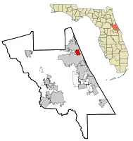
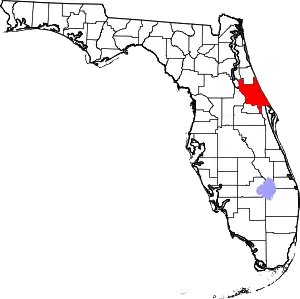
 Location in Volusia County and the state of Florida | |
 Holly Hill, Florida Location in the USA | |
| Coordinates: 29°14′38″N 81°2′47″W | |
| Country | |
| State | |
| County | |
| Area | |
| • Total | 4.52 sq mi (11.72 km2) |
| • Land | 3.96 sq mi (10.26 km2) |
| • Water | 0.56 sq mi (1.46 km2) |
| Elevation | 13 ft (4 m) |
| Population (2020) | |
| • Total | 12,958 |
| • Density | 3,272.22/sq mi (1,263.51/km2) |
| Time zone | UTC-5 (Eastern (EST)) |
| • Summer (DST) | UTC-4 (EDT) |
| ZIP code | 32117 |
| Area code | 386 |
| FIPS code | 12-31350[2] |
| GNIS feature ID | 0284170[3] |
| Website | https://www.hollyhillfl.org |
Geography
Holly Hill is located at 29°14′38″N 81°2′47″W (29.243808, –81.046476).[5]
According to the United States Census Bureau, the city has a total area of 4.5 square miles (12 km2), of which 3.9 square miles (10 km2) is land and 0.6 square miles (1.6 km2) (13.94%) is water.
History
Holly Hill was incorporated in 1901.[6] The original intention for incorporation was to force local owners of razorback hogs to keep their livestock penned up.[7]
Demographics
| Census | Pop. | Note | %± |
|---|---|---|---|
| 1910 | 207 | — | |
| 1920 | 332 | 60.4% | |
| 1930 | 1,146 | 245.2% | |
| 1940 | 1,665 | 45.3% | |
| 1950 | 3,232 | 94.1% | |
| 1960 | 4,182 | 29.4% | |
| 1970 | 8,191 | 95.9% | |
| 1980 | 9,953 | 21.5% | |
| 1990 | 11,141 | 11.9% | |
| 2000 | 12,119 | 8.8% | |
| 2010 | 11,659 | −3.8% | |
| 2020 | 12,958 | 11.1% | |
| U.S. Decennial Census[8] | |||
At the 2000 census there were 12,119 people in 5,583 households, including 2,998 families, in the city. The population density was 3,113.5 inhabitants per square mile (1,202.1/km2). There were 6,148 housing units at an average density of 1,579.5 per square mile (609.8/km2). The racial makeup of the city was 87.10% White, 8.97% African American, 0.36% Native American, 1.00% Asian, 0.02% Pacific Islander, 0.91% from other races, and 1.63% from two or more races. Hispanic or Latino of any race were 3.69%.[2]
Of the 5,583 households 22.3% had children under the age of 18 living with them, 34.9% were married couples living together, 13.6% had a female householder with no husband present, and 46.3% were non-families. 36.9% of households were one person and 17.2% were one person aged 65 or older. The average household size was 2.14 and the average family size was 2.77.
The age distribution was 19.9% under the age of 18, 7.0% from 18 to 24, 28.4% from 25 to 44, 23.5% from 45 to 64, and 21.2% 65 or older. The median age was 42 years. For every 100 females, there were 91.5 males. For every 100 females age 18 and over, there were 87.6 males.
The median household income was $26,651 and the median family income was $29,154. Males had a median income of $25,946 versus $19,178 for females. The per capita income for the city was $16,098. About 13.5% of families and 16.5% of the population were below the poverty line, including 23.4% of those under age 18 and 12.1% of those age 65 or over.
City officials
Elected
- Chris Via, Mayor
- John Penny, City Commissioner, District 1
- Penny Currie, City Commissioner, District 2
- John C. Danio, City Commissioner, District 3
- Roy Johnson, City Commissioner, District 4
Appointed
- Joe Forte, City Manager
- Scott Simpson, City Attorney
- Jeffrey Miller, Interim Chief of Police
Notable people
- Larry Flynn, racing driver
- William S. McCoy, lived and worked in Holly Hill as a skilled yacht builder, prior to his entry into rum-running
References
- "2020 U.S. Gazetteer Files". United States Census Bureau. Retrieved October 31, 2021.
- "U.S. Census website". United States Census Bureau. Retrieved January 31, 2008.
- "US Board on Geographic Names". United States Geological Survey. October 25, 2007. Retrieved January 31, 2008.
- "Profile of General Population and Housing Characteristics: 2010 Demographic Profile Data (DP-1): Holly Hill city, Florida". United States Census Bureau. Retrieved February 15, 2012.
- "US Gazetteer files: 2010, 2000, and 1990". United States Census Bureau. February 12, 2011. Retrieved April 23, 2011.
- "Holly Hill News". The Daytona Gazette-News. July 6, 1901. Retrieved August 9, 2020 – via Newspapers.com.
- "Holly Hill to be Incorporated". The Daytona Gazette-News. May 25, 1901. Retrieved August 9, 2020 – via Newspapers.com.
- "Census of Population and Housing". Census.gov. Retrieved June 4, 2015.
