Homosassa Springs, Florida
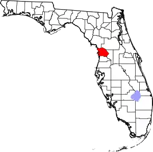
Homosassa Springs is an unincorporated community and census-designated place (CDP) in Citrus County, Florida, United States. The population was 14,283 as of 2020. Homosassa Springs is the principal city of the Homosassa Springs, Florida, Metropolitan Statistical Area.[4]
Homosassa Springs, Florida | |
|---|---|
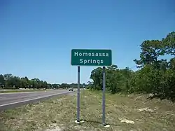
 Northbound US 19-98 as it enters Homosassa Springs | |
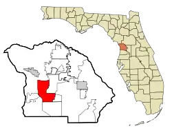
 Location in Citrus County and the state of Florida | |
| Coordinates: 28°48′26″N 82°33′0″W | |
| Country | |
| State | |
| County | Citrus |
| Area | |
| • Total | 25.18 sq mi (65.21 km2) |
| • Land | 25.17 sq mi (65.18 km2) |
| • Water | 0.01 sq mi (0.03 km2) |
| Elevation | 7 ft (2 m) |
| Population (2020) | |
| • Total | 14,283 |
| • Density | 567.51/sq mi (219.12/km2) |
| Time zone | UTC-5 (Eastern (EST)) |
| • Summer (DST) | UTC-4 (EDT) |
| ZIP code | 34447 |
| Area code | 352 |
| FIPS code | 12-32400[2] |
| GNIS feature ID | 0284223[3] |
The name derives from the warm spring located in Homosassa Springs Wildlife State Park that attracts manatees to the area.
Geography and climate
Homosassa Springs is located in southern Citrus County at 28°48′26″N 82°33′0″W (28.807216, -82.550012).[5] The CDP is to the east of U.S. Routes 19 and 98 (Suncoast Boulevard); the CDP of Homosassa is located to the west of the highway, as is Homosassa Springs Wildlife State Park. Homosassa Springs is bordered to the northwest by the city of Crystal River, to the east by Lecanto, and to the south by Sugarmill Woods.
According to the United States Census Bureau, the CDP has a total area of 25.1 square miles (65.1 km2), of which 0.02 square mile (0.04 km2), or 0.06%, is covered by water.[6]
| Climate data for Homosassa Springs, Florida | |||||||||||||
|---|---|---|---|---|---|---|---|---|---|---|---|---|---|
| Month | Jan | Feb | Mar | Apr | May | Jun | Jul | Aug | Sep | Oct | Nov | Dec | Year |
| Record high °F (°C) | 85 (29) |
88 (31) |
91 (33) |
93 (34) |
98 (37) |
99 (37) |
97 (36) |
98 (37) |
96 (36) |
94 (34) |
90 (32) |
86 (30) |
99 (37) |
| Average high °F (°C) | 70.8 (21.6) |
73.4 (23.0) |
77.6 (25.3) |
82.6 (28.1) |
88.4 (31.3) |
90.8 (32.7) |
91.6 (33.1) |
91.5 (33.1) |
89.9 (32.2) |
85.0 (29.4) |
78.7 (25.9) |
72.6 (22.6) |
82.7 (28.2) |
| Average low °F (°C) | 45.1 (7.3) |
47.9 (8.8) |
52.2 (11.2) |
56.7 (13.7) |
63.8 (17.7) |
70.3 (21.3) |
72.0 (22.2) |
72.1 (22.3) |
70.0 (21.1) |
62.8 (17.1) |
54.4 (12.4) |
47.6 (8.7) |
59.6 (15.3) |
| Record low °F (°C) | 21 (−6) |
24 (−4) |
29 (−2) |
40 (4) |
49 (9) |
53 (12) |
63 (17) |
67 (19) |
57 (14) |
40 (4) |
23 (−5) |
18 (−8) |
18 (−8) |
| Average precipitation inches (mm) | 3.56 (90) |
3.05 (77) |
4.17 (106) |
2.54 (65) |
3.23 (82) |
6.50 (165) |
7.60 (193) |
7.78 (198) |
6.40 (163) |
2.51 (64) |
2.32 (59) |
2.64 (67) |
52.30 (1,328) |
| Source 1: [7] | |||||||||||||
| Source 2: [8] | |||||||||||||
Demographics
| Census | Pop. | Note | %± |
|---|---|---|---|
| 1990 | 6,271 | — | |
| 2000 | 12,458 | 98.7% | |
| 2010 | 13,791 | 10.7% | |
| 2020 | 14,283 | 3.6% | |
| source:[9] | |||
As of the 2020 census,[10] Homosassa Springs had a population of 14,283 with 5,946 households.
Of that population 5.7% was under 5 years old, 17.6% was under 18 years old, roughly 50.4% was between 18 and 65, and 26.3% was 65 years and older.
51.1% of the population was female persons, 2.8% were foreign born persons, and there were 1,594 veterans living in Homosassa Springs.
95.1% of the population was white, 1.2% was black, 0.4% was American Indian and Alaska Native, 0.1% was Asian, 3.3% was two or more races, 3.5% was Hispanic or Latino.
The median value of owner-occupied housing units was $86,500 and the median gross rent was $750.
86.6% of the population 25 years and older had a high school diploma or higher, and 7.7% of the population 25 years and older had a bachelor's degree or higher.
90.2% of the households had a computer and 81.2% of the households had a broadband internet subscription.

Education
Homosassa Springs is served by Citrus County School District.[11] Residents are divided between Homosassa Elementary, Lecanto Elementary, and Rock Crusher Elementary;[12] Crystal River Middle School and Lecanto Middle School;[13] and Crystal River High School and Lecanto High School.[14]
The Homosassa Public Library of Citrus Libraries is located in Homosassa Springs.[15]
Notable person
- Dazzy Vance, baseball pitcher, Hall of Fame inductee
References
- "2020 U.S. Gazetteer Files". United States Census Bureau. Retrieved October 31, 2021.
- "U.S. Census website". United States Census Bureau. Retrieved 2008-01-31.
- "US Board on Geographic Names". United States Geological Survey. 2007-10-25. Retrieved 2008-01-31.
- "Office of Management and Budget (OMB) Bulletins". Office of Management and Budget. Retrieved December 9, 2015.
- "US Gazetteer files: 2010, 2000, and 1990". United States Census Bureau. 2011-02-12. Retrieved 2011-04-23.
- "Geographic Identifiers: 2010 Demographic Profile Data (G001): Homosassa Springs CDP, Florida". U.S. Census Bureau, American Factfinder. Archived from the original on February 12, 2020. Retrieved June 26, 2014.
- "Zipcode 3447". www.plantmaps.com. Retrieved March 6, 2022.
- "Homosassa Springs, Florida Climate". www.bestplaces.net. Retrieved March 6, 2022.
- "CENSUS OF POPULATION AND HOUSING (1790-2000)". U.S. Census Bureau. Retrieved 2010-07-17.
- "U.S. Census Bureau QuickFacts: Homosassa Springs CDP, Florida". www.census.gov. United States Census Bureau. Retrieved 3 June 2022.
- "2010 CENSUS - CENSUS BLOCK MAP (INDEX): Homosassa Springs CDP, FL." U.S. Census Bureau. Retrieved on February 3, 2017. Pages: 1, 2, 3 - Compare this map to school district attendance boundary maps
- "Citrus County Elementary School Attendance Boundaries." Citrus County Schools. Retrieved on February 2, 2017.
- "Citrus County Middle School Attendance Boundaries." Citrus County Schools. Retrieved on February 2, 2017.
- "Citrus County High School Attendance Boundaries." Citrus County Schools. Retrieved on February 2, 2017.
- "Locations & Hours Archived 2017-02-05 at the Wayback Machine." Citrus Libraries. Retrieved on February 4, 2017. "HOMOSASSA PUBLIC LIBRARY 4100 S. Grandmarch Avenue Homosassa, FL 34446"
