Hopfgarten, Thuringia
Hopfgarten is a village and a former municipality in the Weimarer Land district of Thuringia, Germany. Since December 2019, it is part of the municipality Grammetal.
Hopfgarten | |
|---|---|
Location of Hopfgarten | |
 Hopfgarten 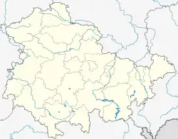 Hopfgarten | |
| Coordinates: 50°59′11″N 11°13′15″E | |
| Country | Germany |
| State | Thuringia |
| District | Weimarer Land |
| Municipality | Grammetal |
| Area | |
| • Total | 9.09 km2 (3.51 sq mi) |
| Elevation | 235 m (771 ft) |
| Population (2018-12-31) | |
| • Total | 673 |
| • Density | 74/km2 (190/sq mi) |
| Time zone | UTC+01:00 (CET) |
| • Summer (DST) | UTC+02:00 (CEST) |
| Postal codes | 99428 |
| Dialling codes | 03643 |
| Vehicle registration | AP |
References
This article is issued from Wikipedia. The text is licensed under Creative Commons - Attribution - Sharealike. Additional terms may apply for the media files.